Good morning. This is Ian Hoyer with the Gallatin National Forest Avalanche Forecast on Saturday, January 6th at 7:00 a.m. This information is sponsored by Cooke City Super 8/Bearclaw Bob’s and Uphill Pursuits. This forecast does not apply to operating ski areas.
A trace to 2” of very light snow fell as snowfall ended yesterday morning. Temperatures dropped down into the single digits and low teens F overnight and will rise into the teens and 20s F today. Winds are westerly at 15-25 mph with gusts of 30-35 mph. Winds will shift a bit more southwesterly today and potentially increase in speed a little. Snowfall will begin this afternoon in the southern portions of the advisory area, becoming more widespread overnight. By tomorrow morning generally expect 1-2” of new snow with possibly a few more inches around West Yellowstone and Island Park.

All Regions
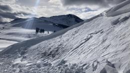
Triggering an avalanche in wind drifted snow is the primary concern today. A couple inches of light snow fell yesterday morning and winds have been strong and gusty. This has built slabs on top of the very weak snowpack that developed during our extended dry spell (Taylor Fork video, Bacon Rind video, Beehive Basin video).
Yesterday we had several reports of higher snowfall totals (5-6”) than weather stations reported (in Cooke City and N. Madison Range). We also got reports of wind drifts up to a foot deep. As you travel today, keep a close eye on the depth of new and windblown snow. The thickness of the slab of new snow is going to be the critical factor determining how likely you are to trigger a slide, and if you do, how big and dangerous that slide will be. Be very wary of any slope with more than 6” of new and wind drifted snow. Keep an eye out for changing conditions and new slopes being loaded as the wind direction shifts today and snowfall starts in the southern areas.
With the new snow falling on such a weak snowpack full of persistent weak layers, avalanches may break further above you, wider, and less predictably than you’d typically expect with new snow or wind slab avalanches.
On slopes without wind effect, the light new snow hasn’t built a deep or substantial enough slab to avalanche.
Look out for signs of wind drifting and signs of instability (cracking, collapsing, recent avalanches) before getting onto steep slopes. Be ready to adjust your travel plans if you see these signs.
The avalanche danger today is MODERATE on windloaded slopes and LOW on all other slopes.
If you get out, please submit an observation. It does not need to be technical. Did you see any avalanches? How much snow is on the ground? Was the wind moving snow? Simple observations are incredibly valuable. You can also contact us by email (mtavalanche@gmail.com), phone (406-587-6984), or Instagram (#gnfacobs).
Upcoming Avalanche Education and Events
Our education calendar is full of awareness lectures and field courses. Check it out: Events and Education Calendar.
Every weekend in Cooke City: Friday at The Antlers at 7 p.m., Free Avalanche Awareness and Current Conditions talk, and Saturday from 10 a.m.-2 p.m. at Round Lake Warming Hut, Free Rescue Practice.
We offer Avalanche Fundamentals with Field Session courses targeted towards non-motorized travelers in January and one geared towards motorized users. Sign up early before they fill up.
King & Queen 2024, 3 February 2024. Form a team or sign up individually to hike laps on the Bridger Bowl ridge to fundraise for the Friends of the Avalanche Center.
Loss in the Outdoors is a support group for those affected by loss and grief related to outdoor pursuits. Check out the link for more information.
Here’s a quick read, The Invisible Hands of Avalanche Work, an interview with GNFAC forecaster, Doug Chabot.