Snow Observations List
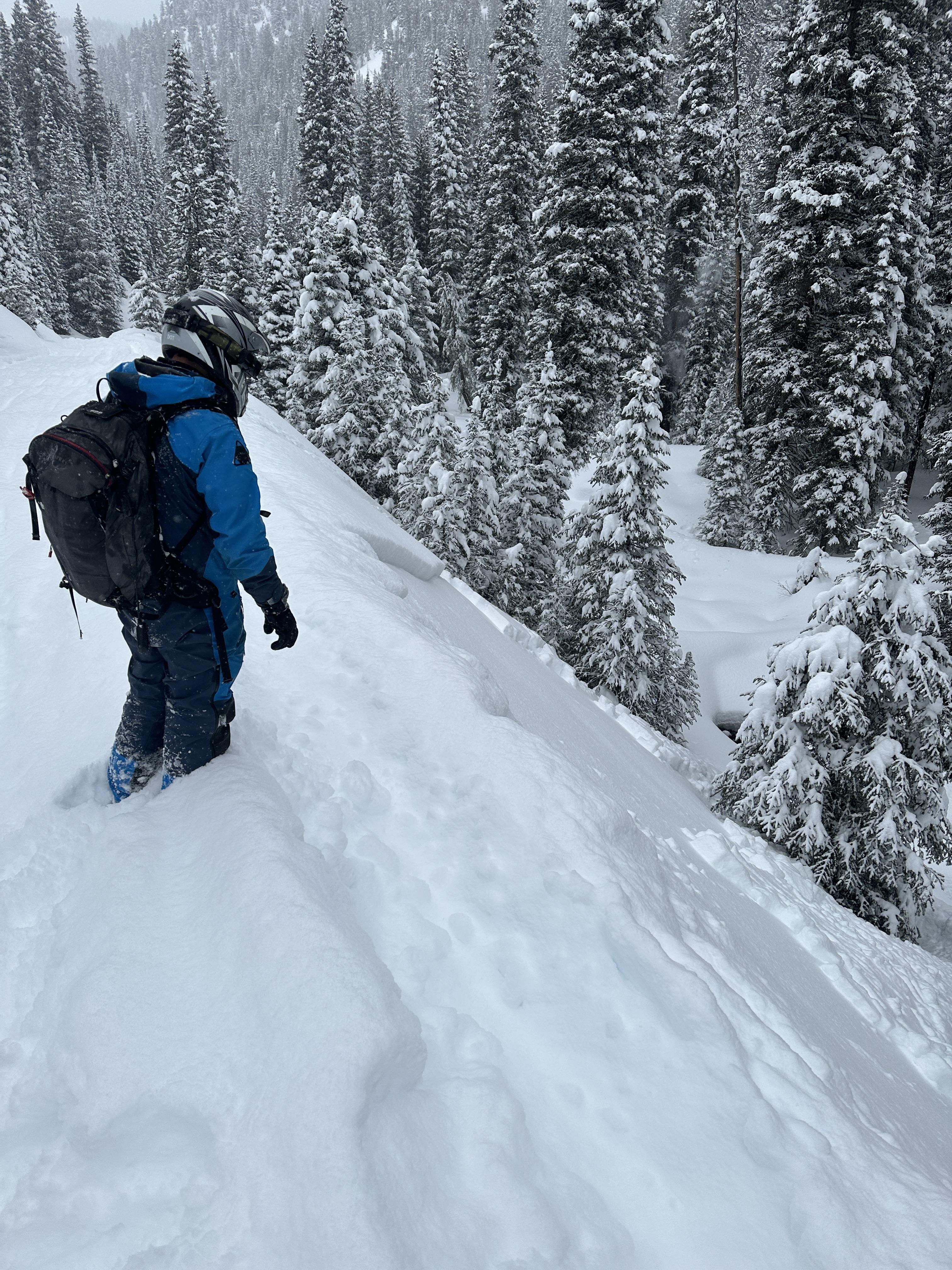
We rode up to Daisy Pass, then back to Marty's. We skied up to the starting zone and found the thinner (100-150 cm deep) and weaker snowpack typical for this area. We found weak depth hoar near the ground and layers of surgery facets in the middle of the snowpack. This path slide 1.5 weeks ago, likely triggered by a rider. Four days ago a slide caught two riders and seriously injured one on the same aspect of West Henderson a mile from where we were. The snowpack structure was similar. The scary thing is Cooke right now is that avalanches are not happening on every slope or every day, but when they have occurred recently, they've been big.
We recommend either choosing terrain very unlikely to slide because it is less than 30 degrees and not underneath steep slopes, or choosing terrain that minimizes the consequences of getting caught - small slopes that don't have terrain traps like gullies, trees, rocks, or cliffs. And always, travel one at a time on the slopes while watching your partners from a safe spot.
We saw a smaller natural avalanche on Ray's while driving into town, north-facing slope, 2-3' deep, not very wide. This was the only recent avalanche we saw today, but the visibility was poor and we didn't cover much ground.
Full Snow Observation Report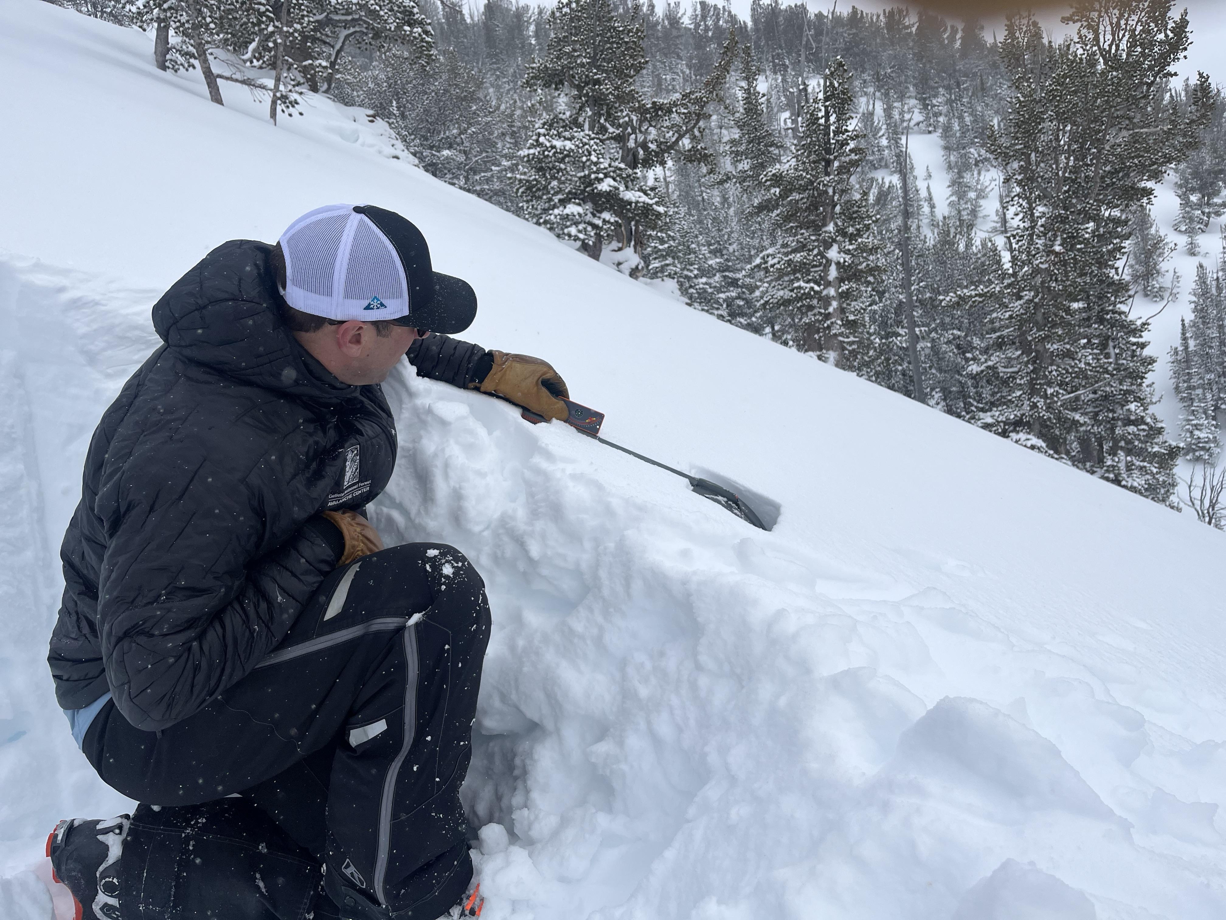

Saw a couple small natural slides breaking in the new snow. The one on the small slope beside the road actually appeared to have broken when a snow bike crossed the top just off the side of the road. The other was natural and occurred in the afternoon sometime
Full Snow Observation Report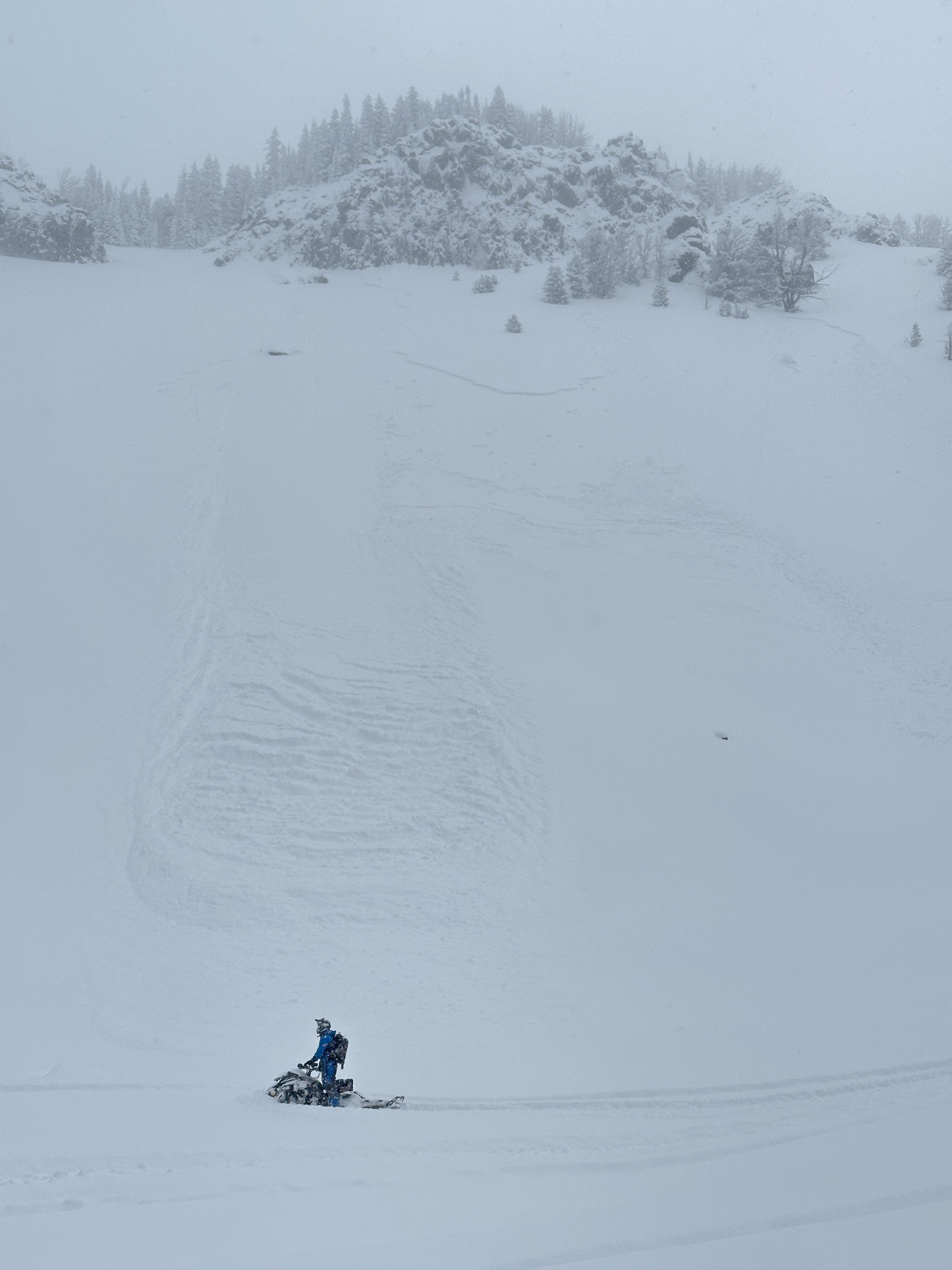
Near Big Sky today we found 8-14" of right side up storm snow from 7500' to 9400' on a south southeast aspect. We observed very minimal and isolated cracking on the occasional wind pillow, but by and large the snow was non-reactive, unconsolidated, and very well bonded to the stout crust below.
Winds were light and variable and it snowed lightly all day, accumulating about 3" by the late afternoon.
Full Snow Observation Report
Came across debris of a recent skier-triggered slide near the top of Little Ellis in a small, protected, eastern facing gully around 7,500'. Crown was ~3.5-1.5' deep, ~35' wide and it ran ~150'. Ski tracks were observed near the top of the crown and next to a small hole near the surface ~70' from the crown where it looks like someone self extracted. No signal was found with a beacon search and my group felt that the one track from the hole must have been from the same skier as the track near the crown.
There was around 2-3' of heavy new snow at that location.
Full Snow Observation Report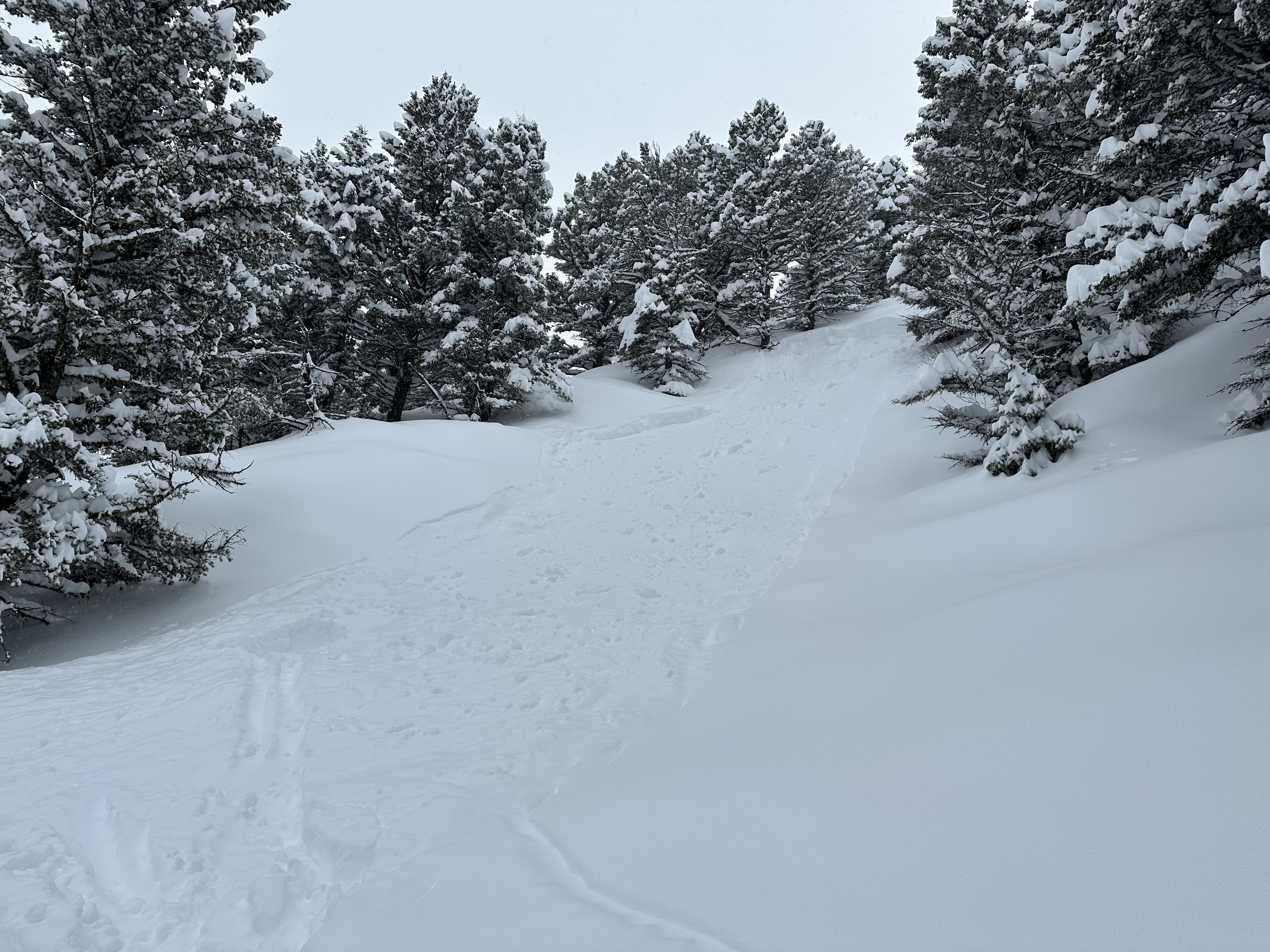

Toured into Moser Creek on 3/25 to find some pow turns. Measured 85cm ~34” of new snow and saw many shooting cracks on a density change in the new snow but surprisingly no propagating pit test results. It seemed that the snow was so new and so low density that it wasn’t making a cohesive slab. There was a stark new to old snow interface.
Full Snow Observation Report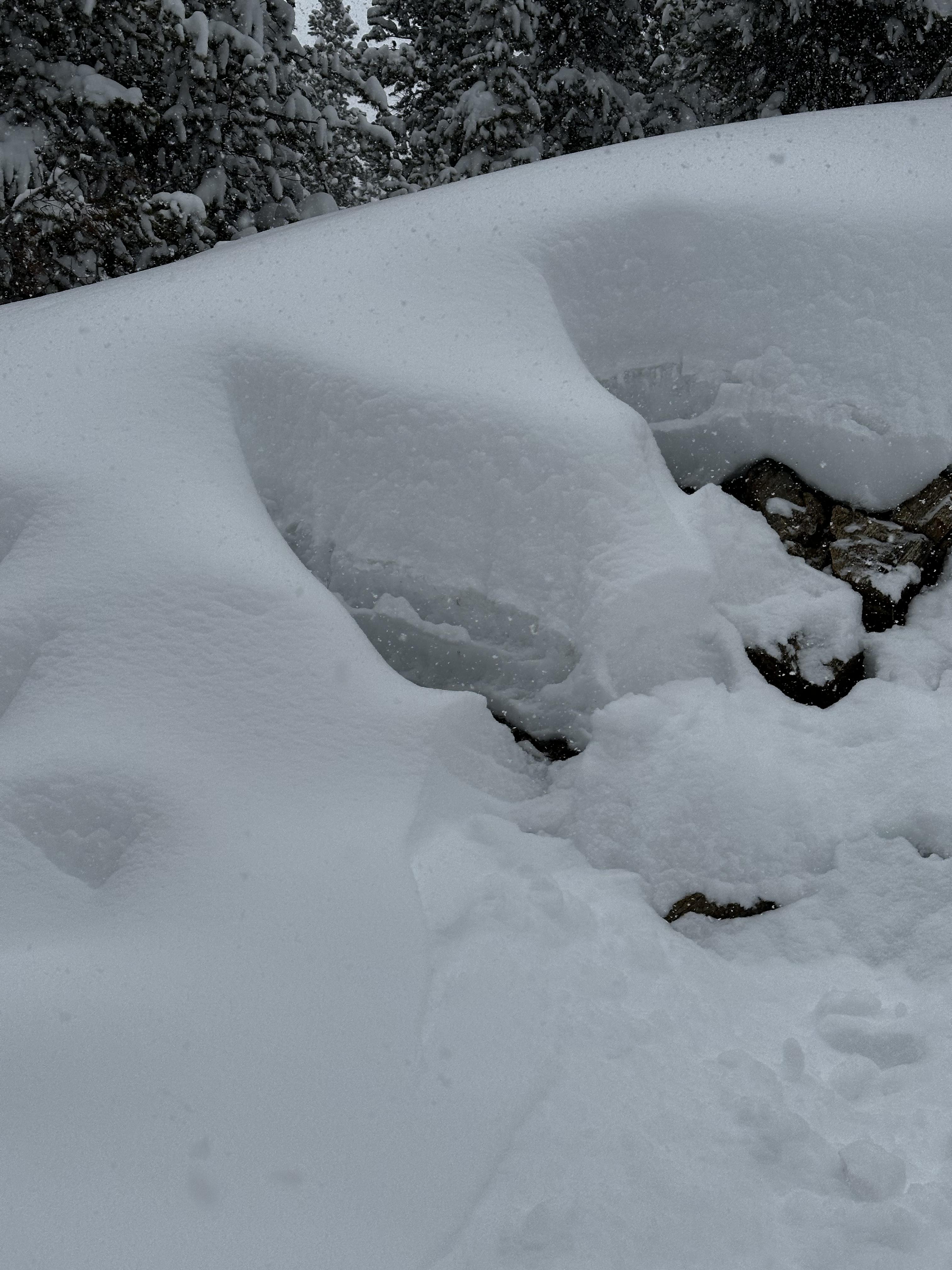
From GVSA groomer via text on 3/24/23: "Small slide in Buck just below 5 mile on the road cut. Likely natural. E Face about 42 degrees, 6-8" new up on top with 10 mph wind out of the SE. Cuttently snowing at .5"/hour (9pm)."
Full Snow Observation Report
We toured up towards Mt. Blackmore, and dug a pit at 9,800' on an east facing aspect. The the height of snow was 6' (HS=184cm). We did not get any propagation in our pit from our ECT tests. The snow was increasing in intensity by the afternoon. There was ~2" of new snow as we skied out. With the new snow we are worried about the weak layers becoming more reactive again. We saw several layers of weak, sugary snow in the middle of the snowpack all the way to the ground. With more snow in the forecast new snow avalanches and avalanches that break deeper in the snowpack like the one reported on Elephant Mountain on 03/23/2023 could become likely.
Full Snow Observation Report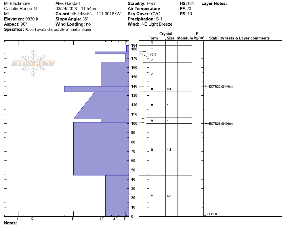

I observed the results of a wet slide avalanche within the first mile of Middle Cottonwood Creek Trail. The slide came down from the south side of the canyon (north facing), and crossed the trail at about 4-5' deep and 10' across at the trail with debris and into the creek at the creek crossing about .75 mile from the trailhead. The crown was only about 100' up the side of the canyon. The avalanche would've occurred earlier in the week, there was just the skiff of snow on it from the previous light snow (22nd?). In the rest of that section there are pinwheels all along that south canyon slope (north facing).
This is the 3rd wet slide I've seen in the last 3-4 weeks on Middle Cottonwood in the same region where the trail is on the south side of the creek (mile .4-.80 from summer trailhead). This area is easily accessible by hikers (I was running) and I've seen wet slides in that area 3 of the last 4 years once the sun hammers that south slope in the afternoon. I would expect more at the next warm spell after this current storm cycle.
Full Snow Observation Report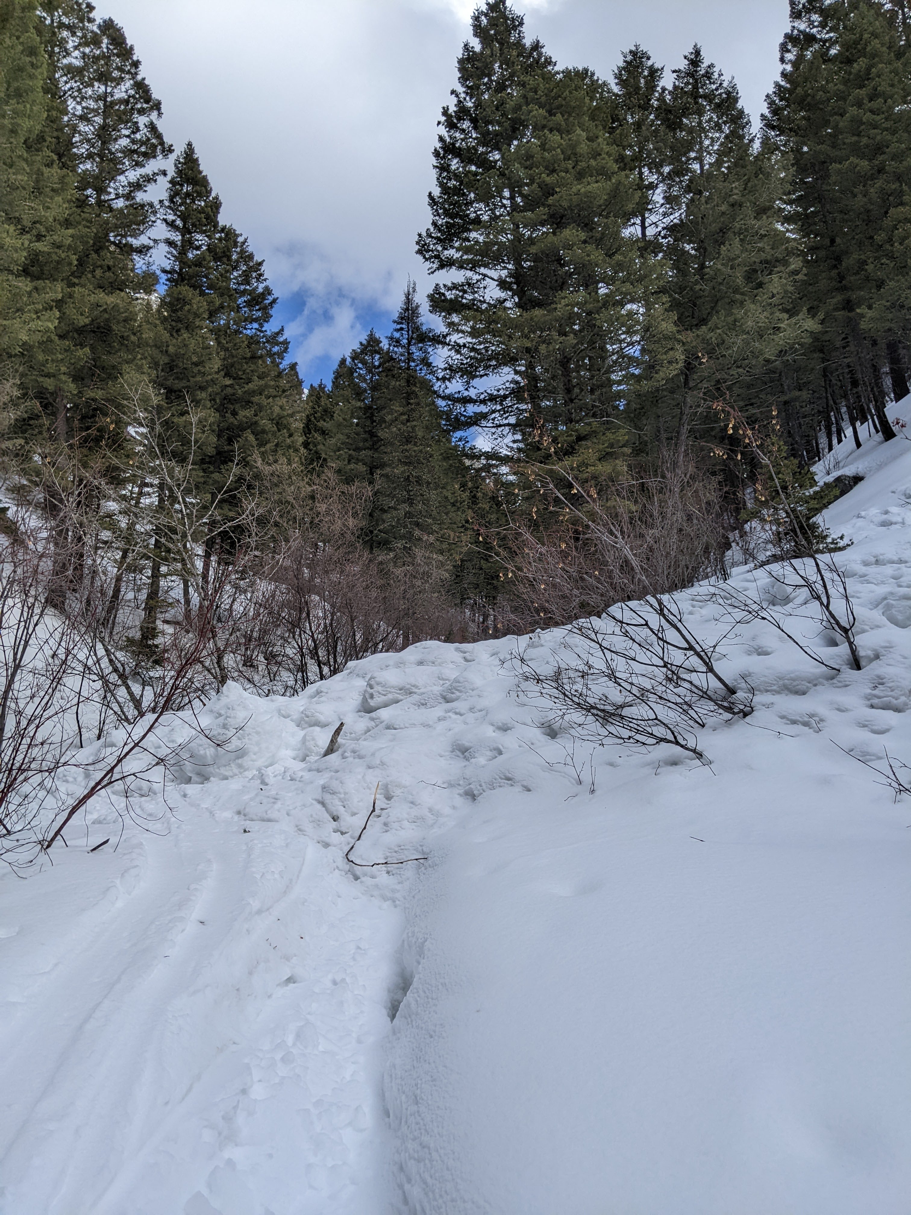

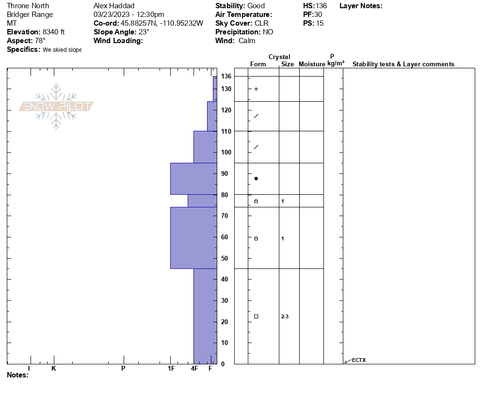
We dug two pits on the Throne today, and we had an ECTX in each pit. One pit was on a north facing slope at 8,400' with 4.5' of snow (HS=136). There are weak layers in the bottom half of this pit. The second pit was south facing at 8,400' with 6' of snow (HS=180cm). In the south facing snowpit we found buried weak layers 1.5' below the surface, and there were facets at the bottom of the snowpack. Despite the spring like temperatures today, the south facing snowpit was dry throughout. We saw the top couple of inches of snow getting wet by late afternoon (~1400), but we did not see any avalanche activity from the warmup. The buried weak layers were not a concern today, but they could be this weekend with more snow on the way.
Full Snow Observation Report

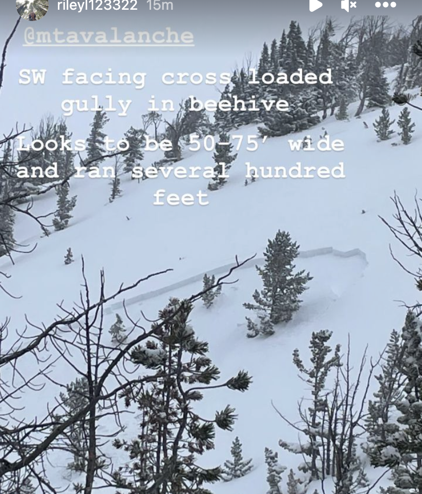
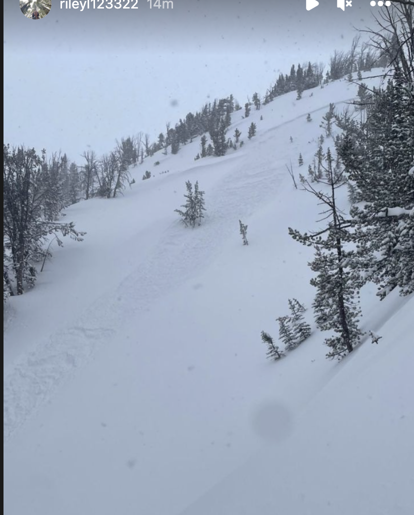
Toured around beehive peak today. Viewed 1 older large avalanche and other smaller slides. All were north to east aspects
Full Snow Observation Report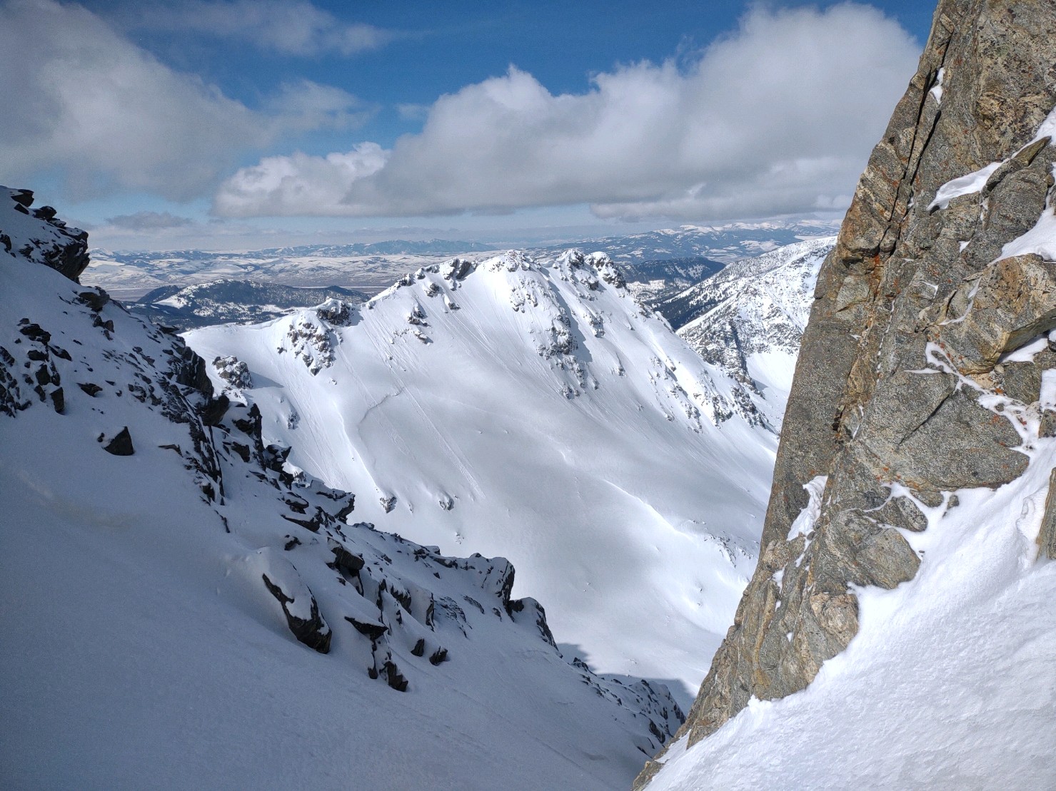
Bowl after the climb up Denny Creek. The runout area is the first big downhill on the trail that follows the bottom of the ridge. Best guess is 24-48 hours old. Extremely deep runout.
Full Snow Observation Report
Compiled from multiple observations-
One observed noted "Large avalanche in the Bunny Ears on Elephant Mtn. Best guess is HS-N-R3/4-D3-O."
Second observer noted: "Skiers left flank appears at a distance to be 8-10' and by the looks of the bed surface I'd guess this was on advanced facets on an early season (late Oct/early Nov) ice crust."
Third observed submitted photos of slide from above.
Full Snow Observation Report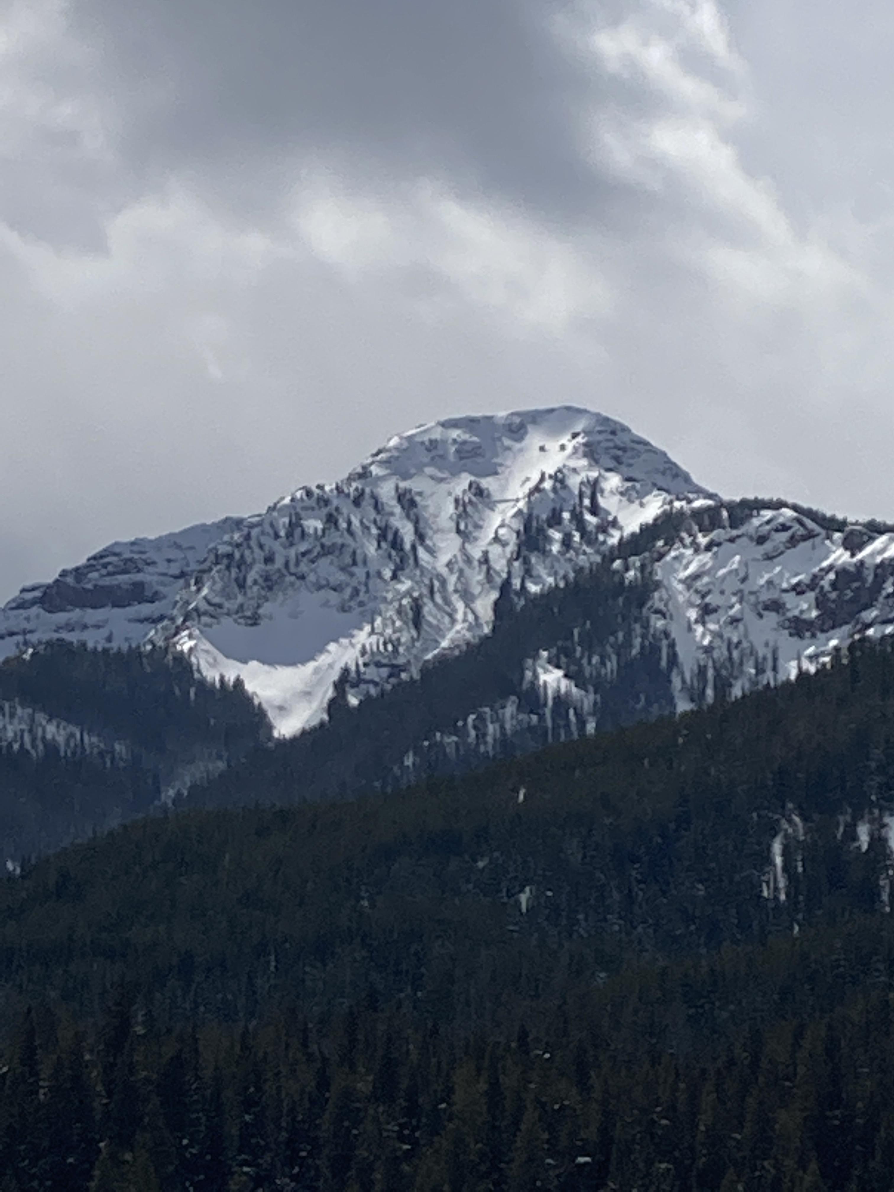

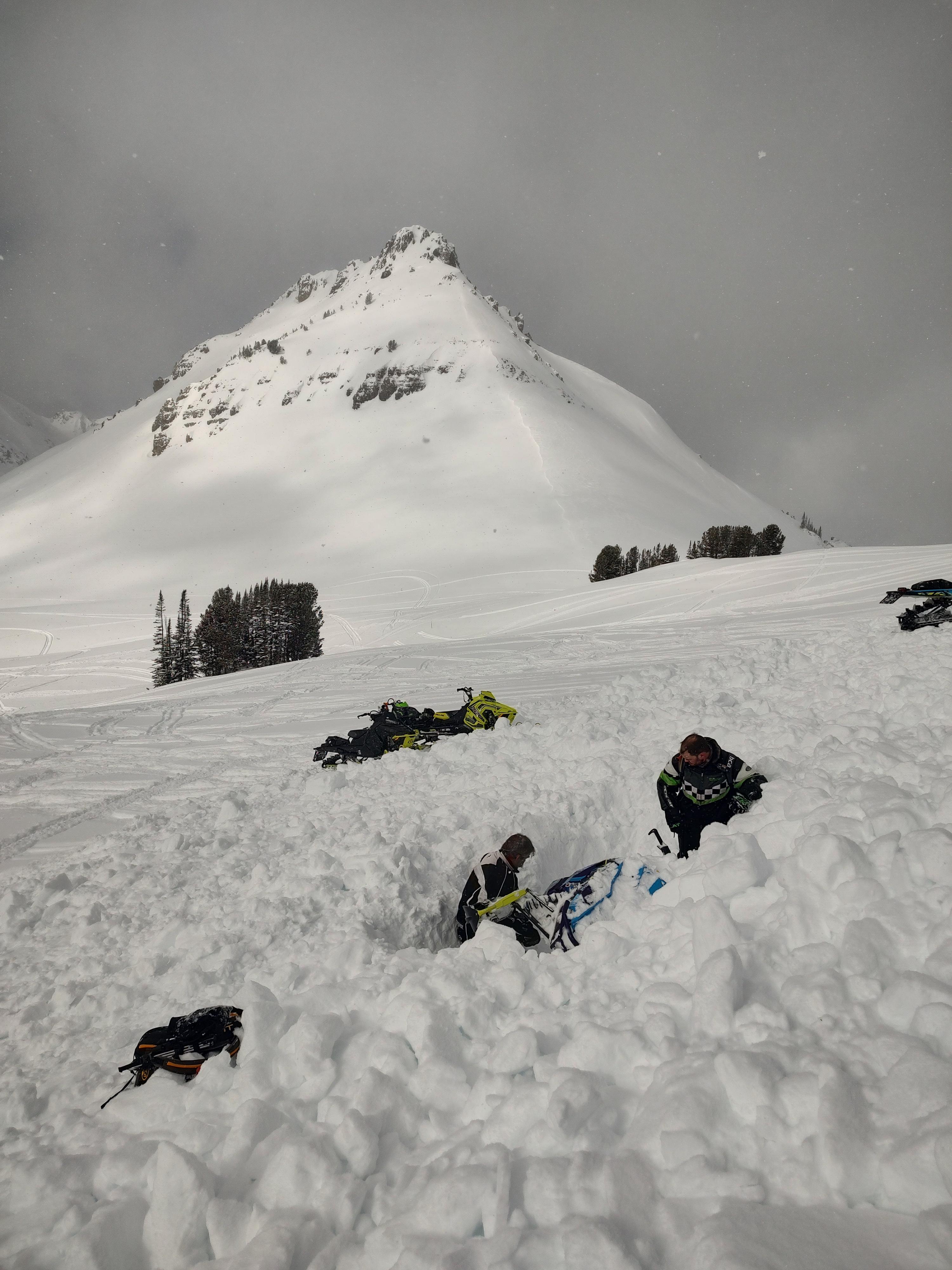
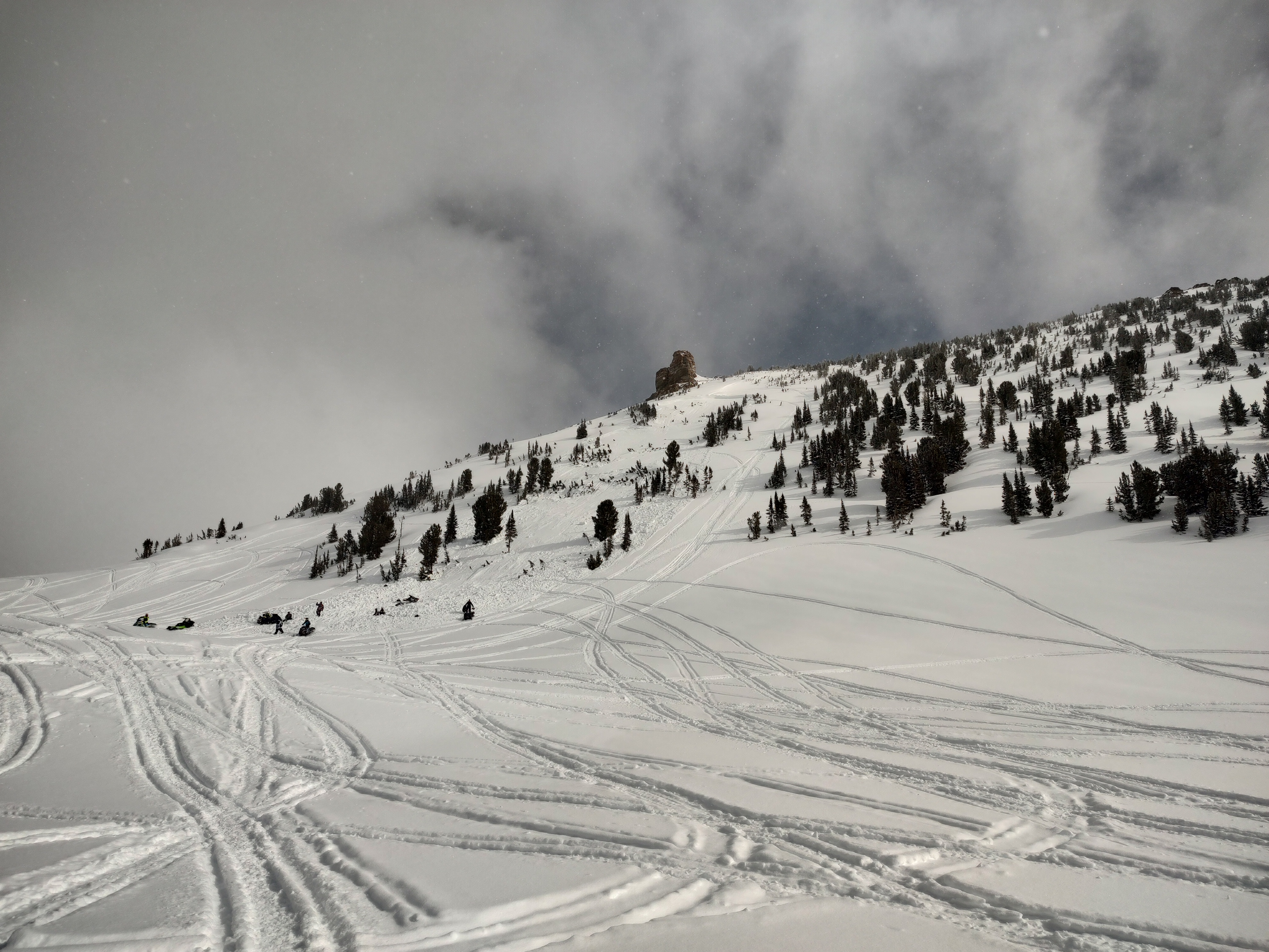
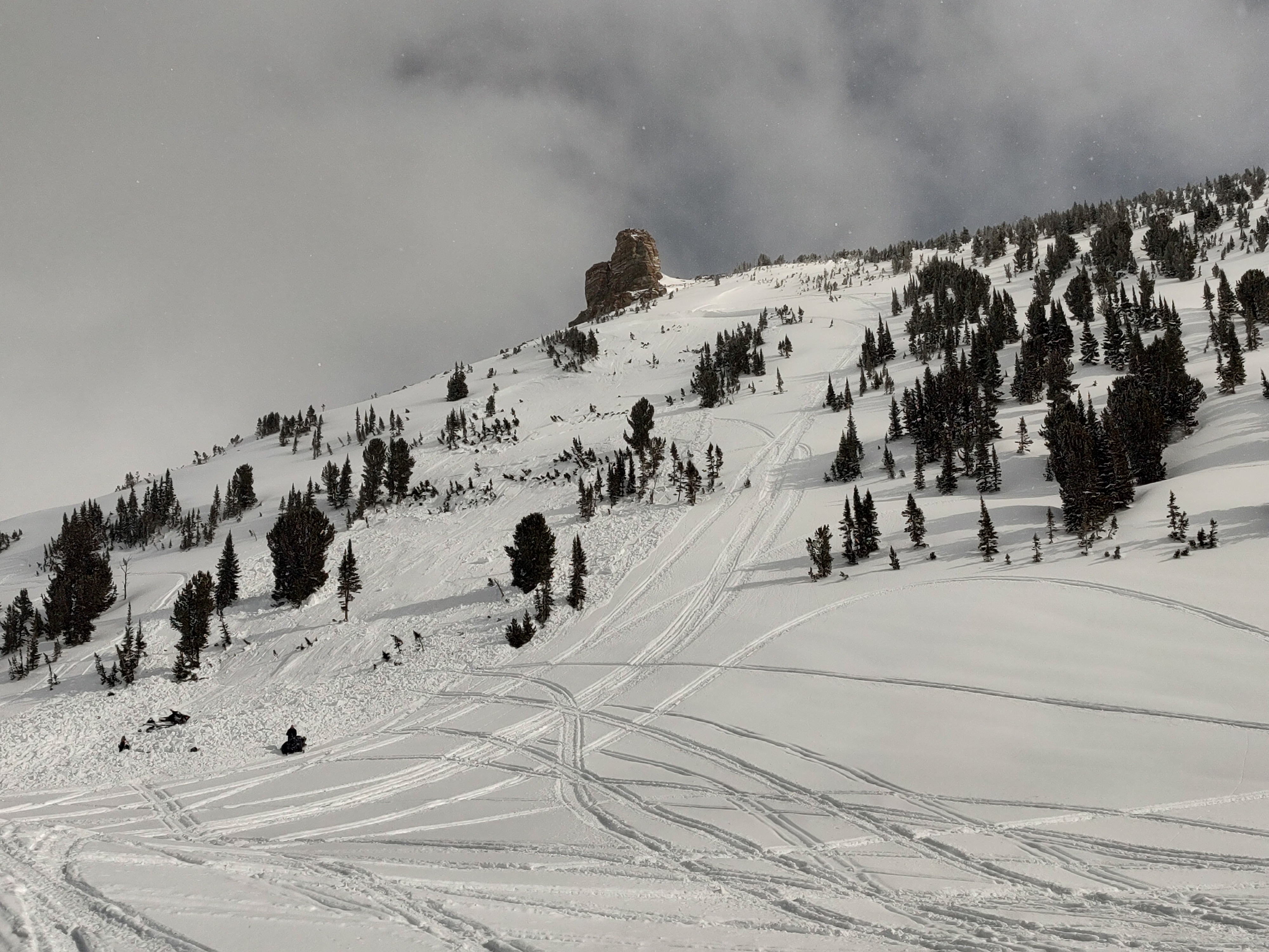
From Ben Zavora at Beartooth Powder Guides on 3/23/23 at 11:00am: "Two guys stuck on slope next to chimney rock. SW aspect. Third guy rode to help and triggered the avalanche. No one buried. One rider broken tib/fib and possibly a femur getting life flighted out right now."
Full Snow Observation Report

There has been a dramatic shift from last week's Avalanche Warning and major avalanche cycle to today at Hebgen Lake. Triggering a large avalanche is becoming much less likely. We had ECTXs in both our snowpits. In one (on a NE aspect), the weak layers were unremarkable. In the second (SE aspect), the snowpack was thinner, and we found a couple of layers of facets. Nothing broke in the test, but recent large avalanches in the vicinity lead me to maintain a healthy skepticism. We remain wary because if you find the wrong spot, trigger an avalanche, and get caught, the result could easily be unsurvivable.
If you take that chance, ease into avalanche terrain rather than going for large slopes, choose less wind-loaded slopes that are generally safer, and follow safe travel protocols, only exposing one person at a time to avalanche terrain.
On a non-avalanche related note, while I was glassing Lionhead Ridge for avalanches, I saw what I believe were the markings (mud and debris) from a bear coming out of hibernation. The season is changing—time to carry bear spray. I know, if it's not one thing, it's another.
Full Snow Observation Report
Sorry no photos, but I toured up blackmore today and saw alot of sluffing on steep terrain and very wet snow on s terrain. I pushed off a small wet slide that built a good amount of momentum and could've ran far if the terrain allowed. I did dig a pit down to the new old snow interface and had no results in an ect.
Full Snow Observation ReportWe found 2-3" of storm snow from 6700' to about 8000' on a south southeast aspect. New snow height increased above 8000', topping out at 6-8" at the ridge at 9600'. It snowed lightly all day. There was a stout melt freeze crust on the slope all the way up to the ridge below the new snow.
From the ridge, we descended a north facing slope and found great skiing with some surface sluffing, no surface slab, and no obvious signs of instability. There were no signs of wind loading where we were and the wind was light and variable all day.
After ascending and regaining the ridge, we descended the dust on crust on the south southeast aspect that we ascended in the morning.
Full Snow Observation ReportI went for a walk up to divide basin today and noticed a slide in the back of the basin on a high north facing slope , there was 5” of low density snow up high
Full Snow Observation Report
We rode through Second Yellow Mule, and then we headed back towards Cedar Creek. There was 2-4" of new snow throughout the area. Next, we rode to Bear Creek and dug a pit. We dug on an east facing aspect, and there was ~4 feet of snow (HS = 130 cm). We had an ECTX. Despite the crust and some warmer temps before today, the snowpack is still dry throughout, and there are still facets in the bottom half of the snowpack. During our ride we were looking for recent avalanche activity, and we only saw a couple of small point releases. We are still concerned about large, unsurvivable avalanches breaking on the weak layers deeper in the snowpack.
Full Snow Observation Report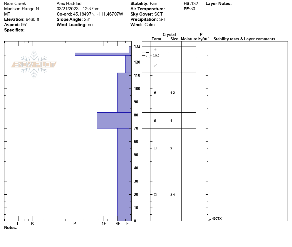

Skied on west and east sides of Woody Ridge. Observed a few small soft wind slab avalanches involving only new snow around the submarine. Dug a pit about a meter deep on west aspect about 9,700 feet. HS was 290cm. No result on extended column test. Fist to 265, 4F to 245, 1f to 200 where there is a crust layer, back to 1f below that.
Full Snow Observation Report