Snow Observations List
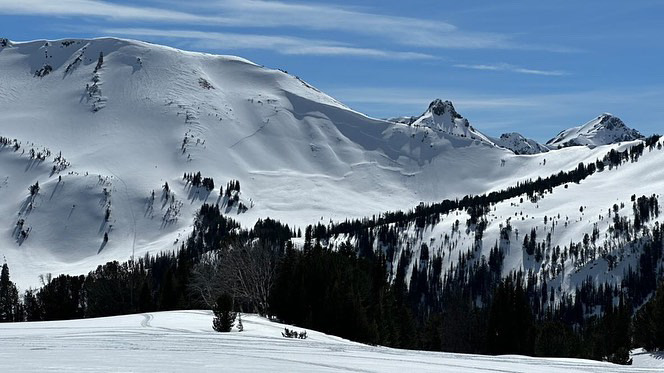
From IG: “Couple shots from today In the cooke area.”
Full Snow Observation Report
Drove Bridger Canyon to Seitz road around 5pm on 4/10. Saw 4-5 D2 wet loose, plus many D1 wet loose. No huge slides or widespread large wet activity, yet.
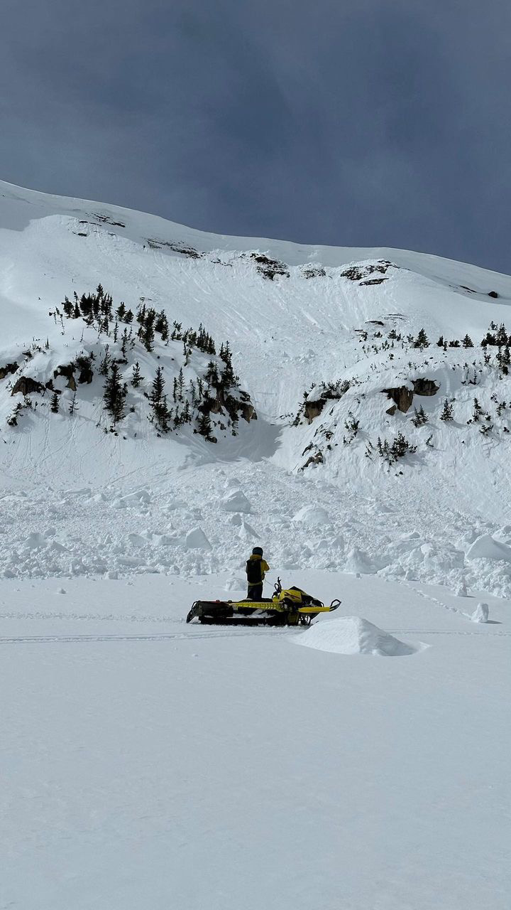
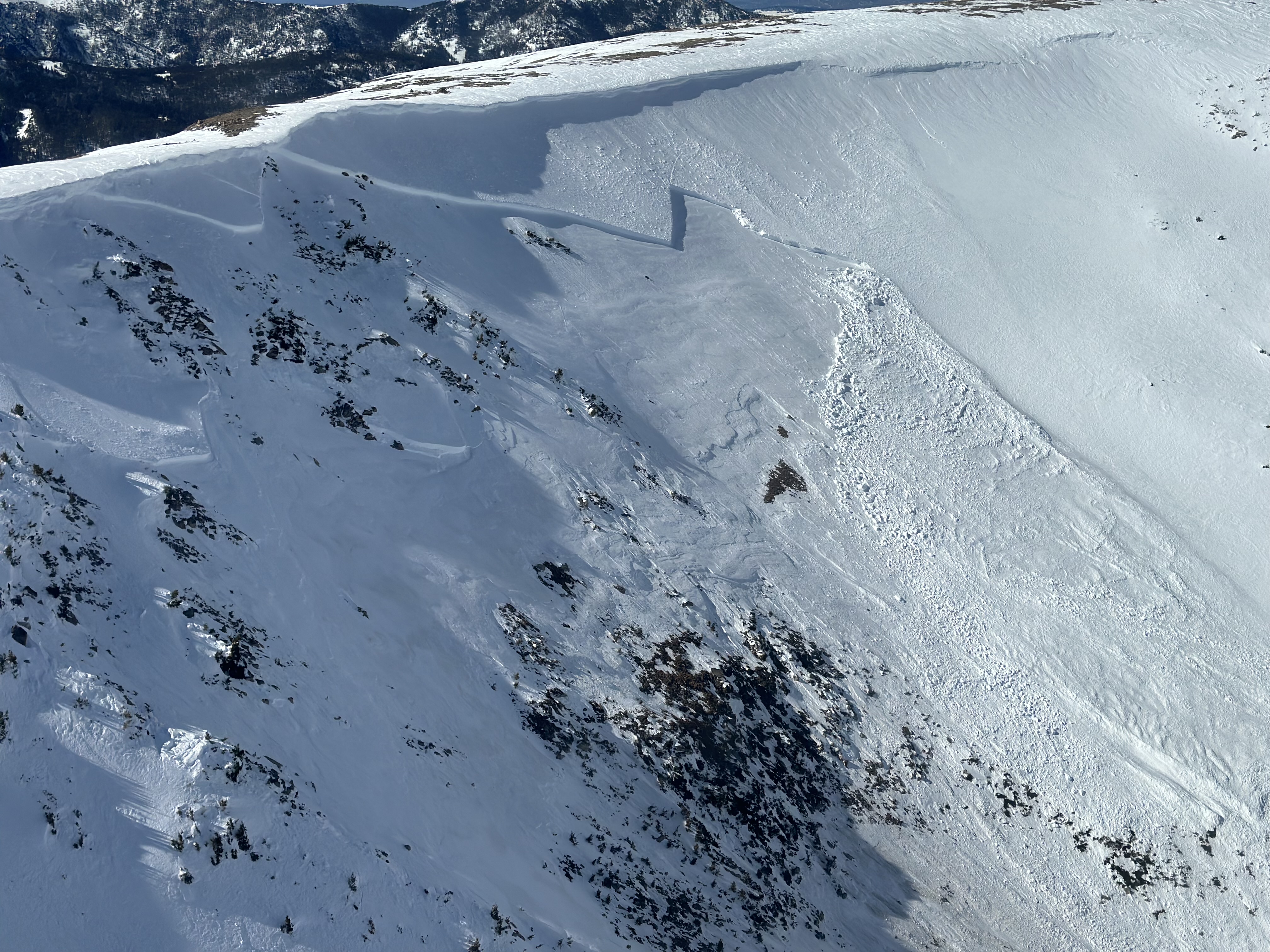
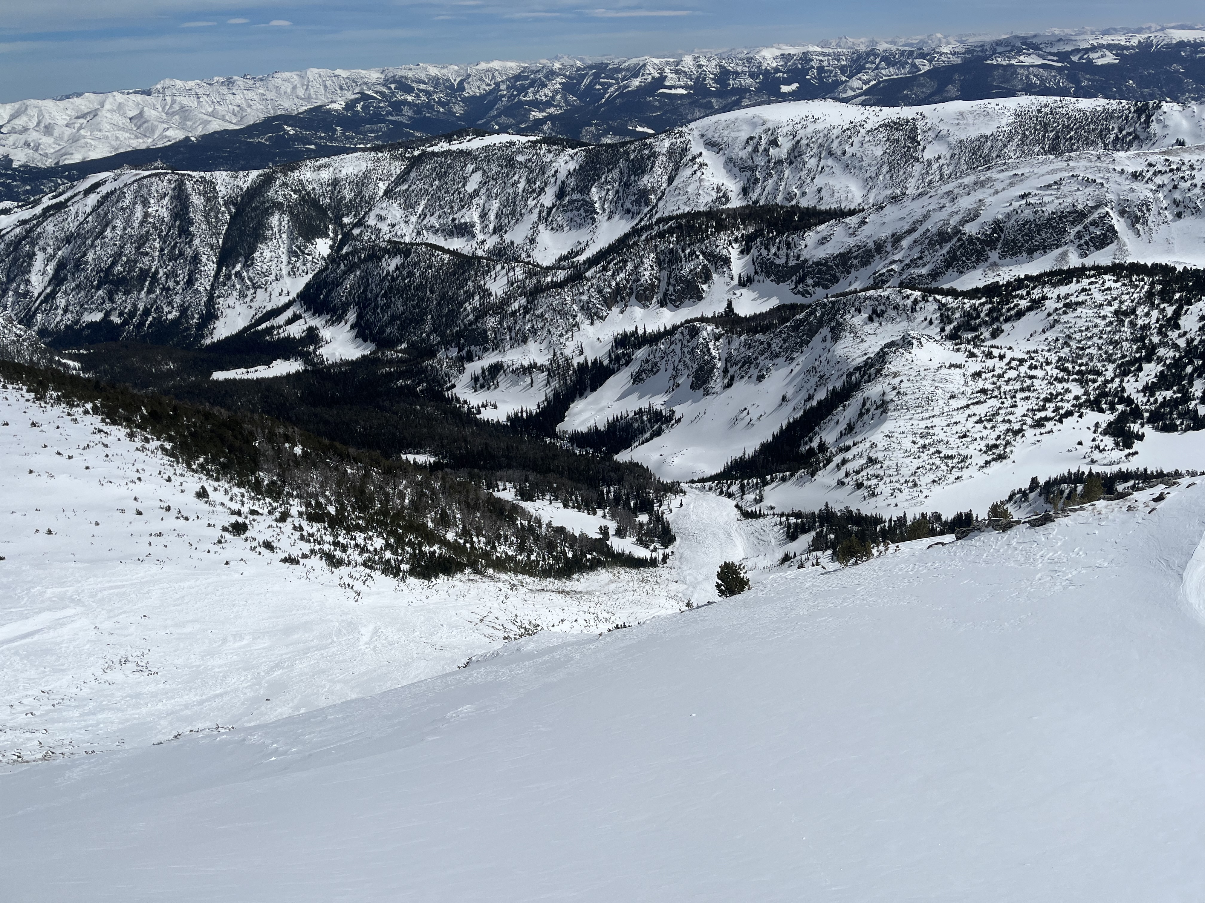
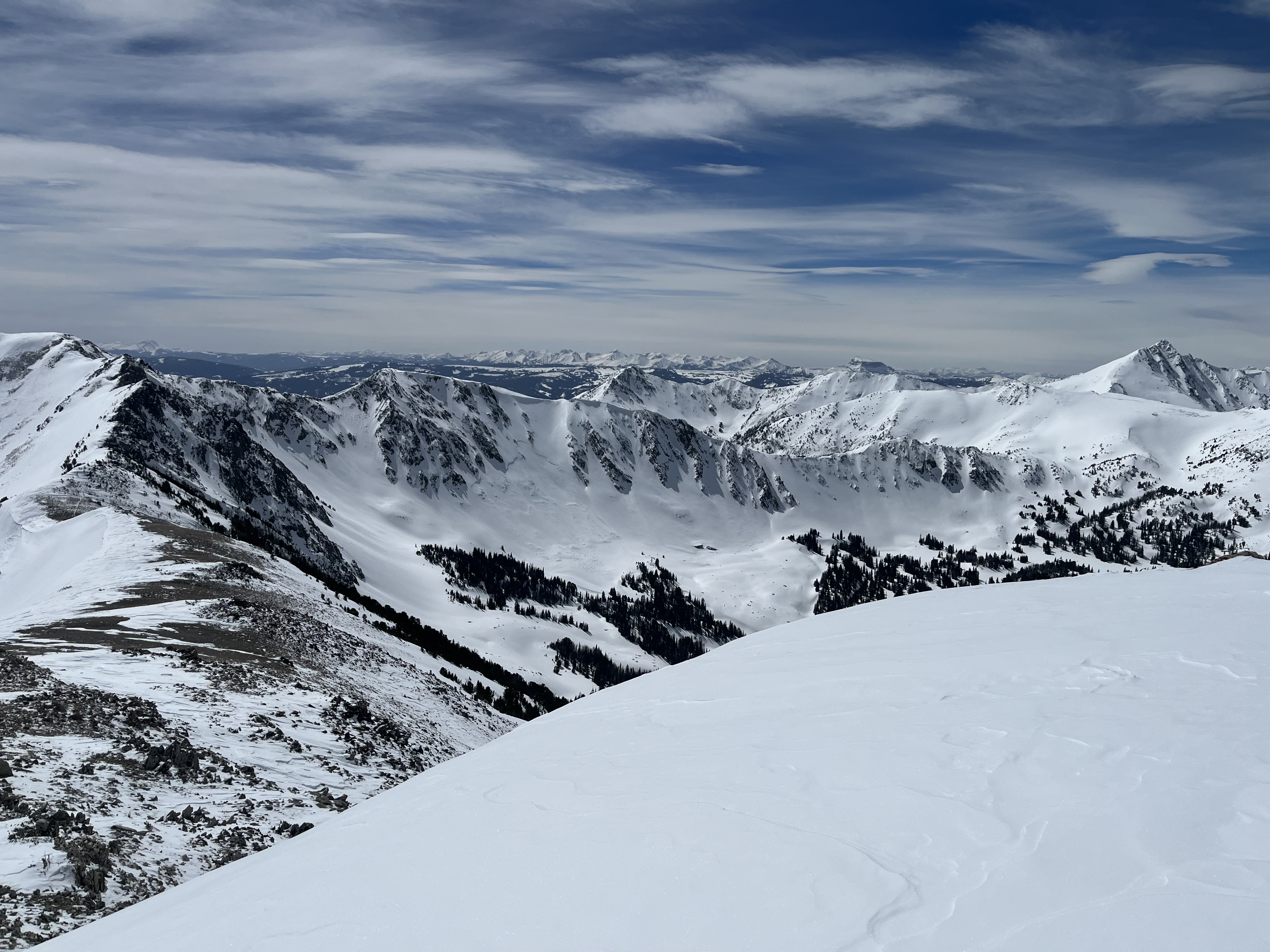
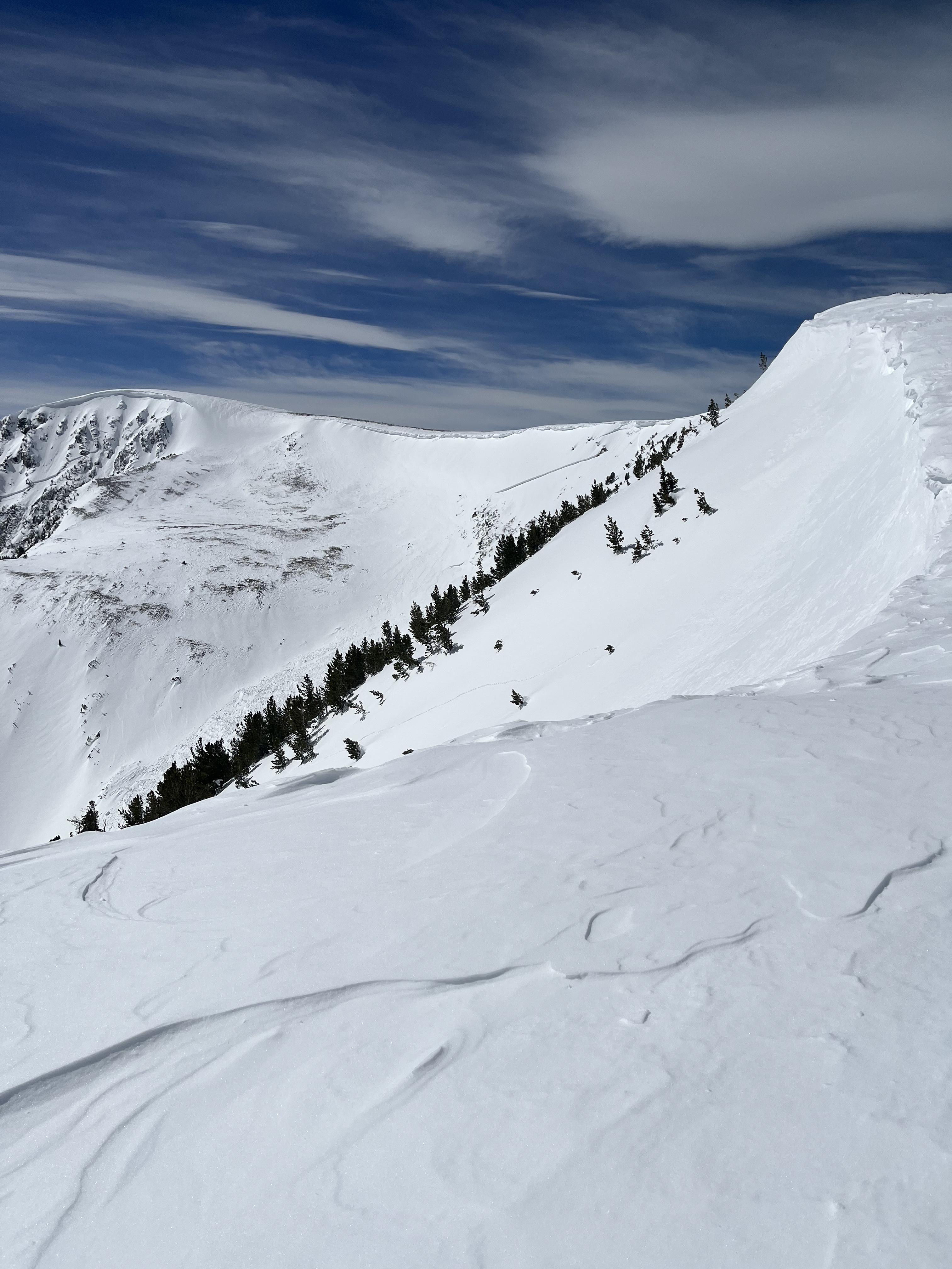
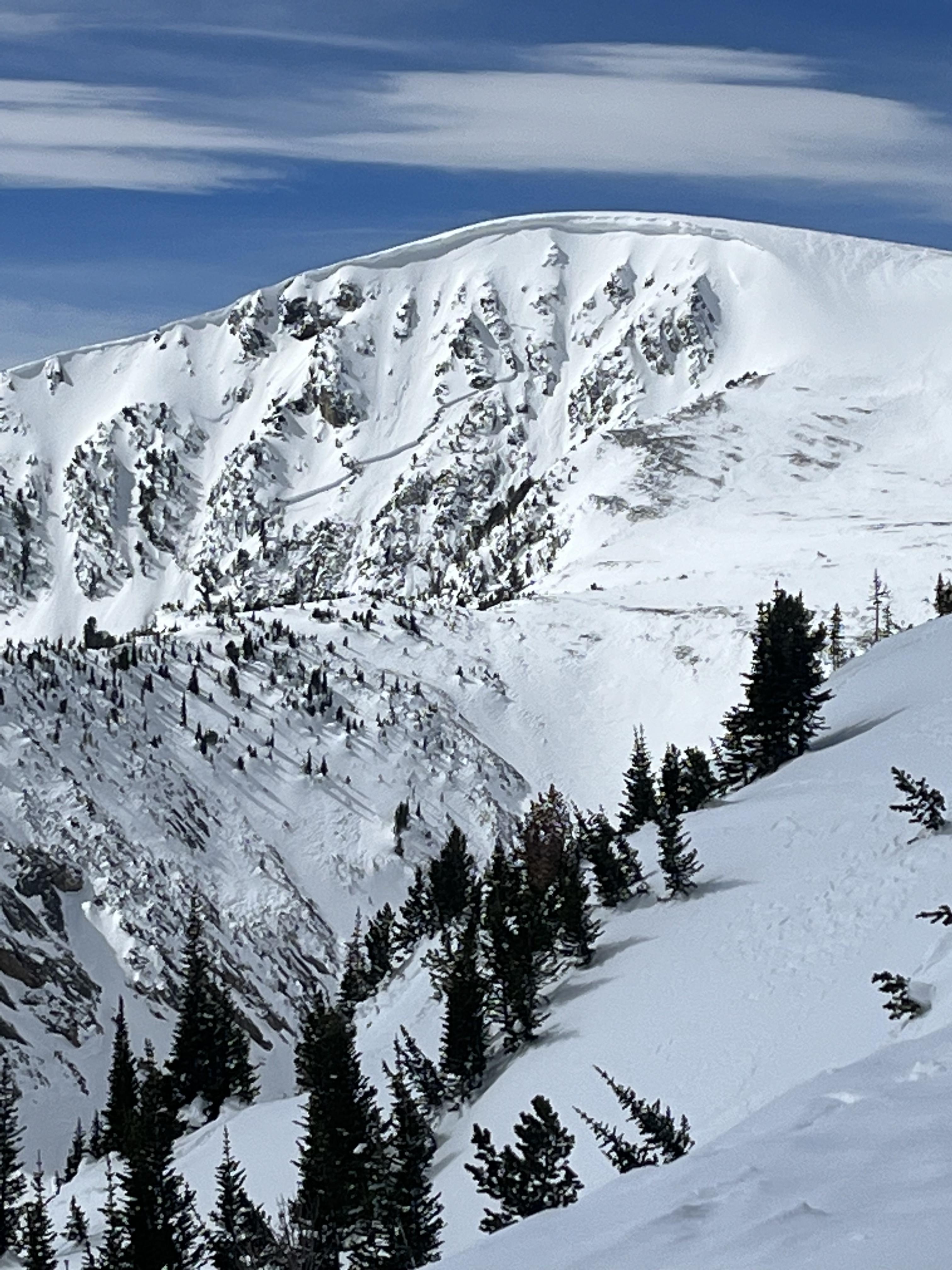
Full Snow Observation ReportFrom email: "This afternoon en route back to Livingston from Idaho, lots of slide activity at all elevations…
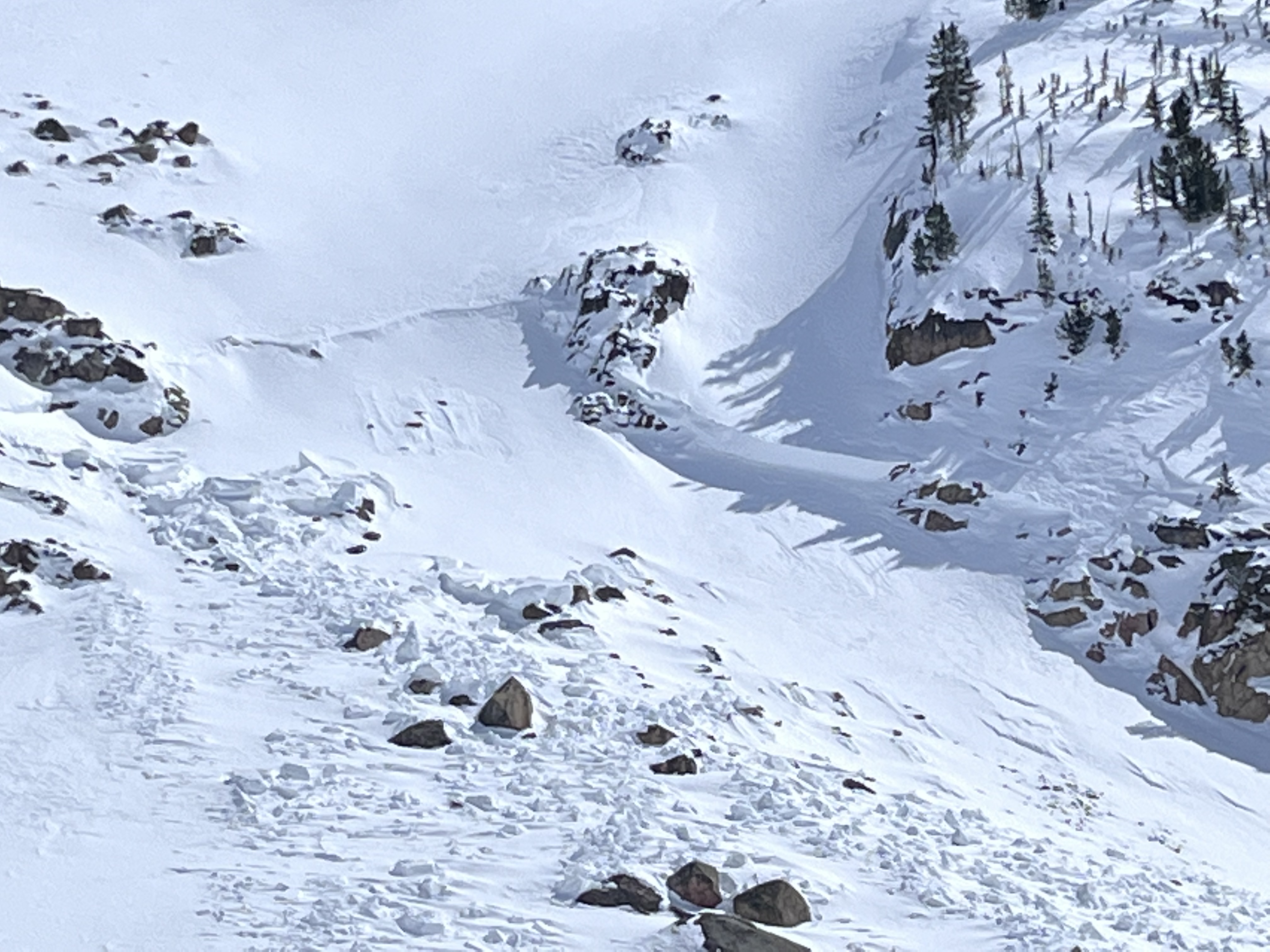
The first picture is the cornice collapse. One block in the debris pile was probably the size of my airplane - a giant ass snowball.
The next few photos are wet slab a mile north along the same ridge, location: approximately 1-2 miles SW of the coordinate photo (it took me a minute to get cords up). Elevation of both approximately 9,800-10,000.
Too many point releases to count in every range I’ve crossed today…"
Full Snow Observation Report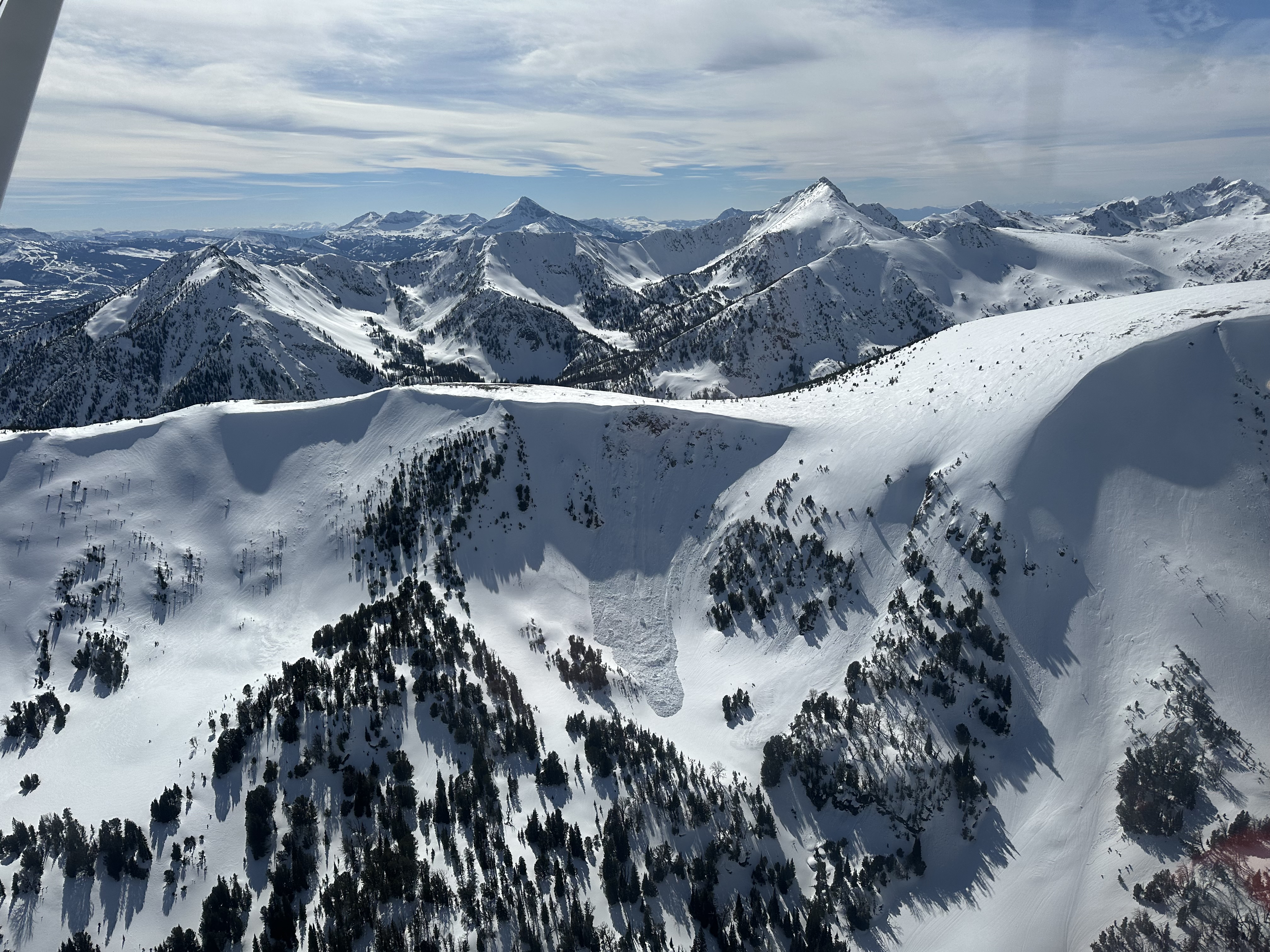


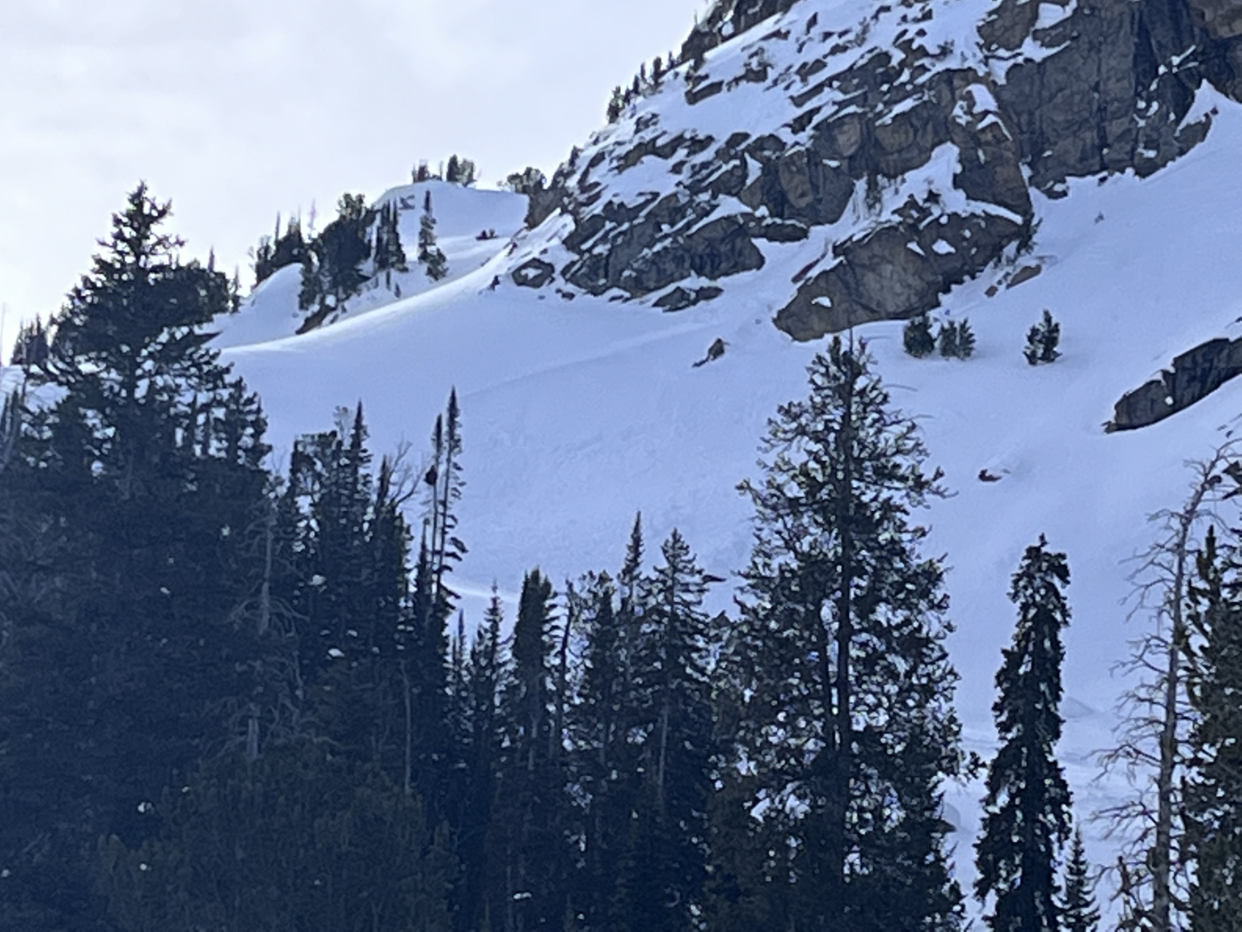
While descending from a trail “run” (definitely more of a post hole) up towards Baldy, I saw a medium-sized wet slide on the eastern side of the ridge underneath some large rocks. The slide was roughly 15-20’ across at the portion I could see and traveled several hundred feet down the mountain. I could hear trees snapping (sadly in the video I don’t think you can, as my breathing is way too loud) and watched the avalanche move for almost a minute. I was very thankful for my careful route finding and avoidance of steep slopes!
~ (45.7311237, -110.9639991)
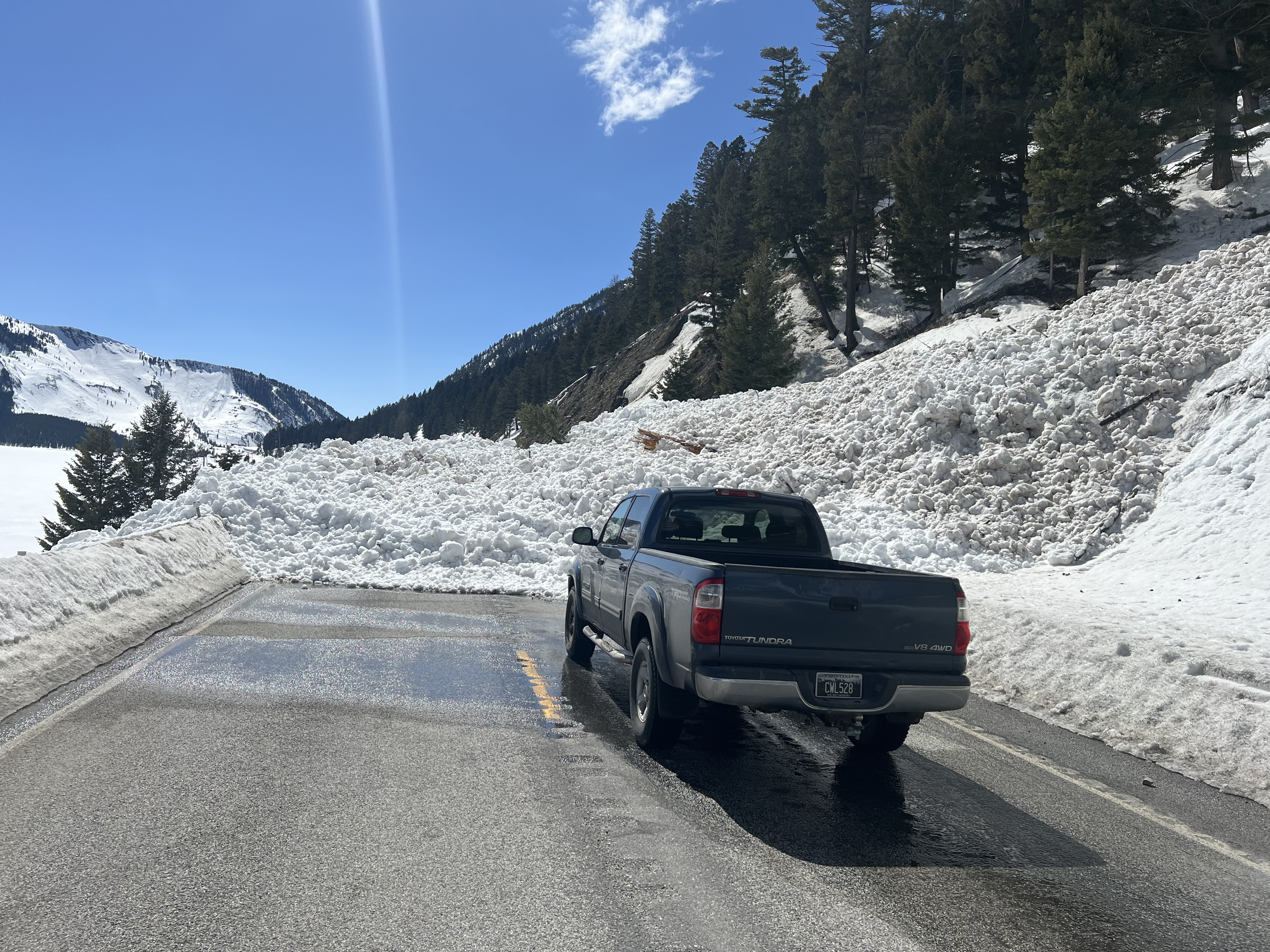
Full Snow Observation ReportBig Unit of a avalanche, photo taken from the Seitz road.
Full Snow Observation Report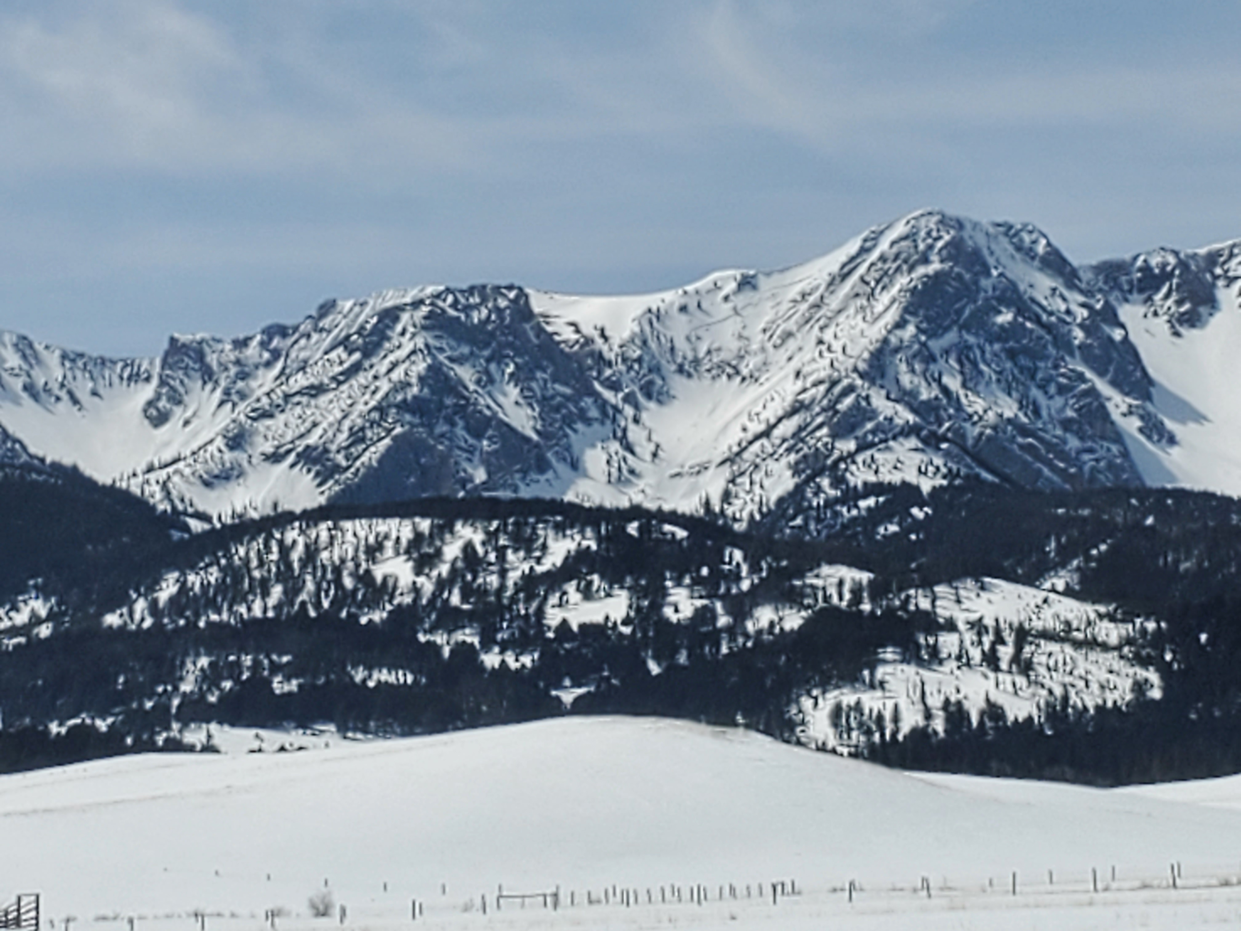
Today we observed wet loose avalanche activity on the southerly aspects in the mountains around Pioneer mountain. We also observed one dry slab avalanche on a NE aspect of Sphinx mountain at approximately 9,000’.
Full Snow Observation Report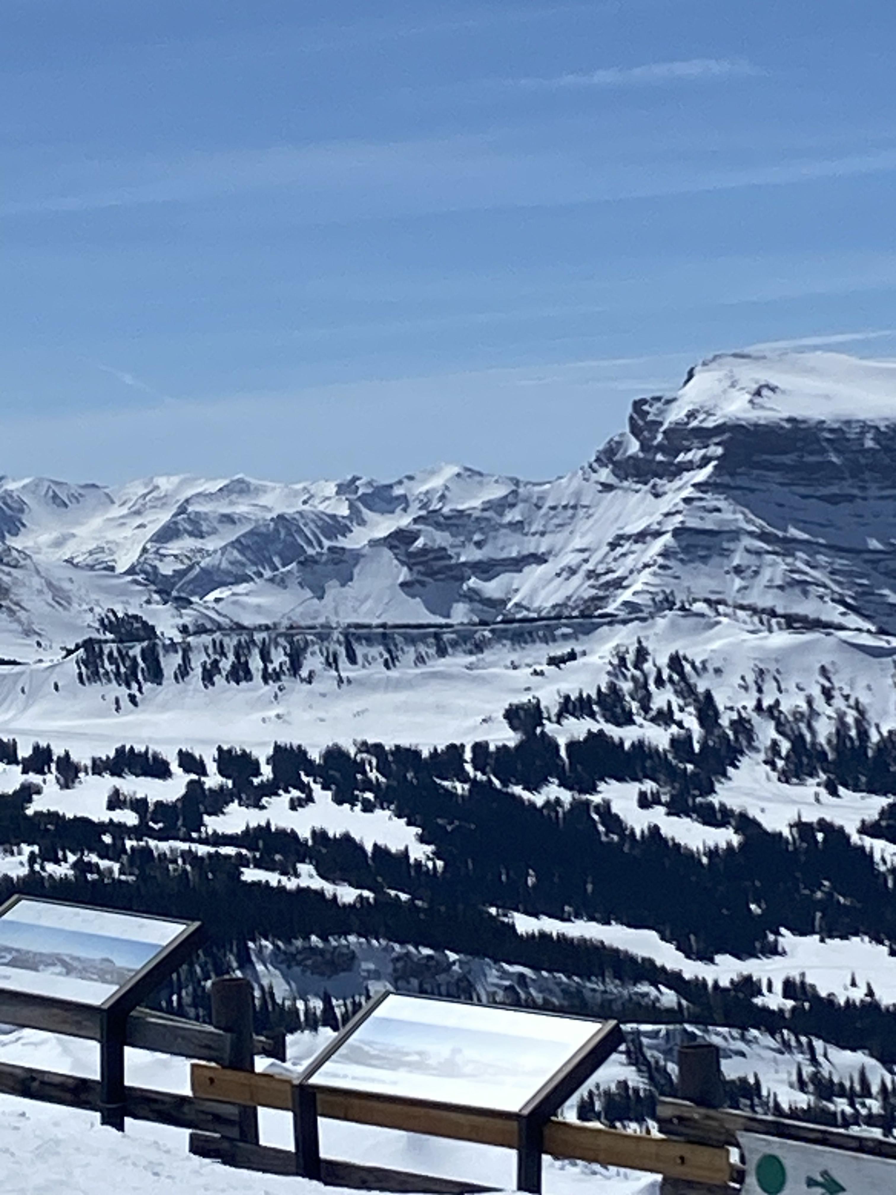
We toured in Hyalite today. By 10:30 in the morning we saw wet, natural avalanches coming down east facing cliffs. We also saw several pinwheels from yesterday. By noon we were at 9,900' on a SE facing aspect, and the snow surface was wet at this altitude. Once we were down at 9,000' the top 8" of snow was wet, and it was beginning to move as a slab on small rollovers.
Full Snow Observation Report

We skied three runs south of Quake Lake, up to 9400 ft. Most snow was crusty until it warmed up, but we found some powder in the shade and on north and east aspects, especially up high. Dug a pit at 8400 ft, N aspect, 32-degree slope. Result was ECTN-20 at 25 cm, and ECTN-22 at 35 cm. Sheared fairly cleanly. We were halfway up the avalanche chute at that point, so skied down with no incidents and skied two other tree runs.
Full Snow Observation ReportWe toured into Emigrants southeast bowl on Saturday. We found thin and reactive wind slabs on north facing slopes. Our ECT on a north face gave us stable results below the wind slab layer. It was the second day in a row of high temperatures and full sun but there was very little wet slide activity in this zone. We observed multiple old crowns in the surrounding mountains that looked to be a few feet thick. They were possibly breaking on a crust layer we found about 2 feet deep in our pit.
Full Snow Observation ReportDocumenting local avalanche cycles, attached is a photo of an avalanche on the south face of Mt. Abundance taken yesterday, that likely happened last Sunday (?) when we got 1" of SWE overnight. Lots of debris chunks the size of refrigerators. Crown mostly covered by wind blown snow.
Full Snow Observation Report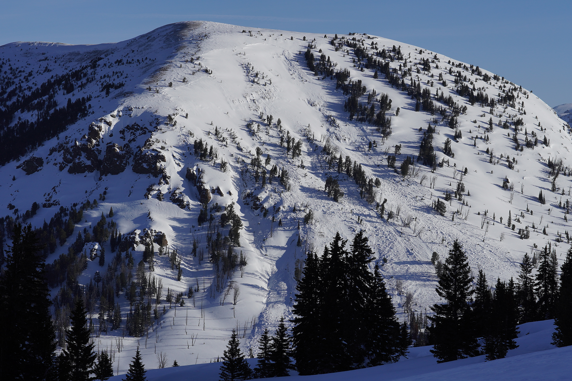
We toured out to republic pass. Saw mutliple small natural wind slab releases. We dug a pit on Republic Pass around 9800 ft on a north facing slope with lots of wind, got an ECTP 26 @ 30cm down from the snow surface on a very thin layer of facets. We only dug a ~5ft deep pit but found very stiff and solid snow throughout the snow pit (1 finger to pencil stiffness). Very little fresh snow was on the surface due to the wind ripping through the pass. It snowed for the whole first half of the day, lots of wind but only about 1cm of accumulation.
Full Snow Observation Report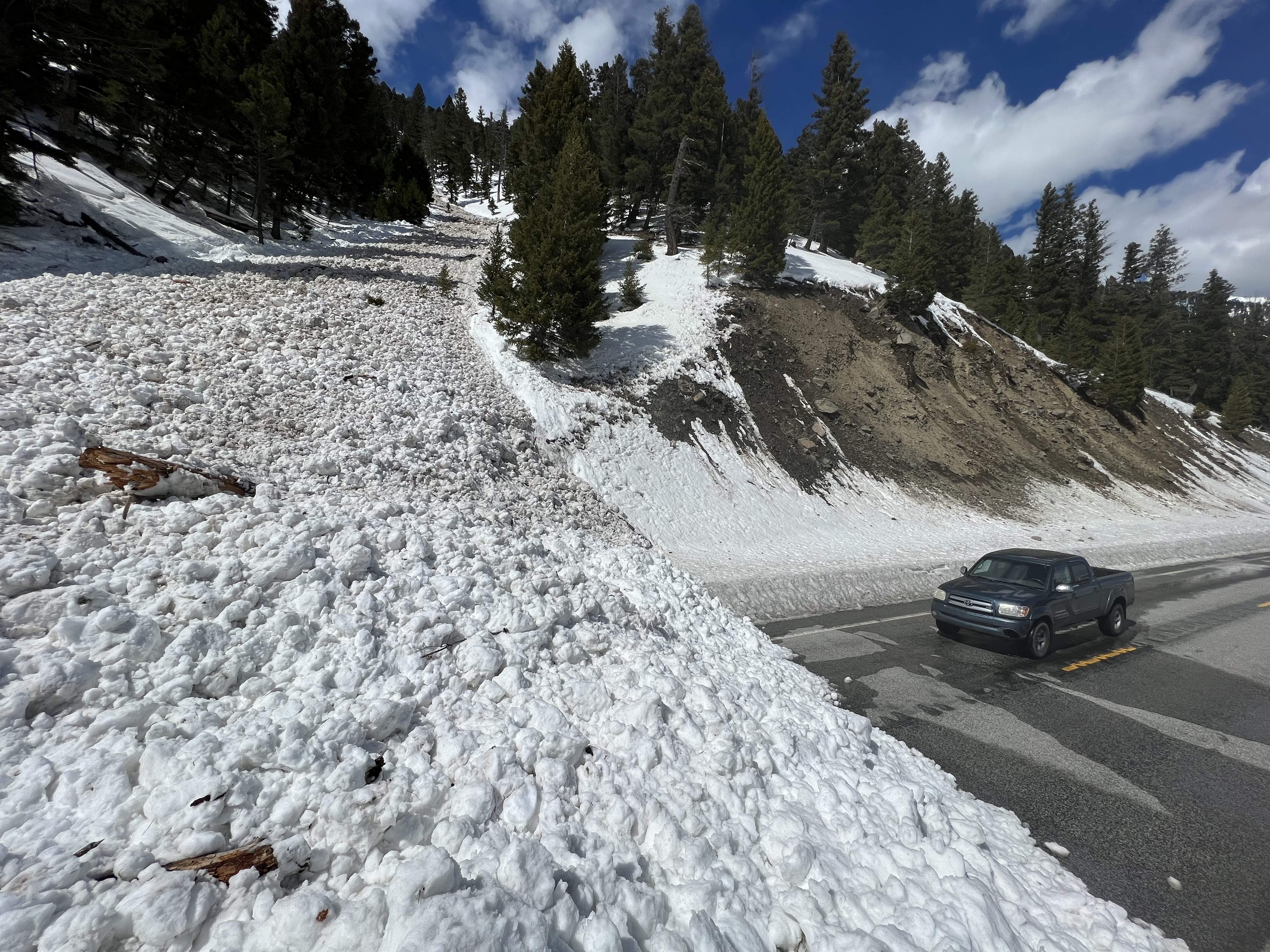
Lots of naturals and maybe a rider triggered avalanche seen today. Steep solar aspects had lots of wet loose activity and small cornice/pillow fall.
Full Snow Observation Report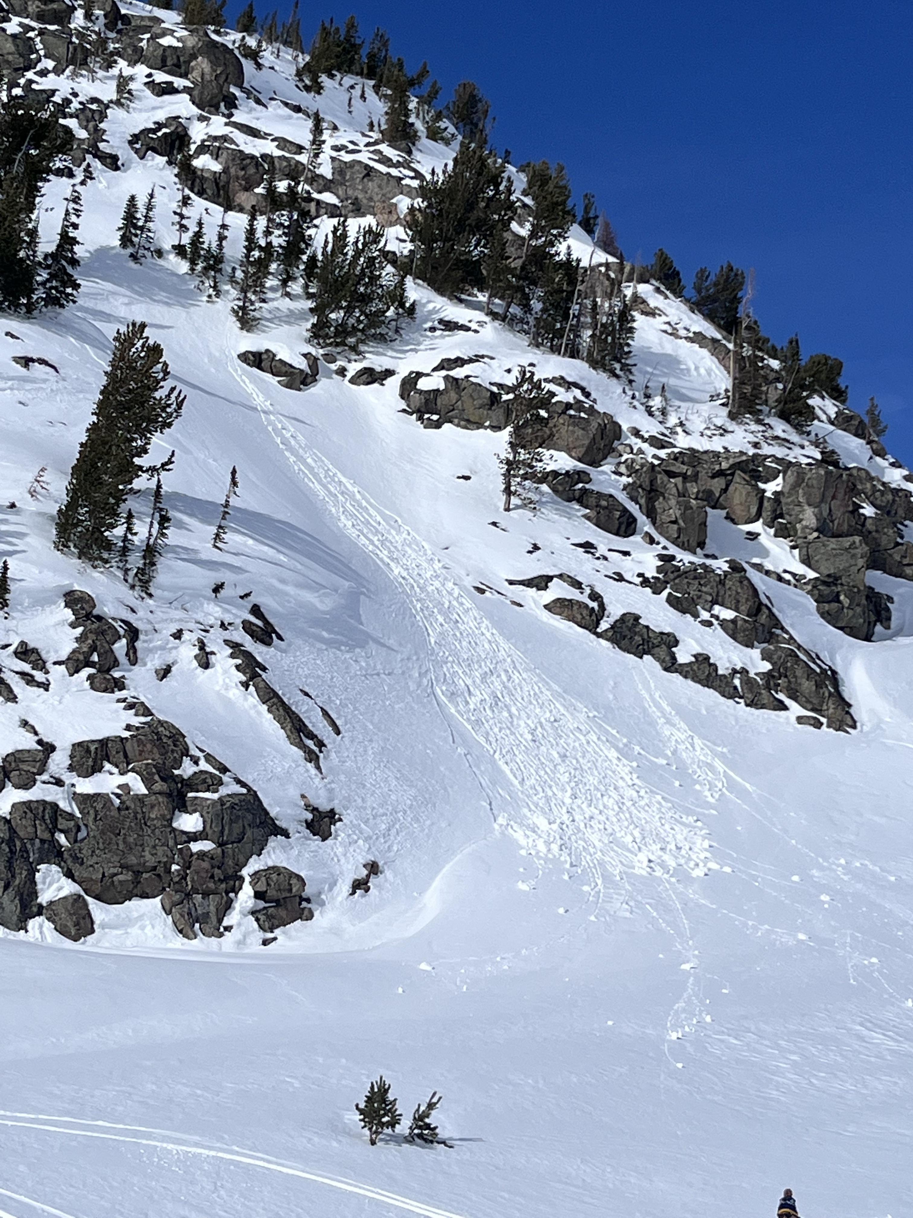
Went for a ski on Jumbo Mountain via the Lava lake parking lot....
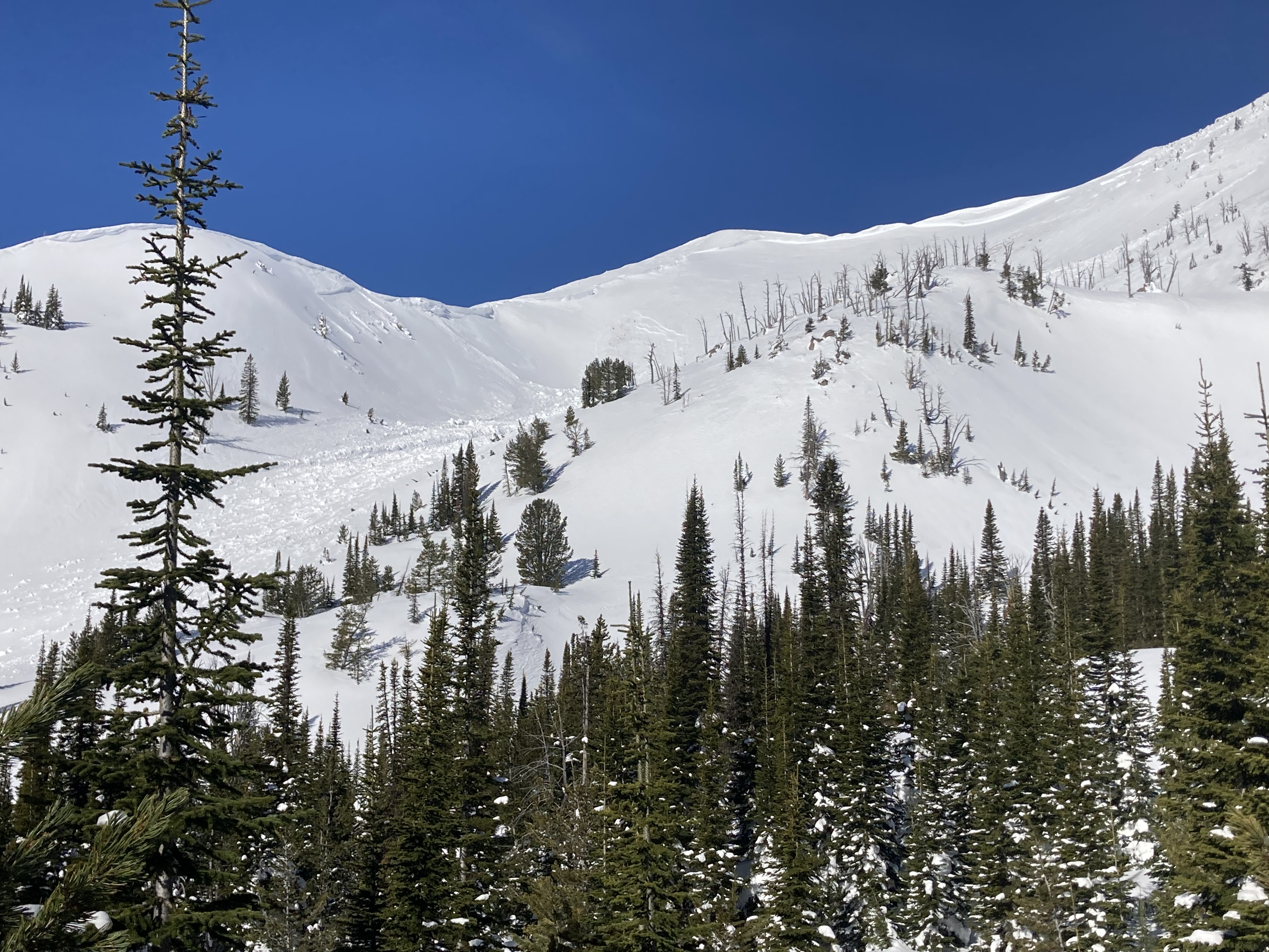
The big surprises for the day were 3 separate deep slab avalanches since the most recent loading event (likely 4/3). Photos are attached. The first that we sighted was on the N/NE face of Jumbo. It appears to be cornice fall triggering a windslab that stepped down, photo attached.
HS-N-R2-D2-O @ around 10000ft on the N/NE face of Jumbo.
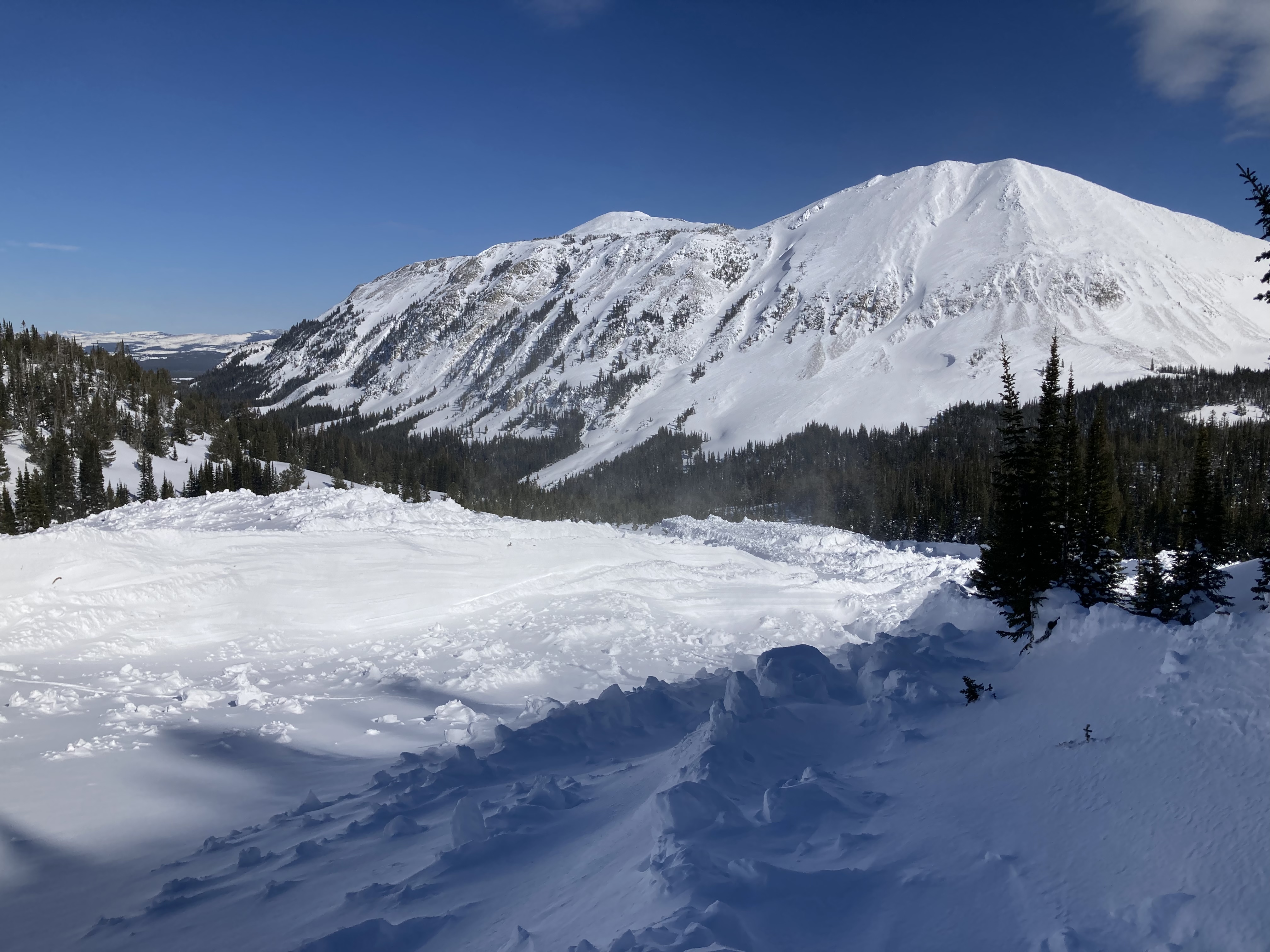
the next that we sighted was a large deep slab on the E face of the ridge just north of the true summit of Jumbo.
HS-N-R2-D2.5-O @ around 10,000ft.
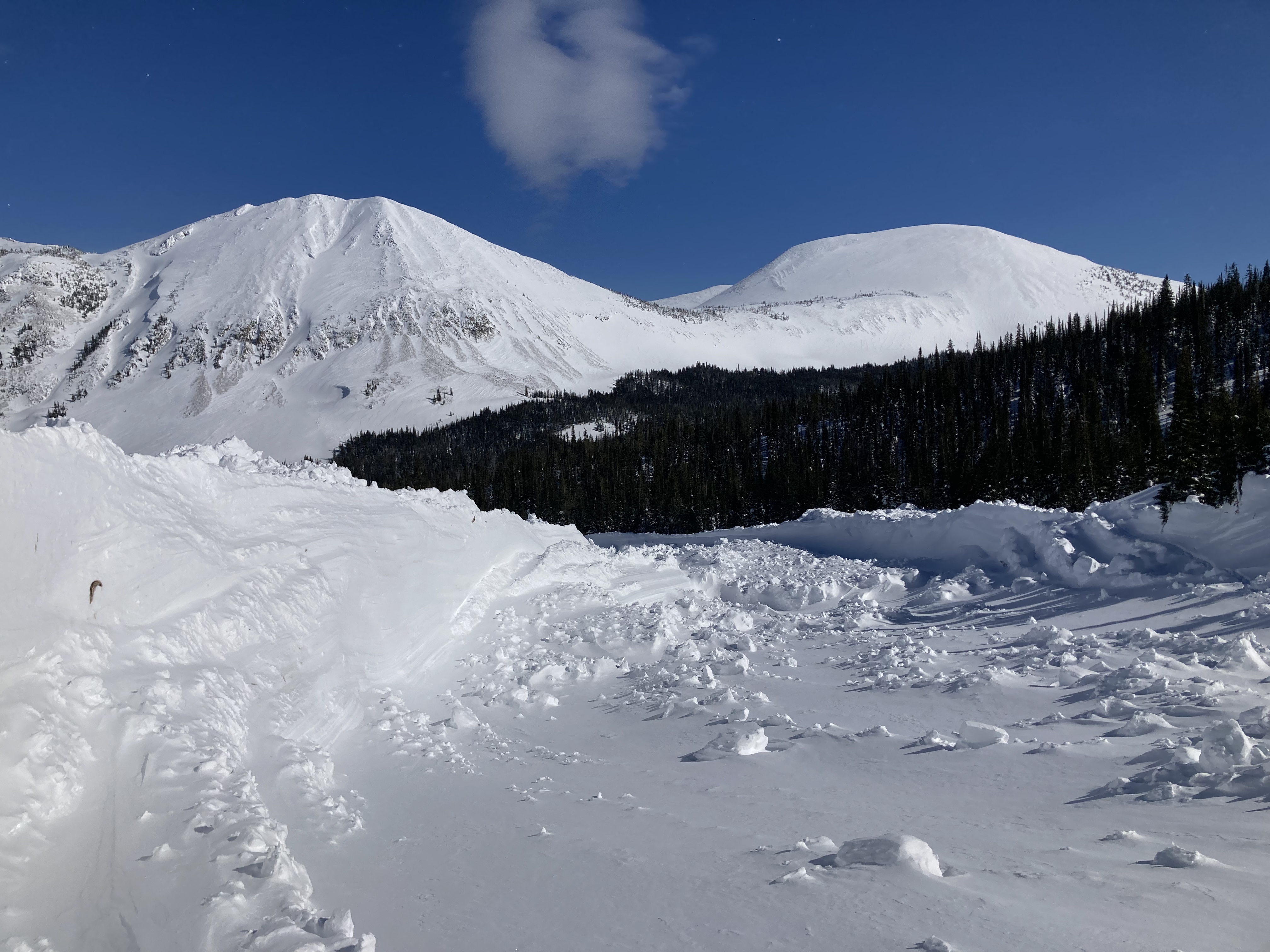
The real show stopper was on the E face of Jumbo.
HS-N-R4-D3.5-O/G. Approximate crown width of 1000ft and average depth of 6-8ft. Total run of around 2000ft. A few photos attached.
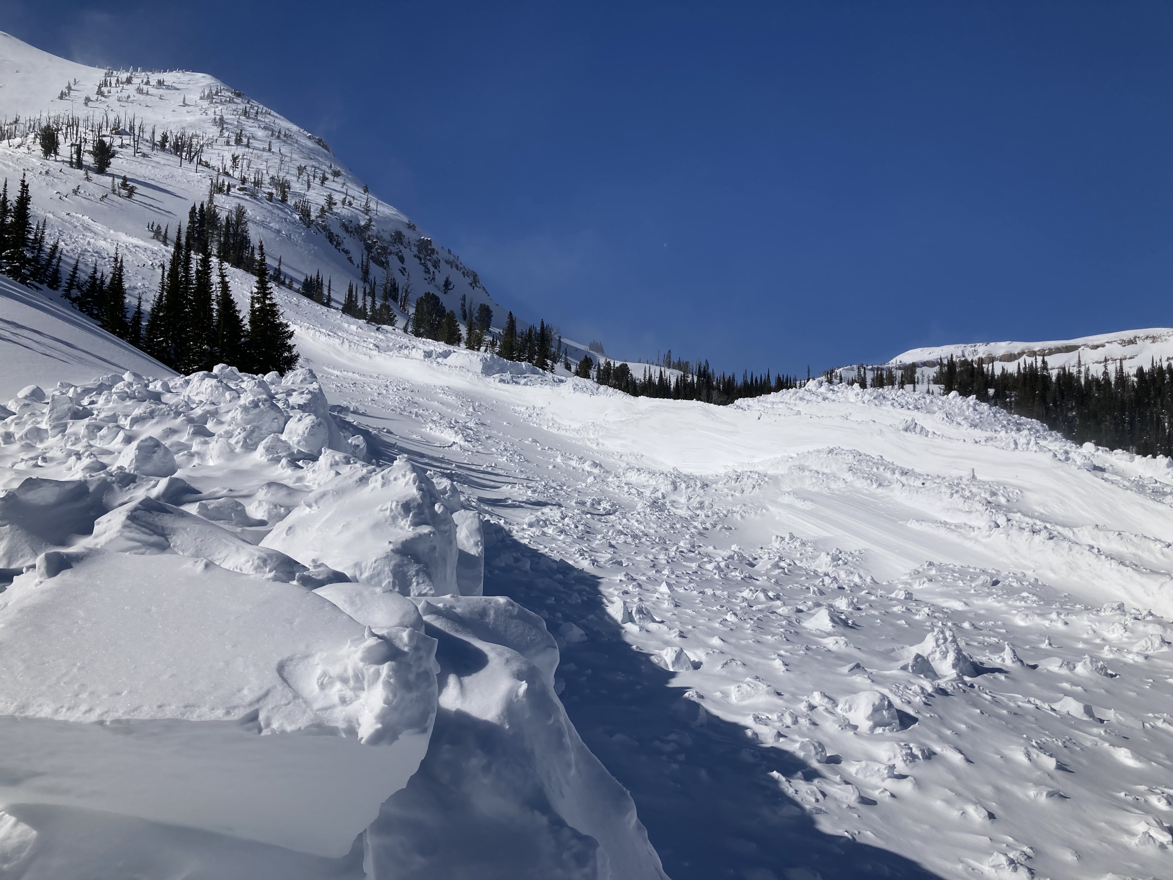
other slides of note, a few D1-1.5 WL slides low in the basin SW facing. Also, an older deep slab on N facing terrain just south of Hell Roaring Lake, D2-D2.5.
Full Snow Observation Report
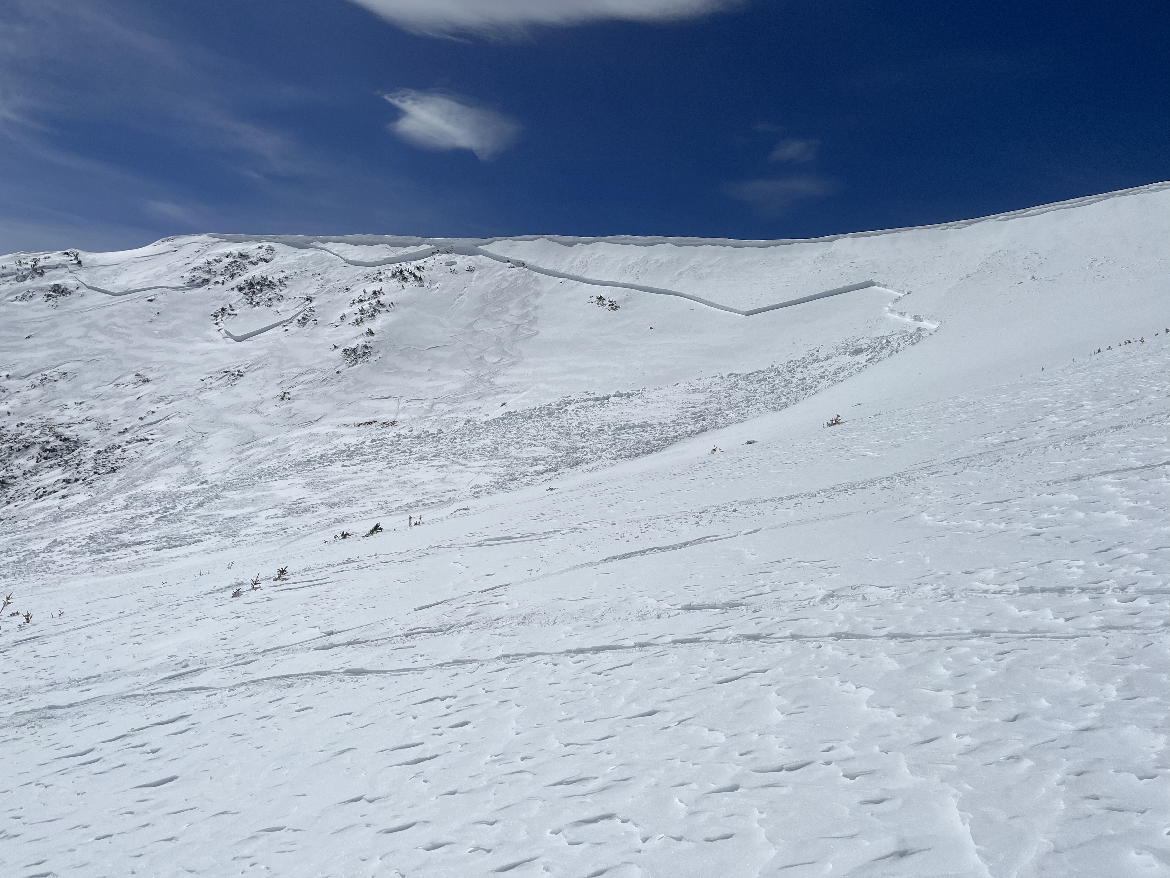

I went through the area of Three Rivers Peak yesterday, and there had been a pretty nice cycle of large slides recently. One on the east face of Three Rivers broke 6-800’ wide 2-10’+ deep, and ran full track. It only had a couple inches of snow on it, so I think it ran sometime during the recent warm days. Some of the walls along the slide were over 20’ high, and I imagine the debris pile might make it through the summer.
I also observed a couple older slides on E\NE aspects that were older, but not a whole lot smaller.
Small wind slab triggered by snowmobile. Slope was assessed by group as wind blown before climb. No one was caught. East facing slope, Storm castle Ridge.
Photo one shows trigger point where the Snowmobiler carved hard and set off the slab deeper in the snowpack
Full Snow Observation Report
We rode through Carrot and Sage Basin and up to the weather station above Sunlight Basin. We dug a pit on a SE facing aspect to see if the snowpack was transitioning from dry to wet. At 9,200' the air temperature was 18 F and the snowpack was dry throughout. Despite the cool temperature the snow surface was close to becoming wet (31 F). This was a good reminder that the sun angle has a significant impact on the snow surface this time of the year, which causes rapidly changing conditions. Additionally, we had an ECTP 13 on a layer of near surface facets 1.5' below the surface sitting on top of a melt freeze crust. This weak layer and the one near the bottom of the snowpack remain a concern.
Full Snow Observation Report
South of Saddle Peak, ~8500', ENE aspect, 2-3' crown depth estimated and likely cornice-triggered. N-facing snow remained dry until the latter afternoon when a high sun angle cooked everything but the truest due north. Avalanche appeared to be all new snow likely on a PWL buried near the end of March. Winds moving snow up high, but everything appeared locked on.
Full Snow Observation Report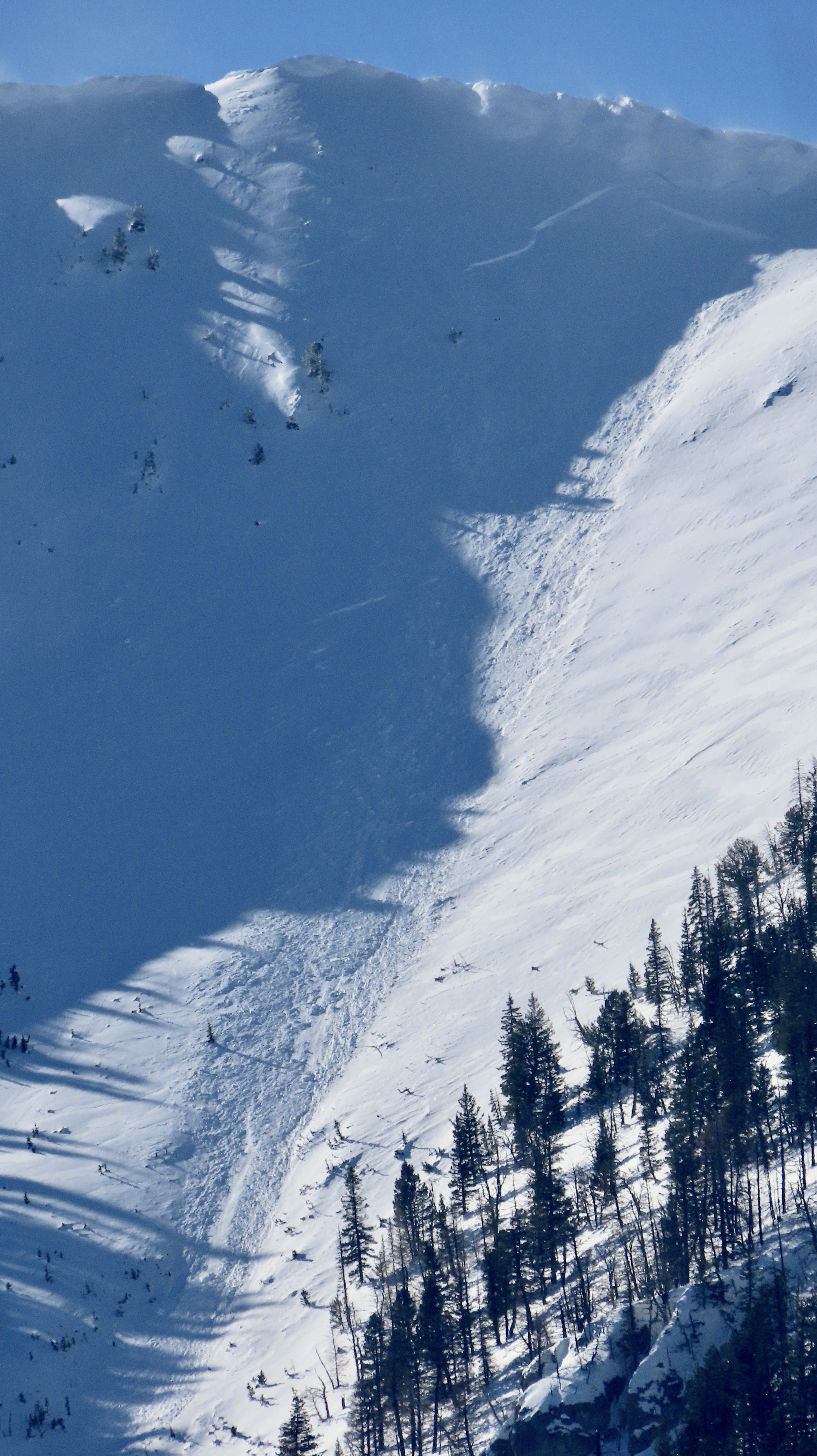
We road into the Meadow Lake Canyon heading up above the lake in the Lemhi Range. Witnessed very sketchy conditions low and higher elevations. Saw 4 avalanches about a week old and many shooting cracks down low and a very nasty 20" think top layer on the snowpack. In that 20" inch layer on top was approx 8" consolidated snow on a 1" think ice layer and another 8-10" of consolidated snow on many feet of faceted sugar snow. We had shooting cracks hitting the cut banks of the road, heading up to around 9,000 ft where we started running into about week old slides. Slides were size 2 to 3. Slides were noted on NE, SE, NW, facing slopes. The bigger slides were at 10,000 feet.
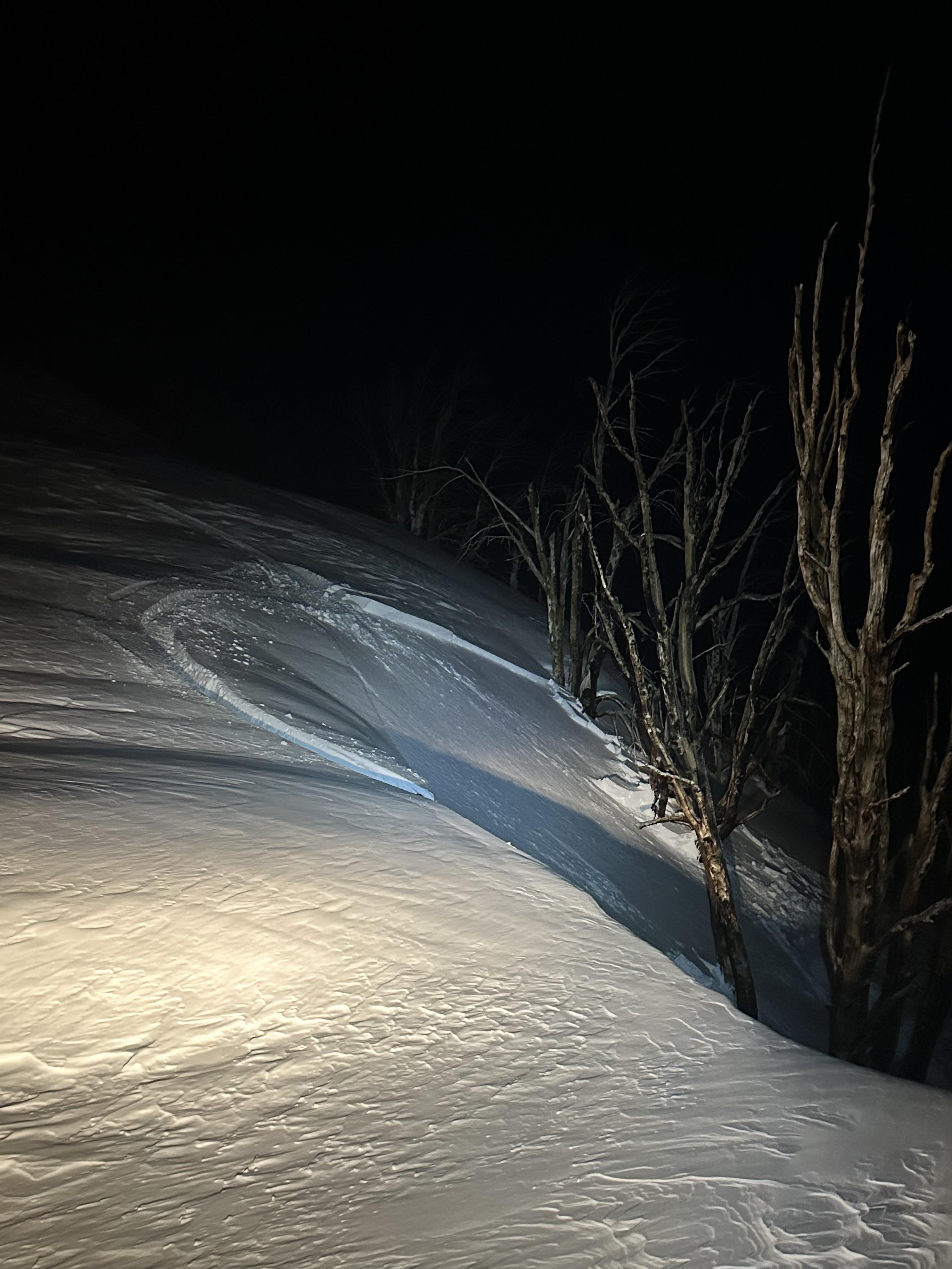
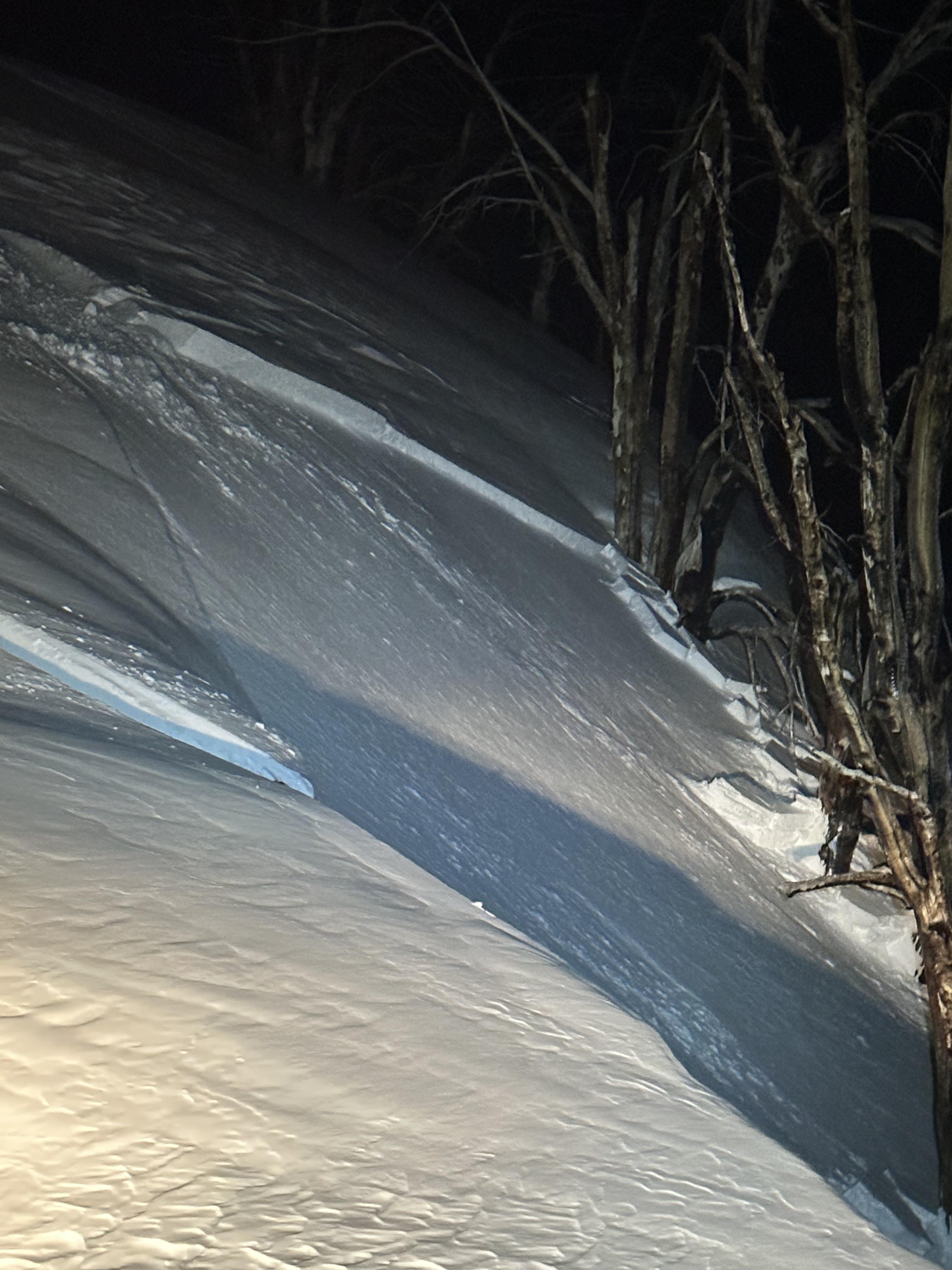
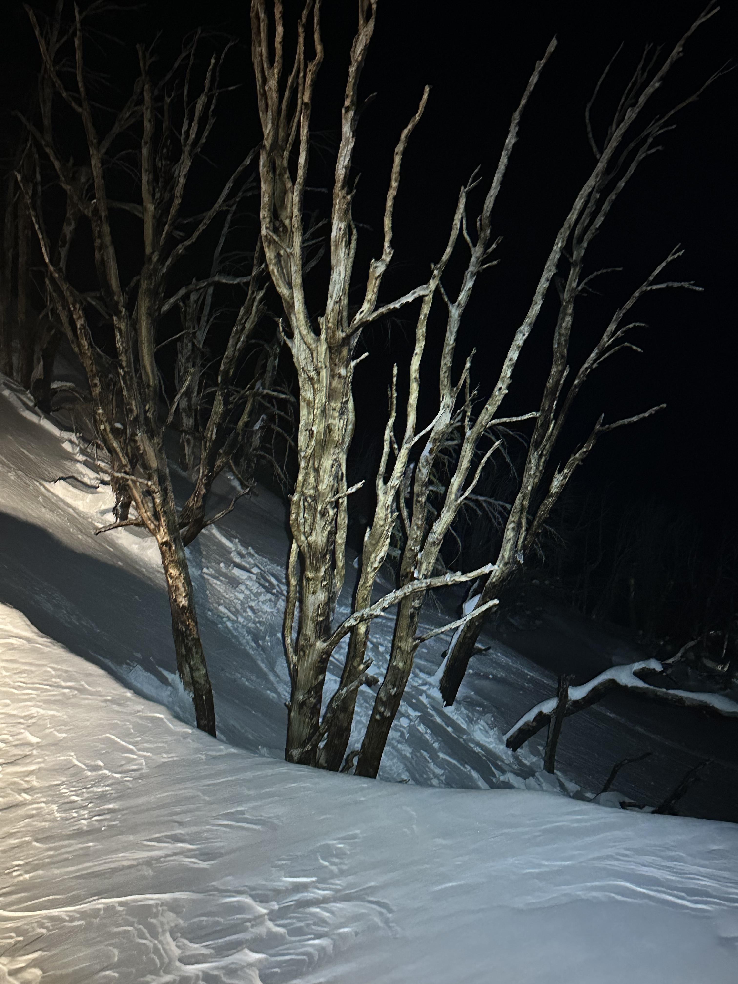
Full Snow Observation Report
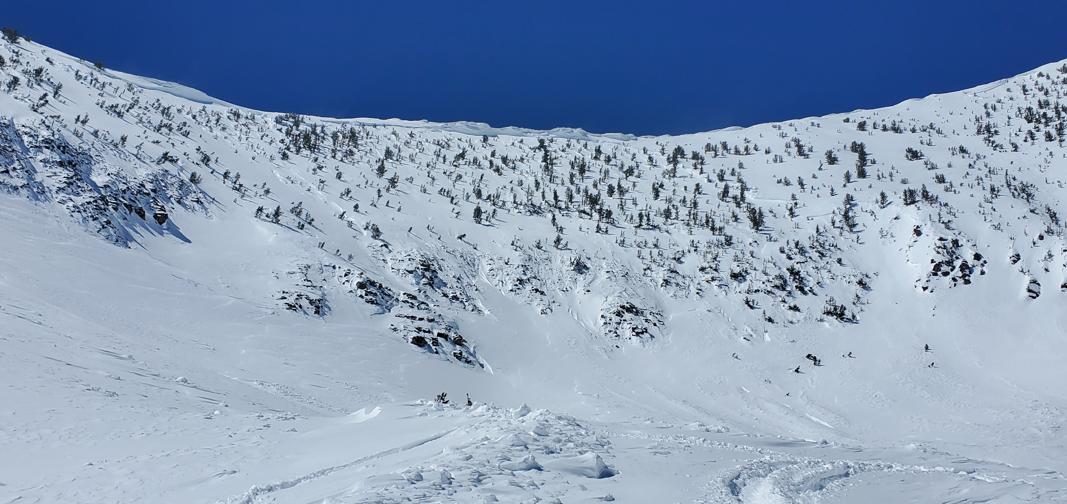
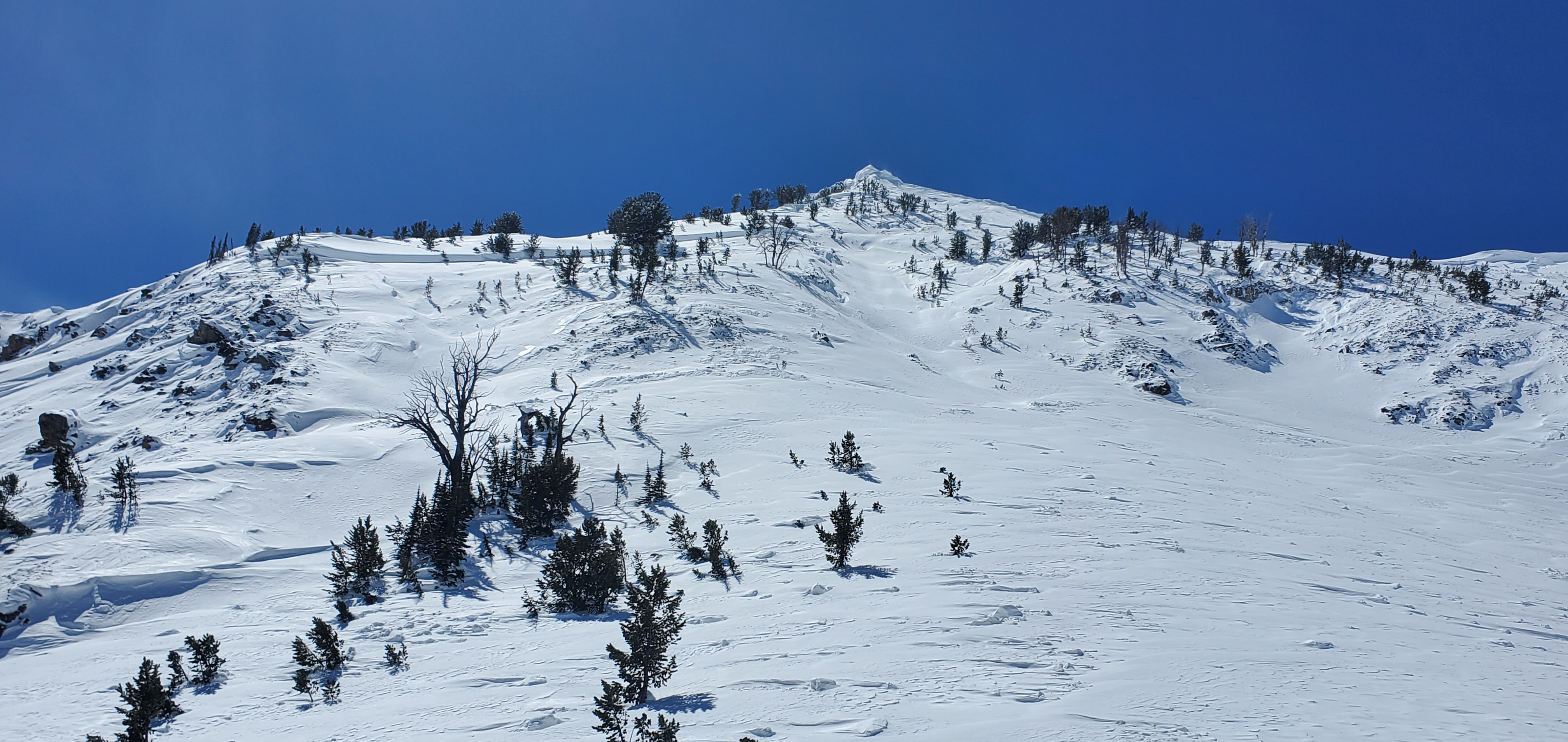
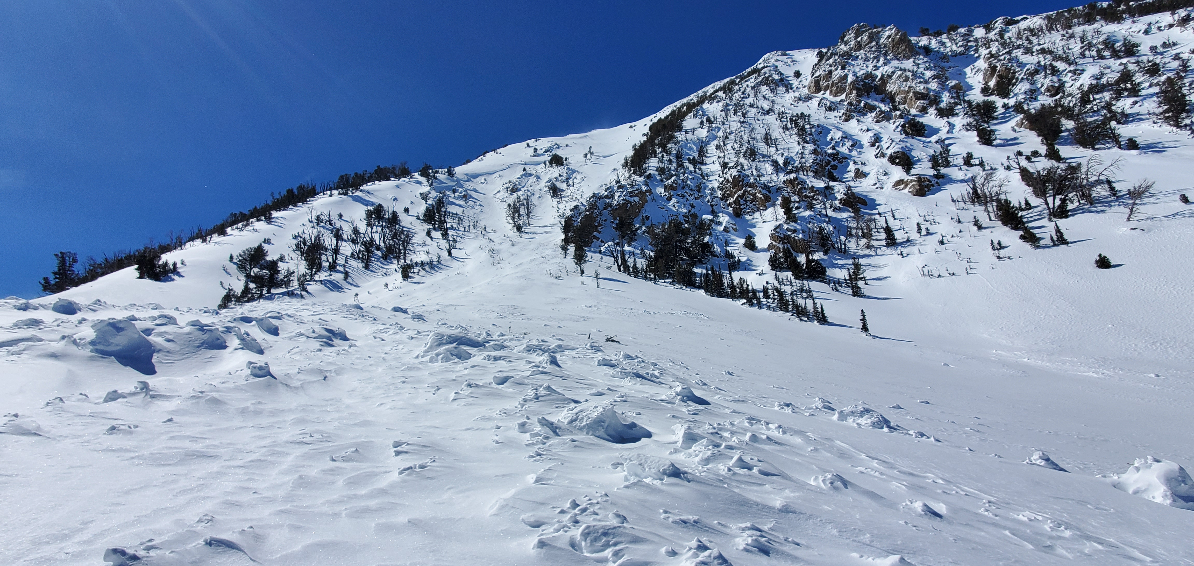

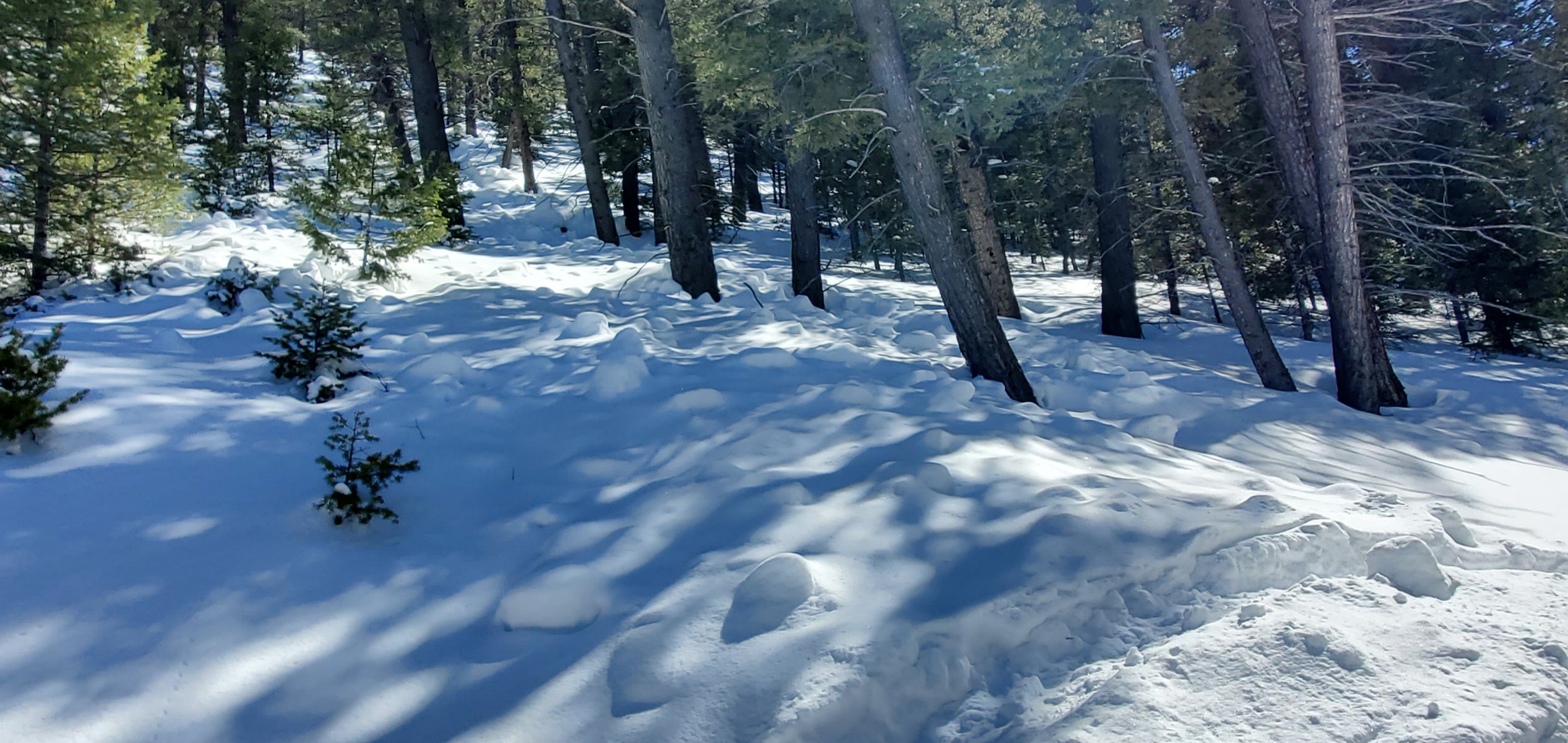
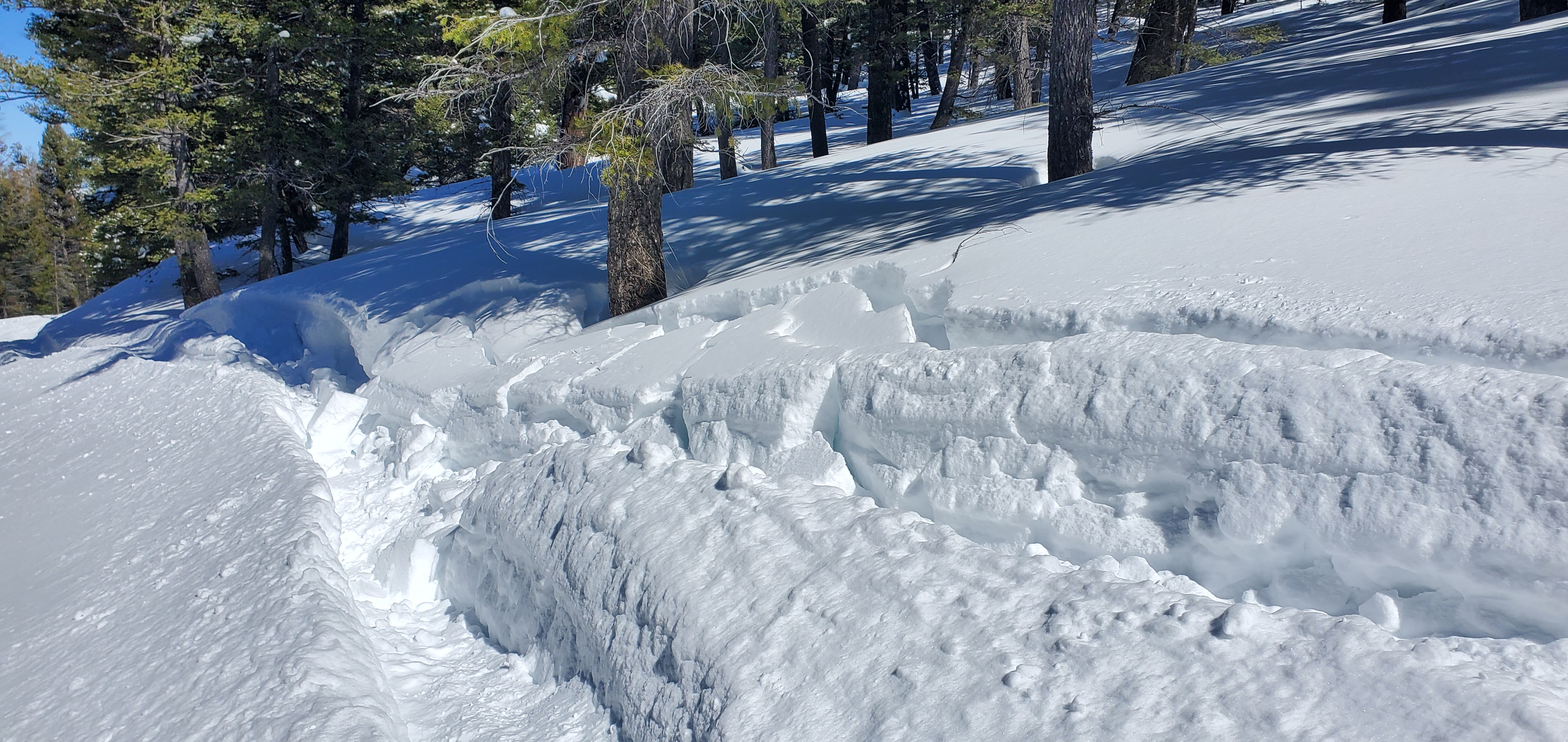
Photo of recent, natural wind slab avalanche near Cooke City. (which likely happened last night)
The avalanche is on a SE aspect around 10,000'. The crown looks to be about 1-3' deep and 75' wide.
The SW/ W winds were moving a good bit of snow around this morning/ today. (more so than the Lulu wx station would lead someone to believe.)
No collapsing today. Minor cracking of the fresh drifts. Fairly widespread wind effect above 9500'.
Also observed a couple of isolated wet loose avalanches today too.
Expecting more wet loose tomorrow in places..
Full Snow Observation Report
