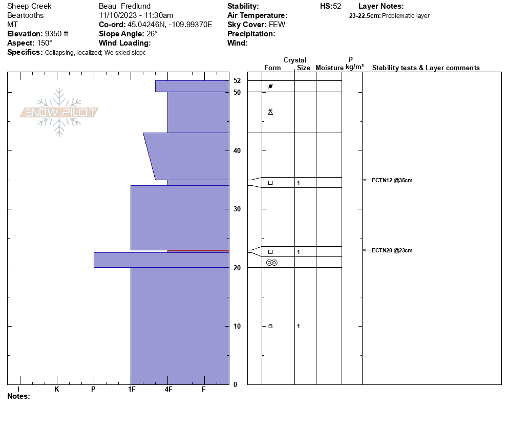
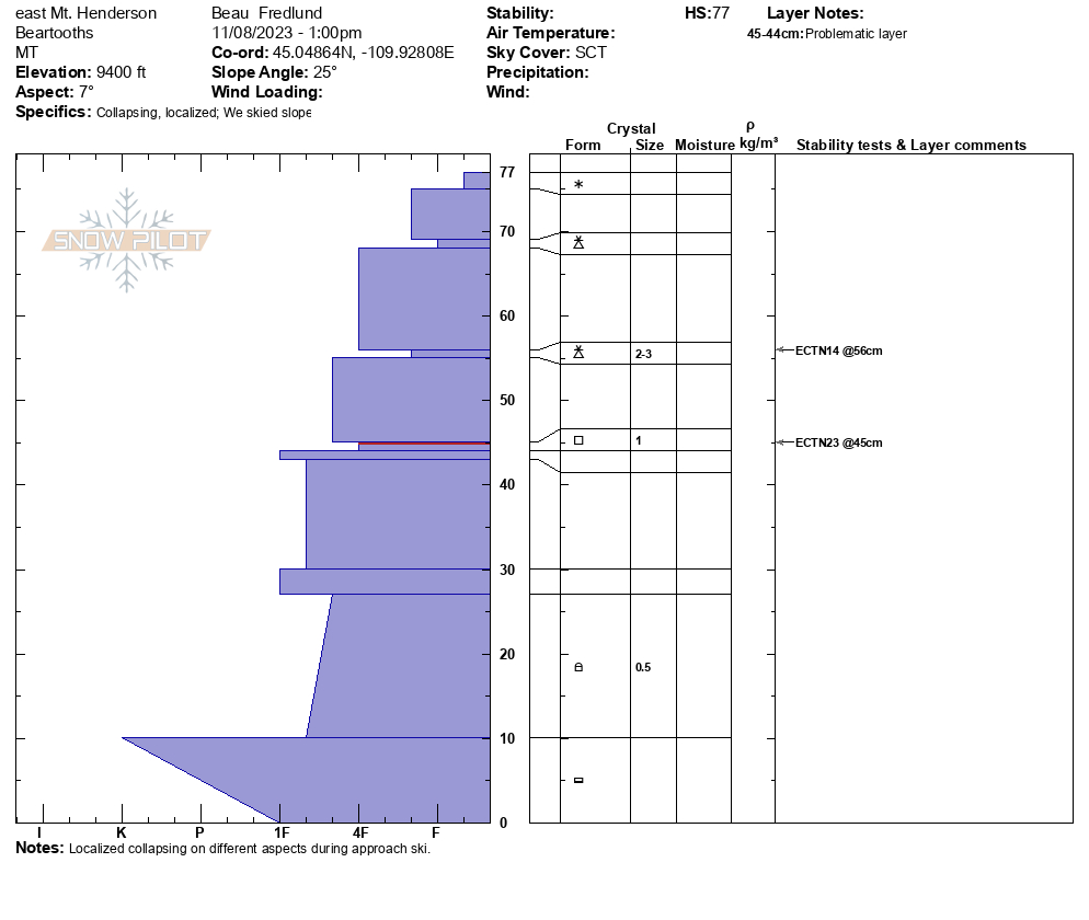
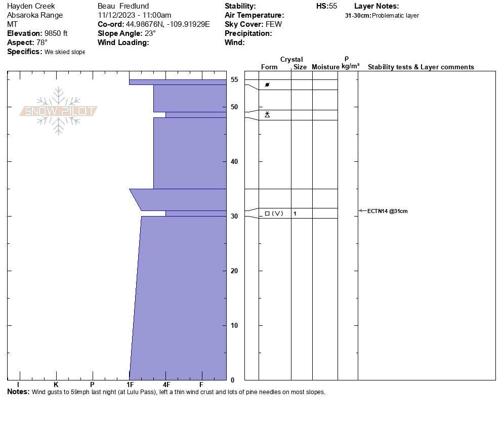
Snow Observations List
At 9,000 feet there was about an inch of new snow. It was calm at first light, but by mid morning winds were gusty and blowing straight down the gullies. It stripped what little snow there was and did not create an avalanche hazard. However, the 6+" in the gullies are all faceted, and with even a thin wind-load it was easy to get cracking. With snowfall predicted for the next 48 hours and again later this week, we'll need to be on the lookout for pockets or gullies of wind blown snow.
Full Snow Observation Report
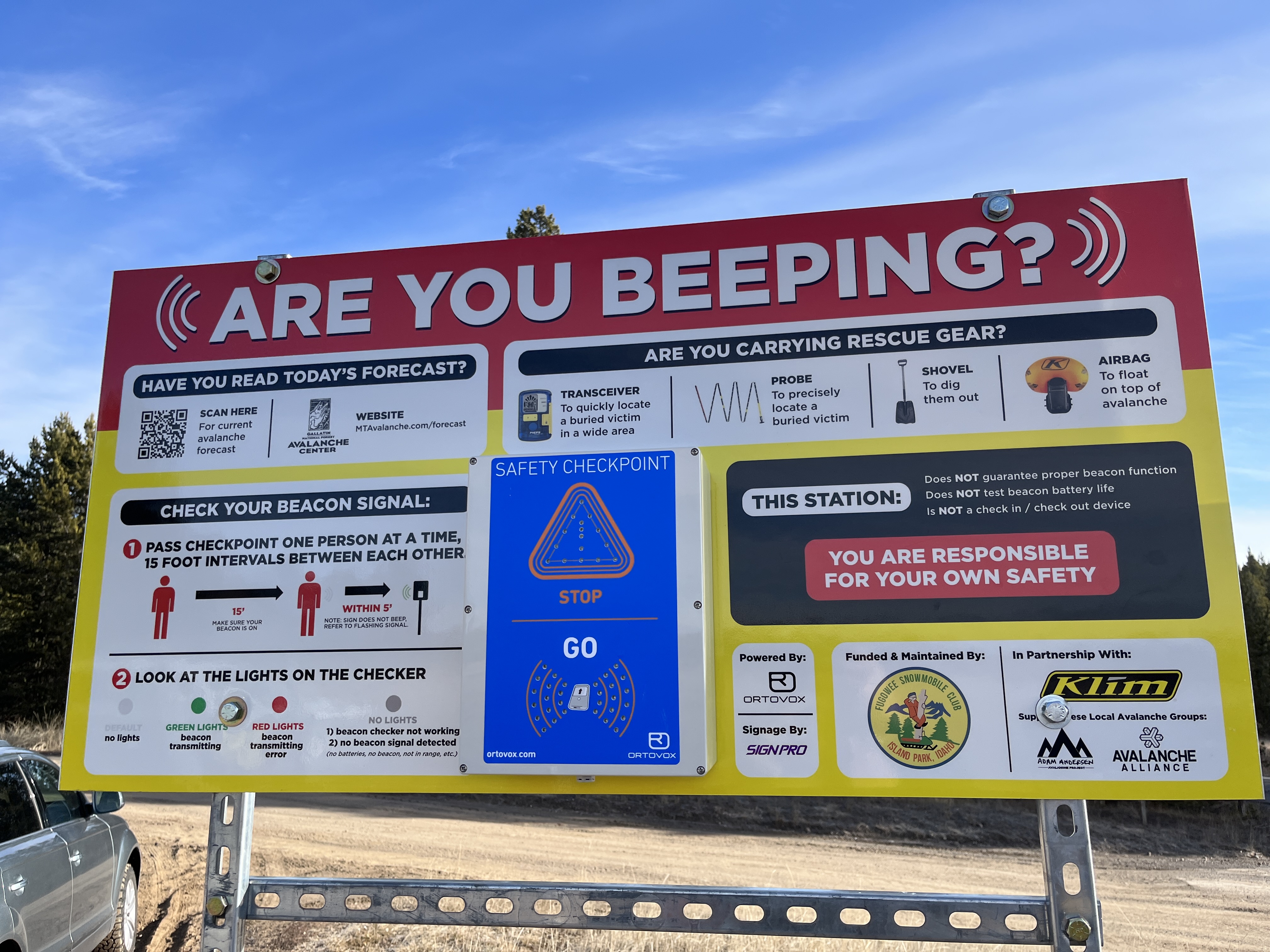
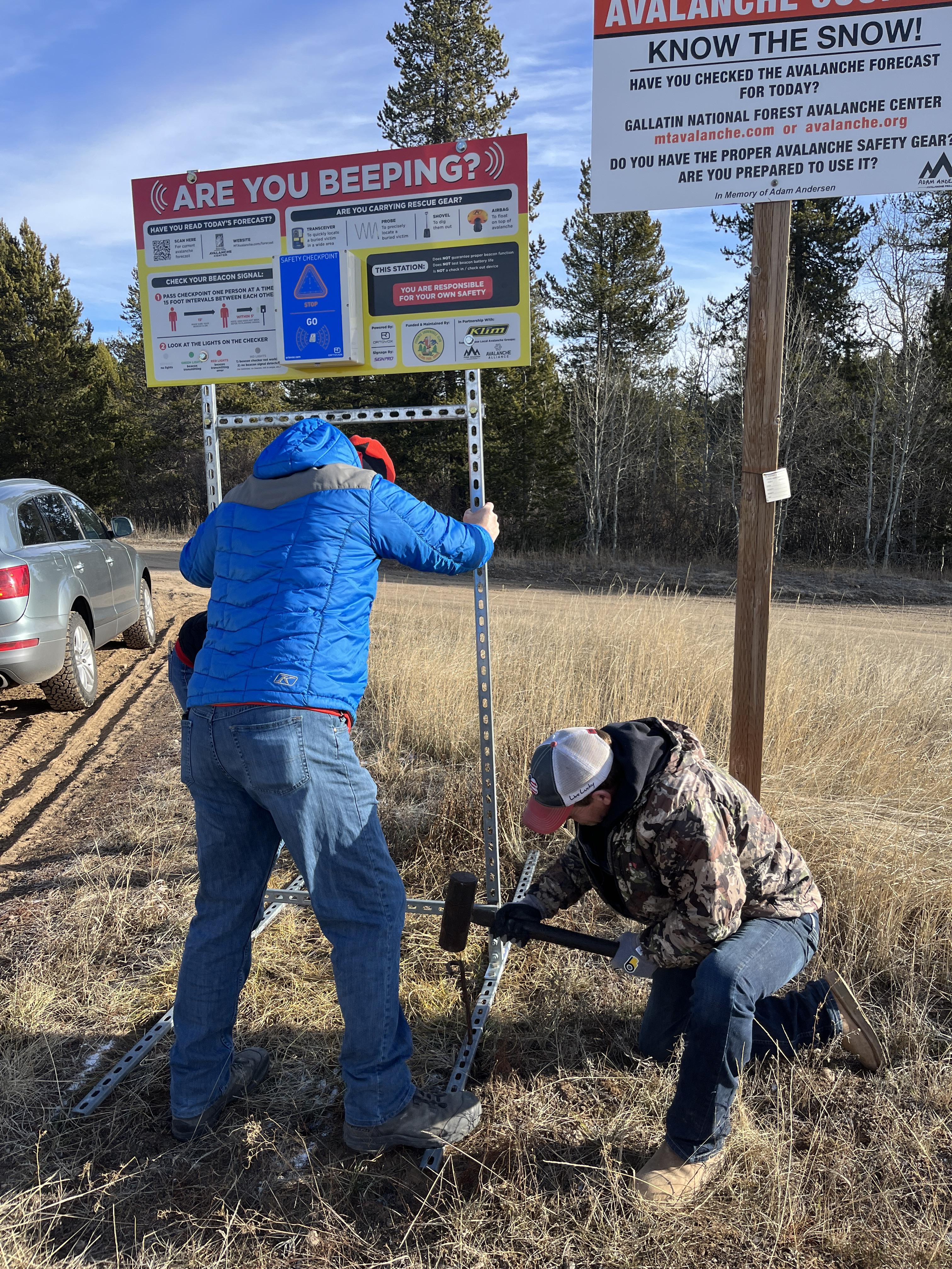
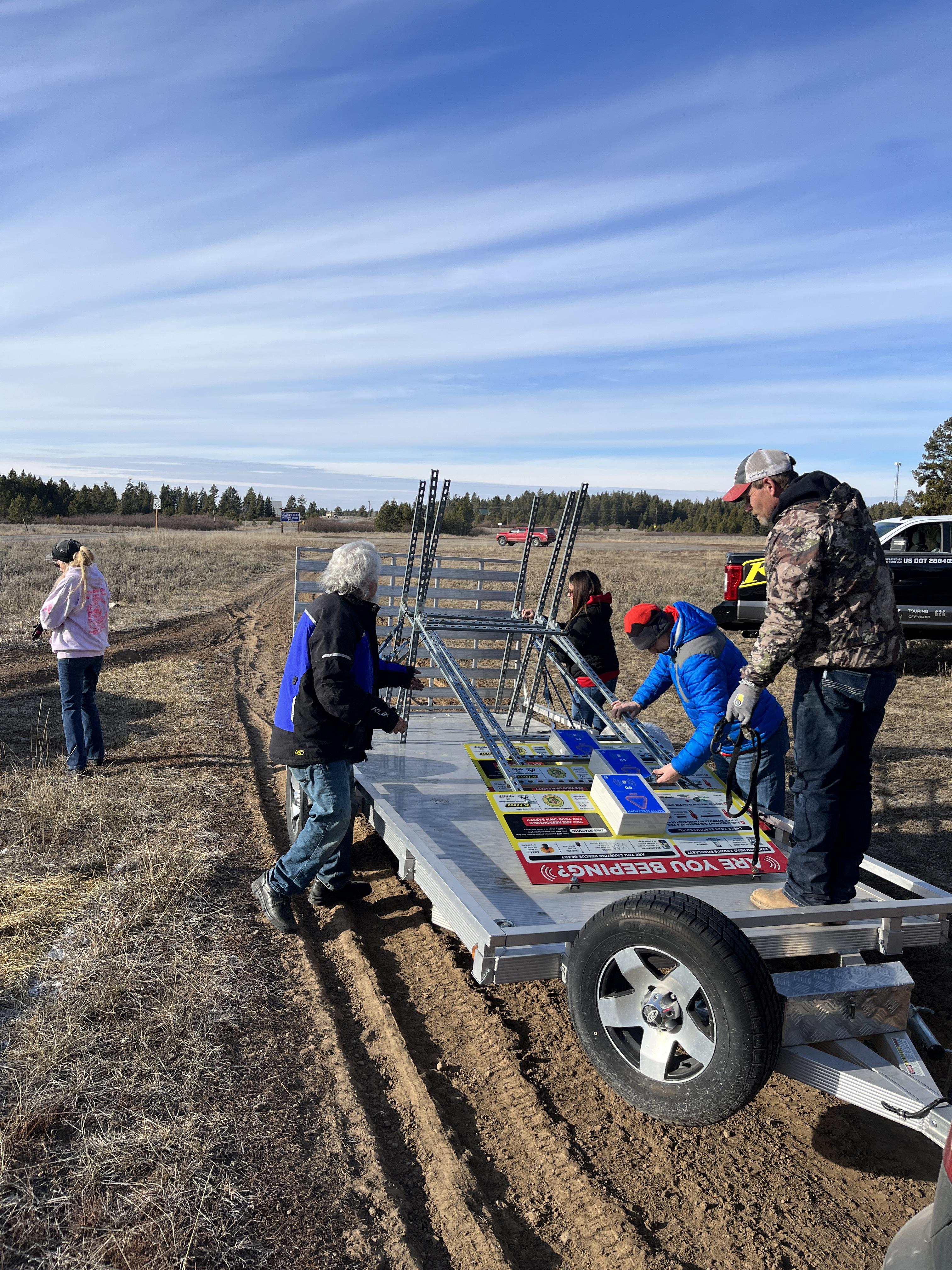
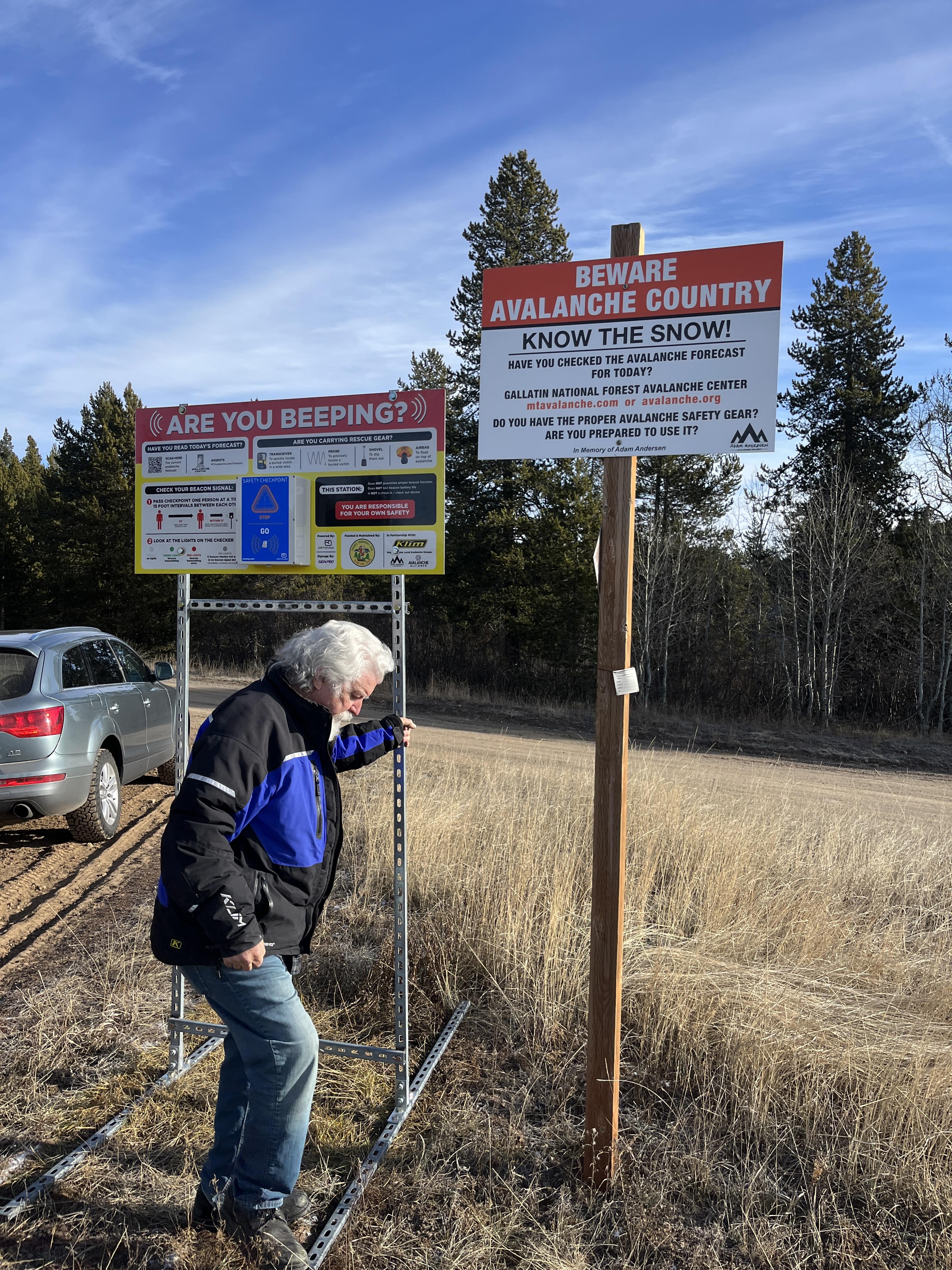
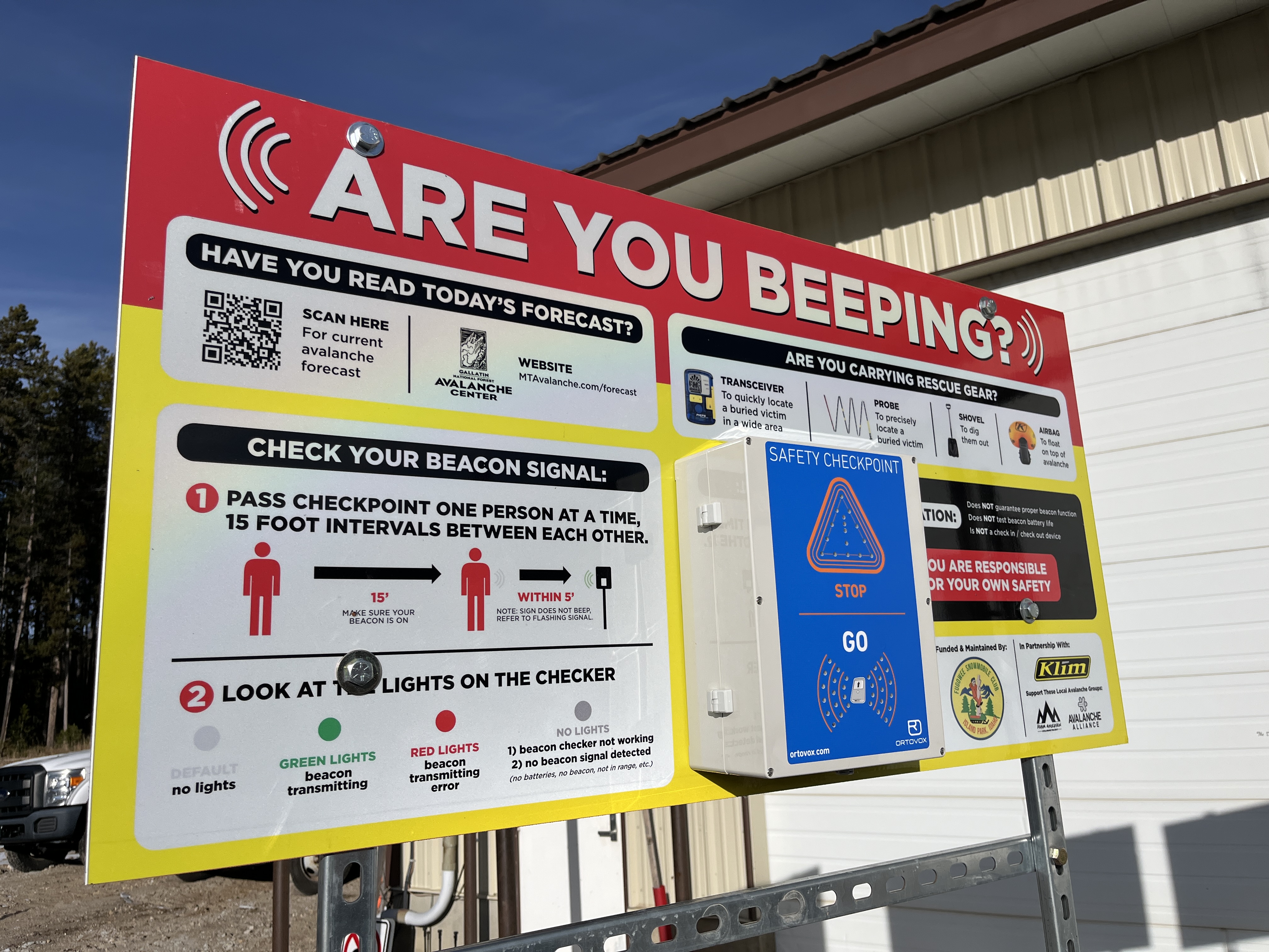
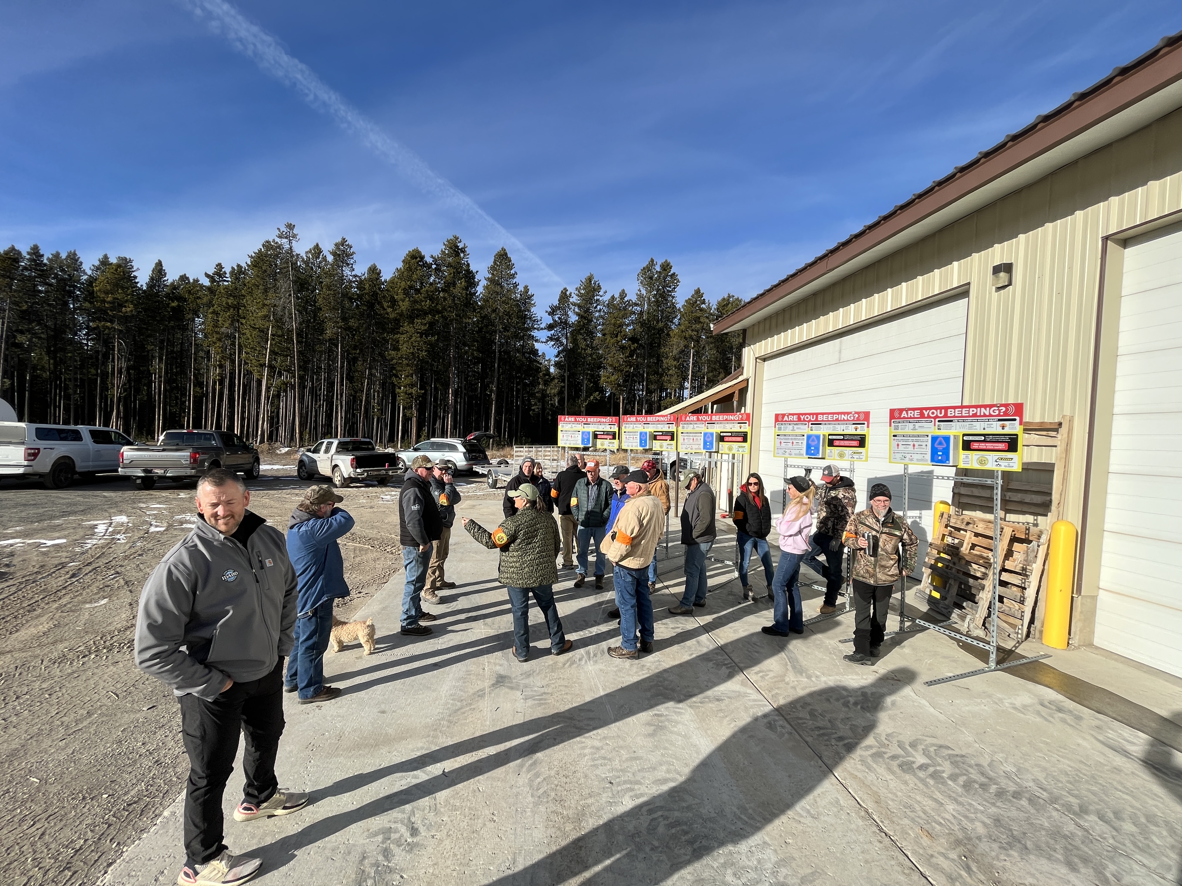
We met up with the Fugawee Snowmobile Club, Idaho Parks and Recreation, and Klim to install new beacon checkers at the trailhead in Island Park. Great work to the team! Photos: GNFAC
Full Snow Observation Report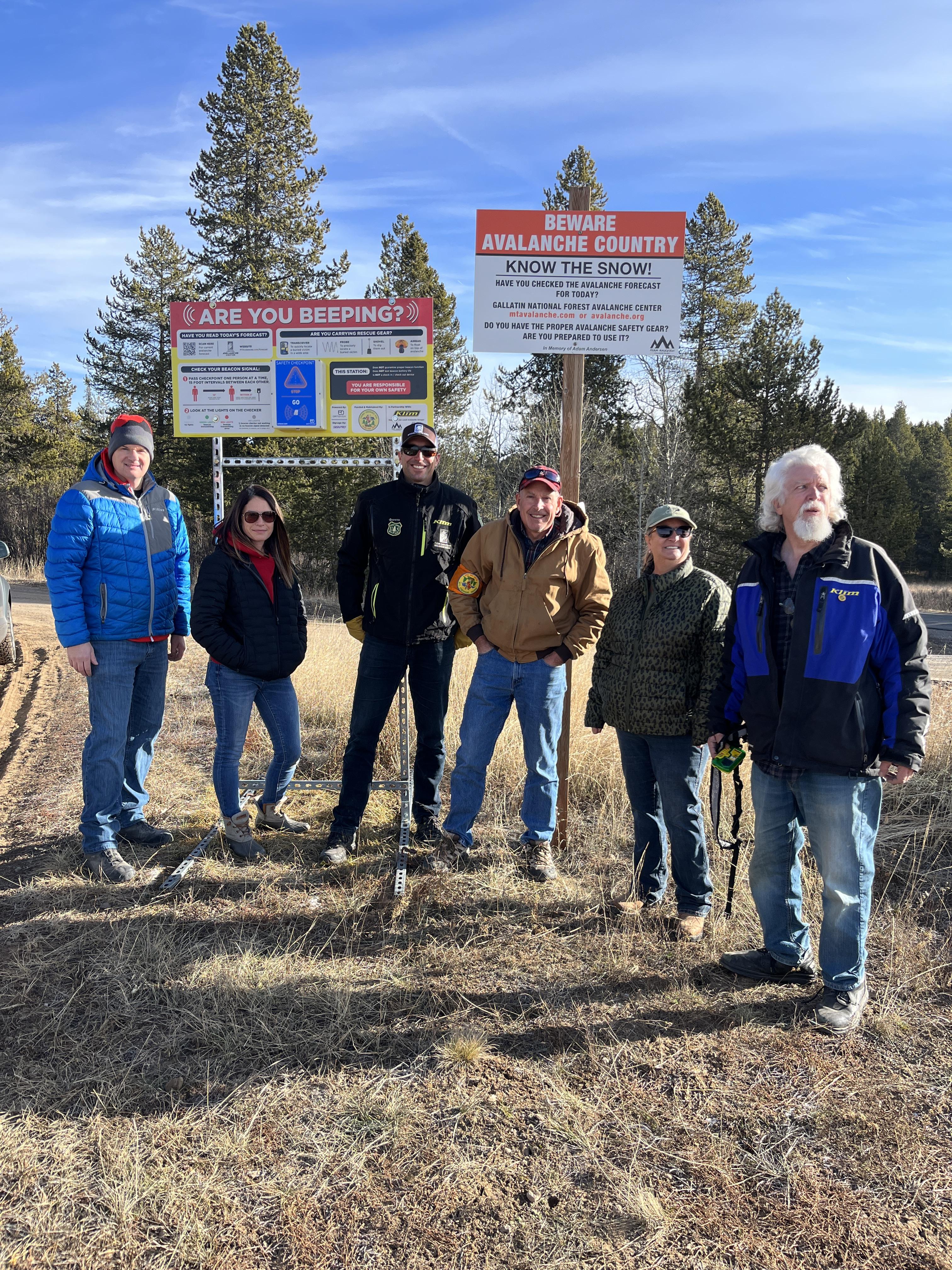
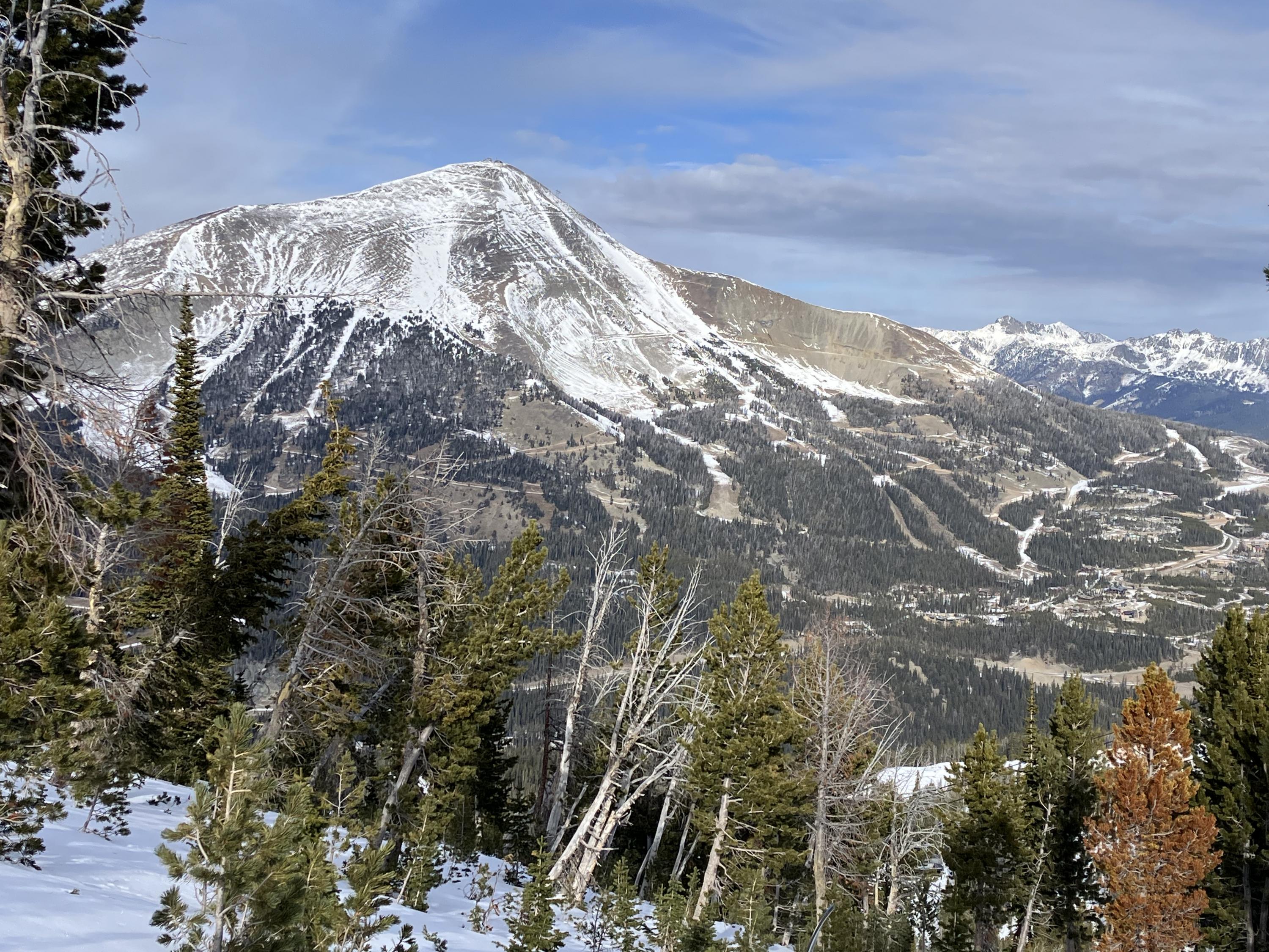
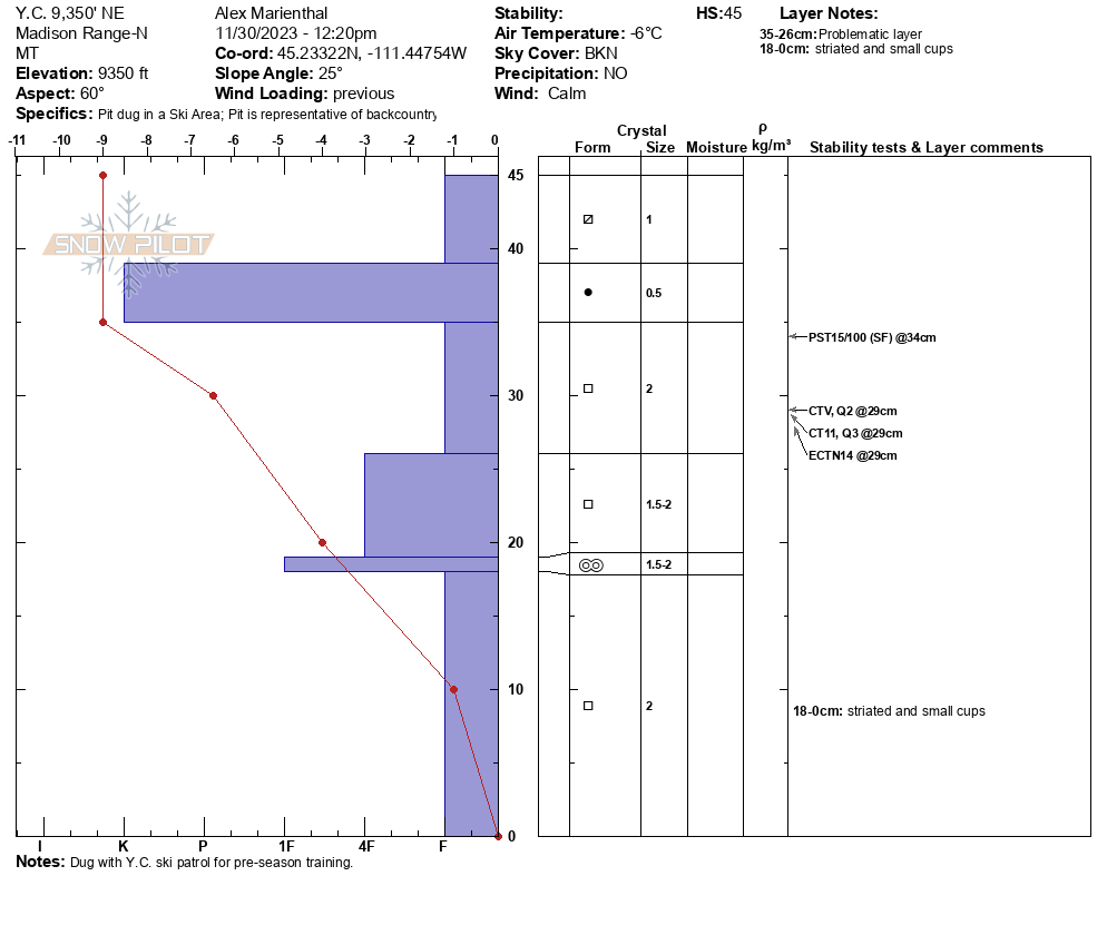
Today (11/30/23) we looked at the snowpack in the northern Madison Range/Big Sky area. At 9,300' on a northeast aspect there was around a foot of snow (30-45cm) which is mostly weak layers of facets. When the mountains get more snow we expect avalanches to break on this weak snow.
Full Snow Observation Report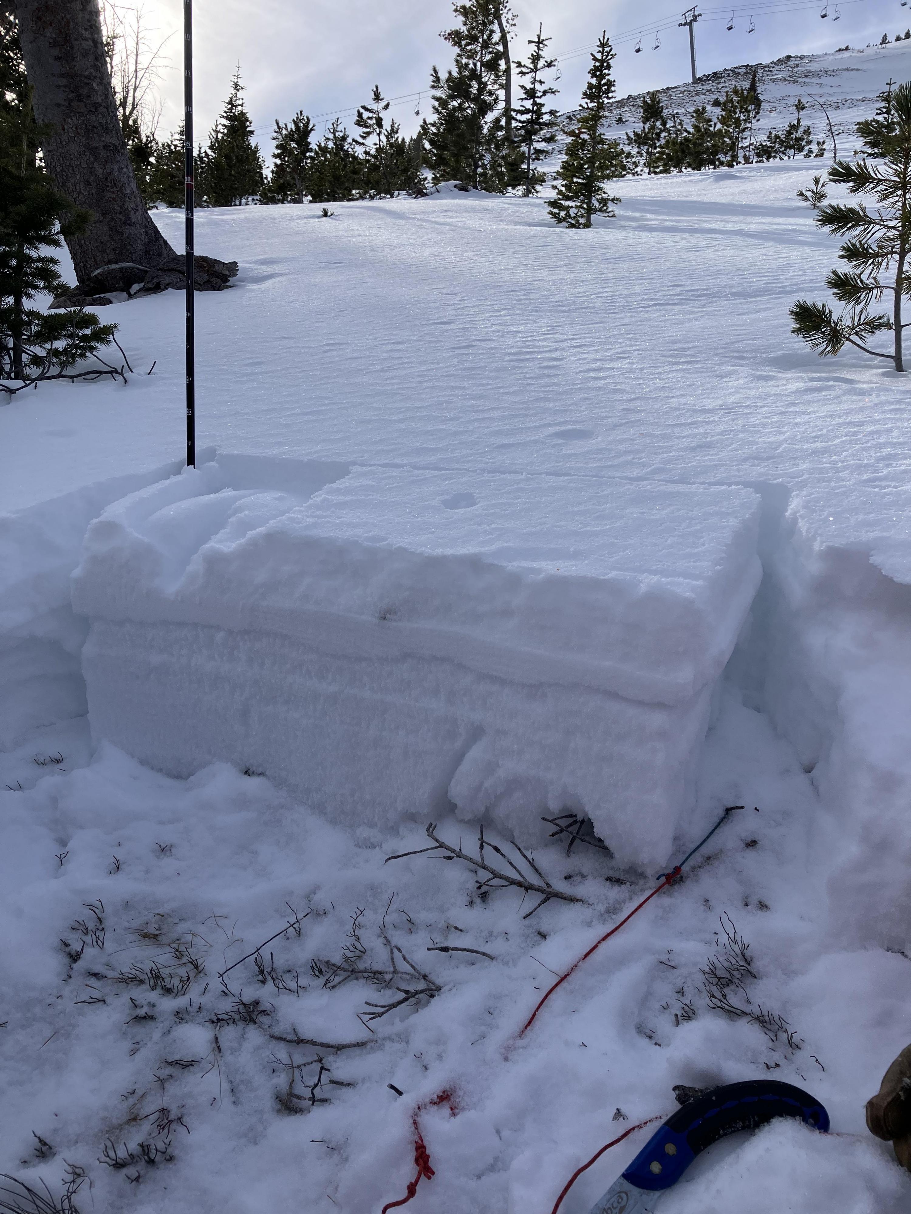

Clear, Light N Wind, No cracking, collapsing, or recent avalanche activity. Snow depth ranged from 6-12" at 8500' to ~2-3' at 9300' and above. Through that whole valley, there is a supportable crust that ranges from 2cm-5cm and is more or less supportable depending on sun exposure. In the trees and shaded areas, this crust doesn't exist. Any shallow and shady area is unsurprisingly a pile of sugary snow. Where the snow is deeper and has been getting sun there is a more layered snowpack.
Full Snow Observation Report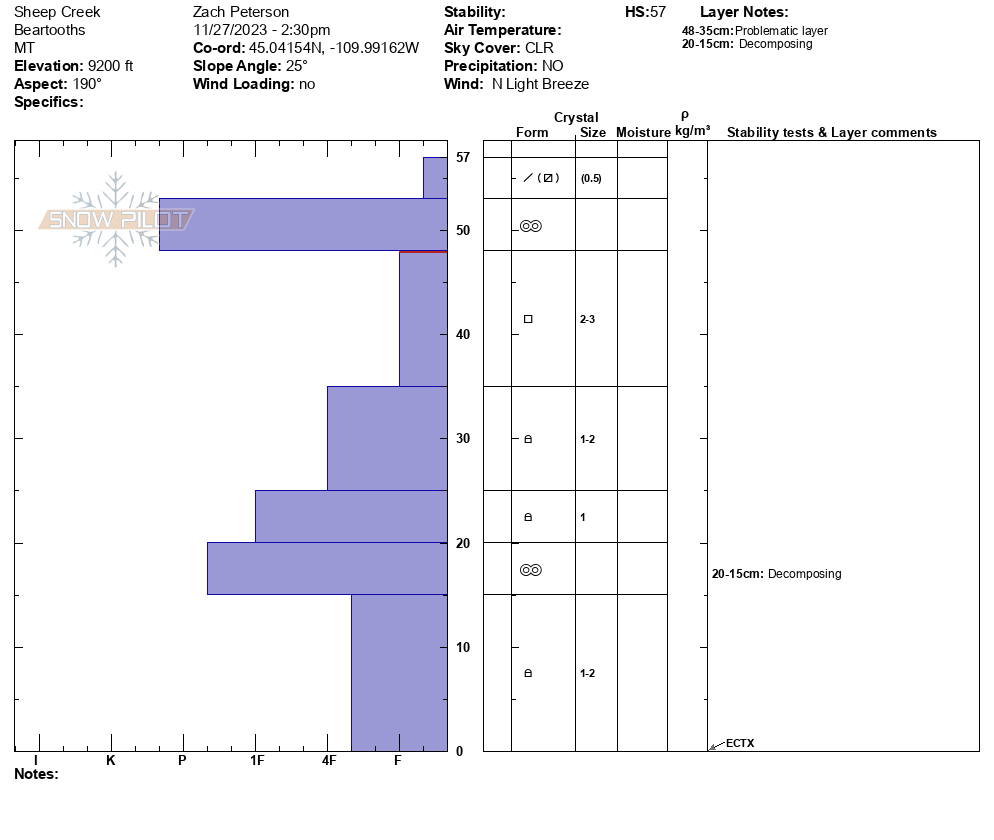
We were in Cooke for the last 3 days skiing around Republic Creek. North of town, the snowpack starts around 8700. South of town is holding snow better with its aspect. We skied and toured every aspect around Woody Ridge and Republic. Slopes that don’t see sun are holding “powder” from weeks ago, but are very rotten and easy to punch a pole down to the ground. Slopes that see the sun have an obvious crust layer. Snow depth varies from upwards of 4 feet in gullies to 1.5 feet in the valleys. There was a very reactive wind slab from the dusting of snow and high wind that occurred over the holidays. We observed it to be 3 inches deep at its max.
Full Snow Observation ReportWe climbed to the Upper Mummy's (west facing) and found relatively little snow at 9,000'. Gullies that usually fill in from wind-loading were not showing much depth. HS was less than 6 inches on the hike up (see pic). Across the valley looking at Elephant and Palace Butte, the bowls were snow covered, but barely (pic). Lower elevation, east facing slopes were mostly dirt.
The avalanche danger is non-existent on most slopes. The exception would be high elevation gullies that happened to get wind drifts, but these are not widespread.
Wind was calm and skies were sunny, with an air temp in the teens F.
Full Snow Observation Report
Went into the Lightning/Taylor Creek area of the Southern Madison’s in search of some powder skiing with the new snow. On our ascent toward Woodward Mountain via the backside, we found fresh snow varying from 2 inches at the trailhead to foot deep lightly drifted areas in the upper elevations. In the protected low angle gully we ascended this new snow sat atop either rocks or a very stout wind crust. The latter of which made for great skiing. We descended Woodward top down and assessed the possibility of thin (3”) wind slabs being reactive on the stout wind crust as the Woodward side seemed to have received a lot more loading from the storm’s E winds. As we rolled over to slightly steeper terrain, I noticed the snow stiffening just below my skis and gave it a few hops where I intentionally popped the pictured slab. With this information, we decided to carefully traverse to more protected trees and descend via a less wind loaded and hazardous route. We ski cut from tree to tree triggering a few more of these very small slabs before finding wonderful powder skiing lower on the mountain where the wind had significantly less effect.
All of the slabs were 1 to 4 inches deep and propagated 5 to 15 feet wide. None of them possessed the mass or were on steep enough terrain to overcome and slide over the stauch wall. Overall was a great lesson in mitigating hazard and we were rewarded with some great turns.
Full Snow Observation Report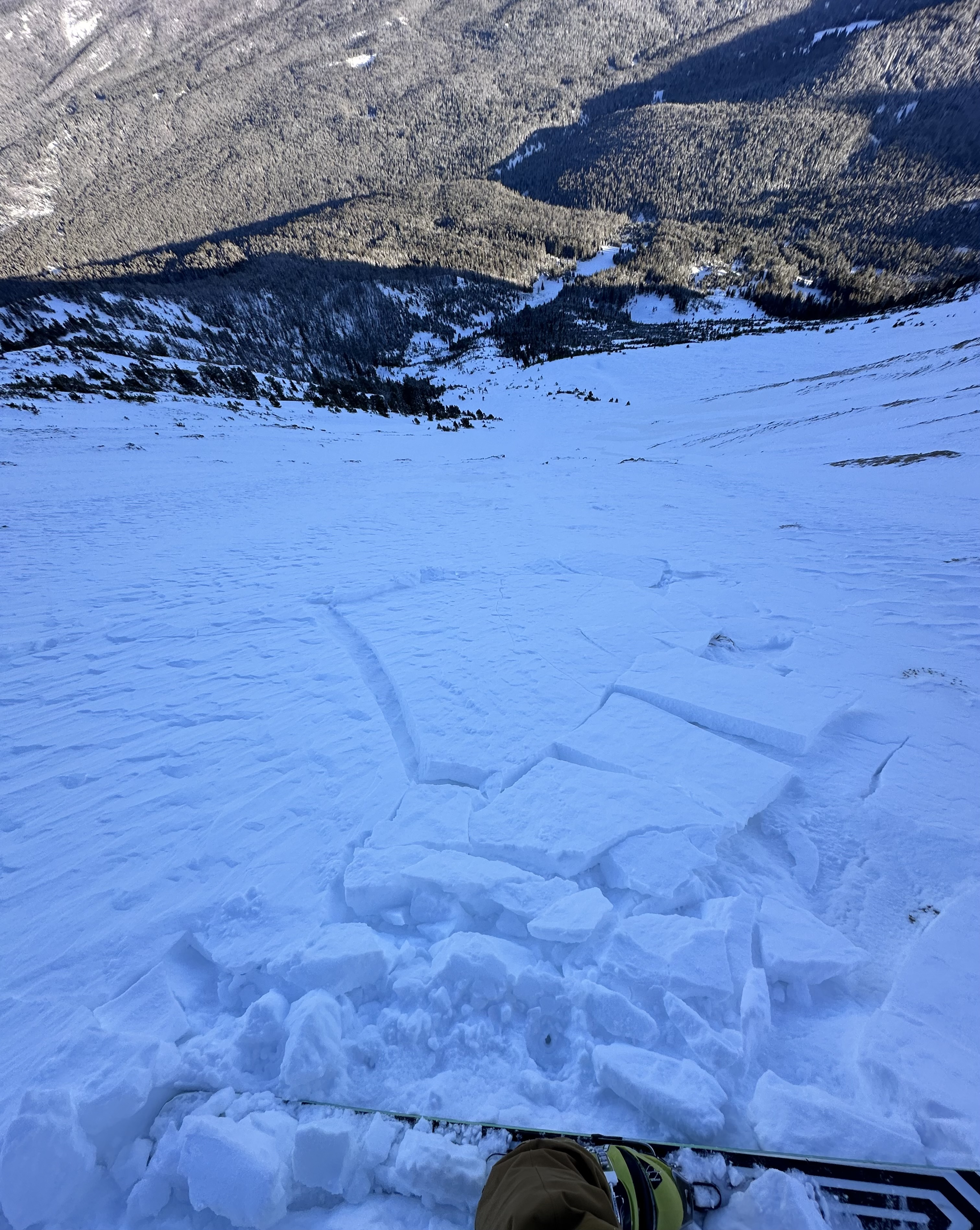
From FB message: "Hi! I’d like to report 2 natural slides that were witnessed in the Flanders fork of Hyalite on Friday 11/24 on the east facing aspect of the canyon. Both avalanches came from a single snow field above “Bobo Like” ice climb. These slides happened at approximately 7:45am and 8:15am"
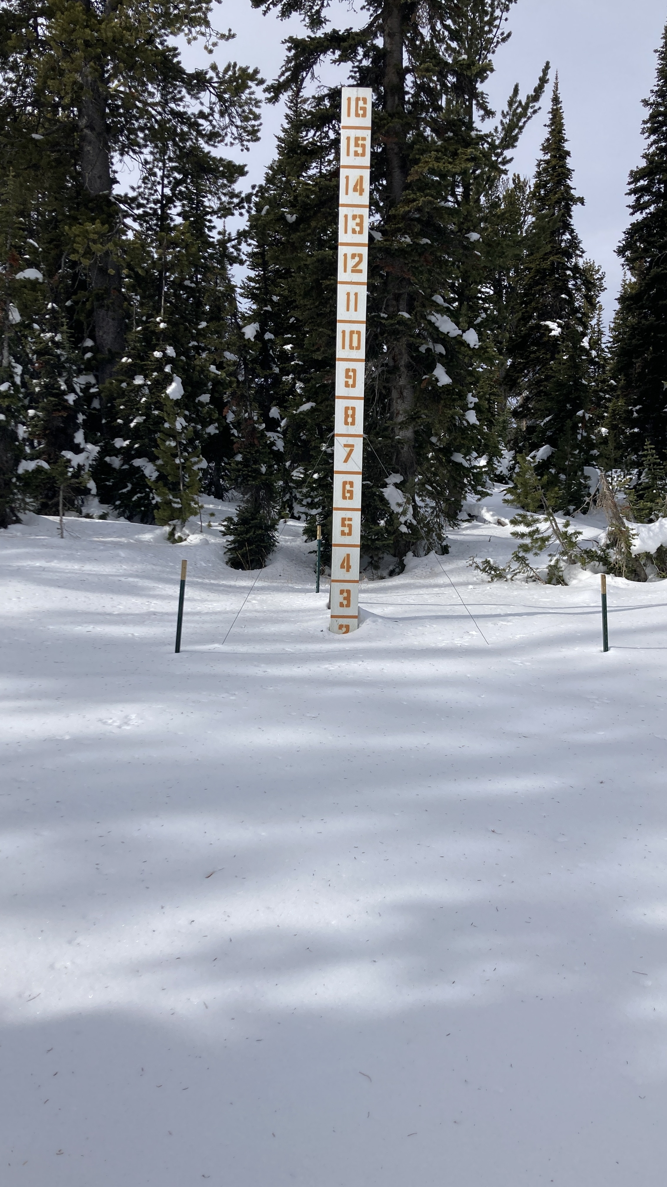
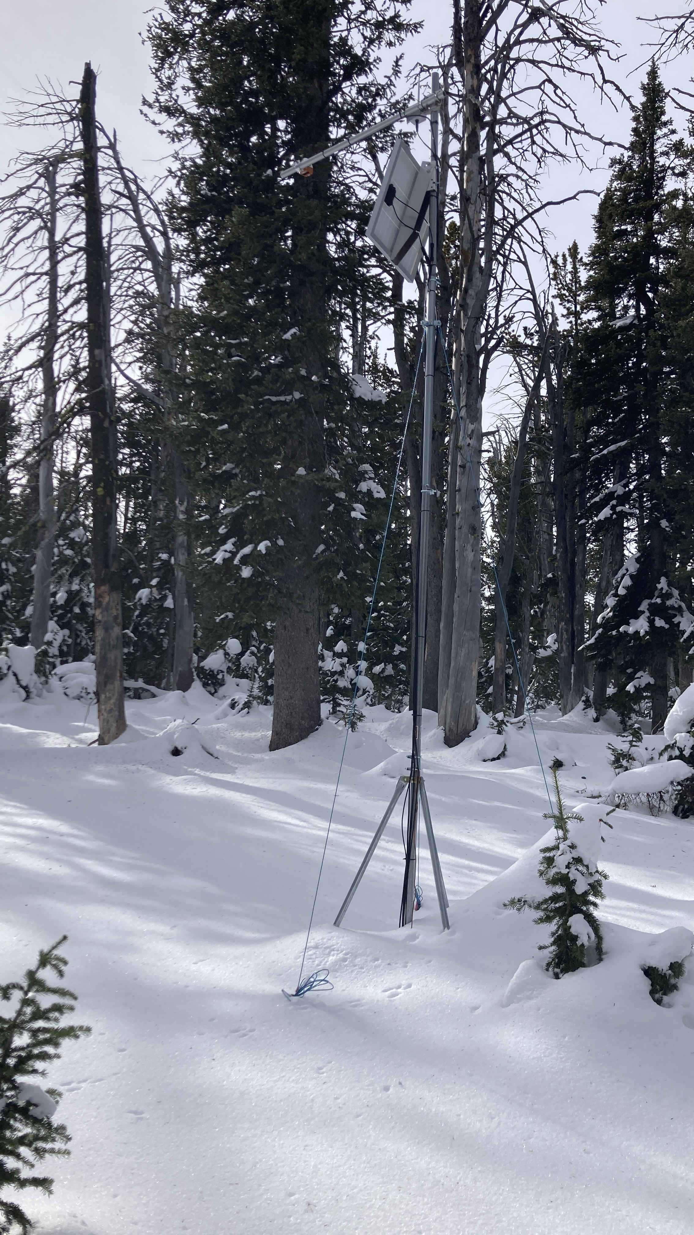
Full Snow Observation ReportWent to do maintenance on the Sawtelle Snowfall weather station at 8800 ft just off the Sawtelle Mountain Road. Continuous snowcover starts around 8000 ft. At 8800 ft there is ~20" of snow with a mix of hard crusts and weak facets. These weak layers near the ground will be something to watch once snows again.
Full Snow Observation Report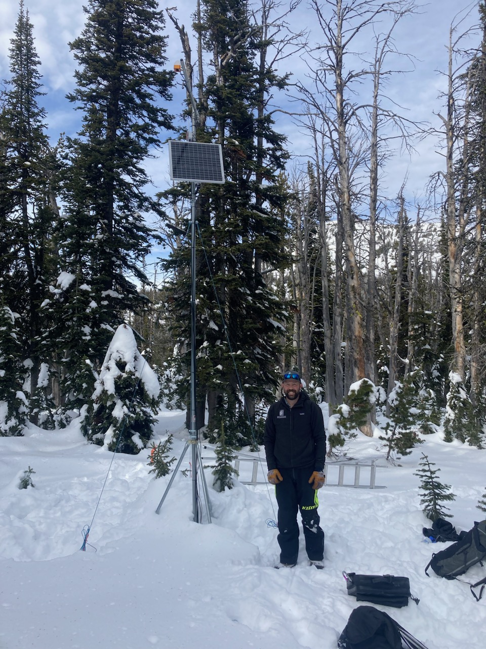
Went for a ski tour in the Southern Madison's up Lightning Creek in search of a deeper snowpack. Our tour brought us up Woodward Mountain via the E sub-ridge with a plan to ski in the bowl to the north on a NE aspect. The snowpack varied immensely due to sun effect/wind loading but overall found 50-60 cm of snow in the deeper locations. We performed 3 CTs in representative locations of our intended ski line and had results of CT21 Q2, CT15 Q2, and CTN. The columns broke on a layer of 4F facets midway down from the surface. Combining this data with a lack of other signs of instability (cracking, whumpfing, recent avalanches, recent loading), we decided to ski our intended line.
Snow quality on the ascent and decent varied from "ripple pow" to breakable wind crust to unbreakable wind crust. Overall, was a great day in the BC getting familiar with our early season snowpack even though good ski conditions lacked.
Full Snow Observation Report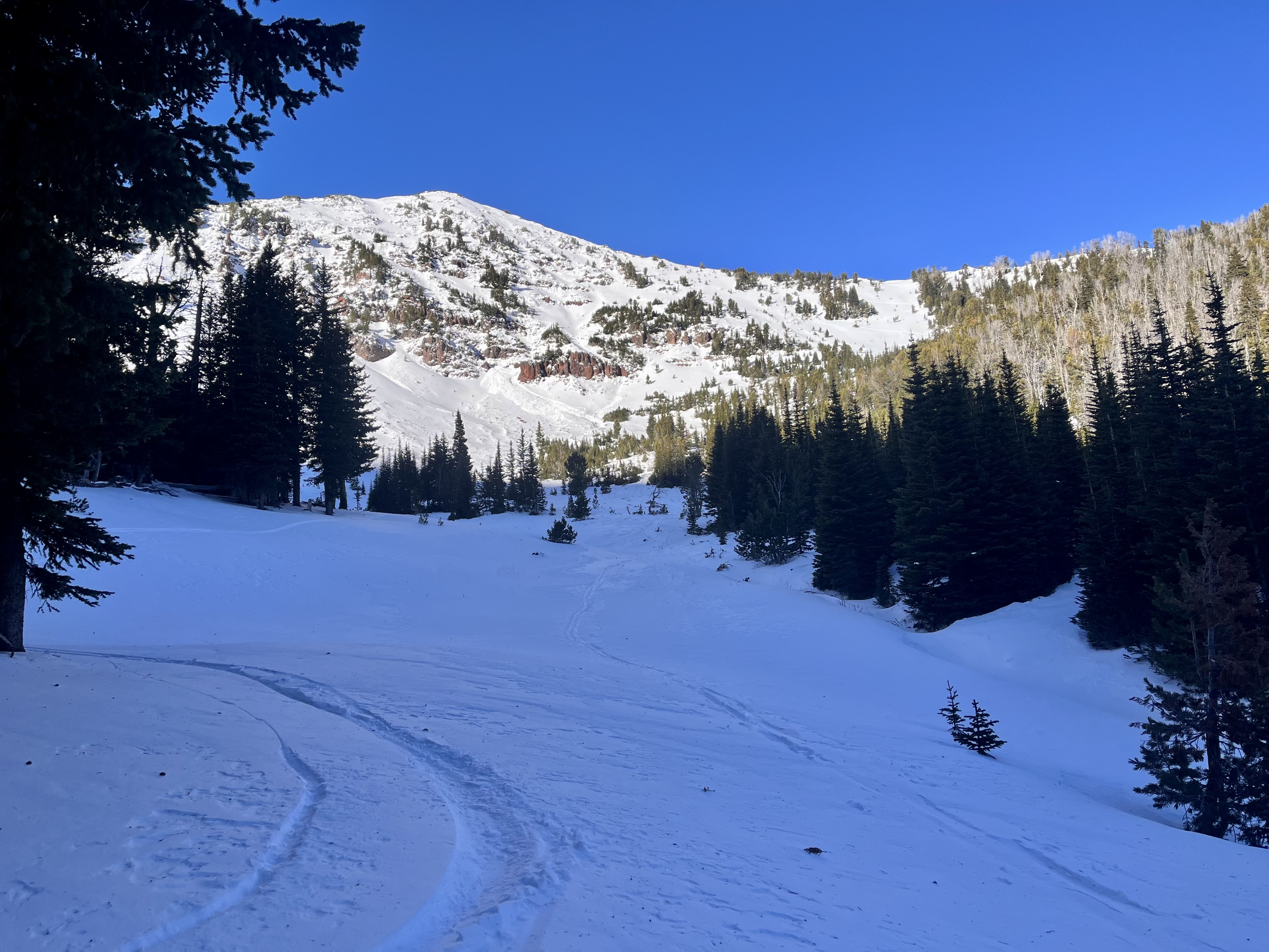
Went for a couple quick tours over the past two days in the Northern Bridgers. In October Bowl at 8157' on a NE aspect I found a HS of 30 cm with recent fist hard snow in the top 10 cm. The new snow sat on top of a 5 cm knife hard crust likely from the warm snow/rain event last week. Below the crust were 15 cm of 1F facets. The crust progressively deteriorated when moving up in elevation. Near the top of October Bowl I performed two CTs in a a location where the HS = ~50 cm. My results were CT12 Q3 and CT15 Q3.
Full Snow Observation Report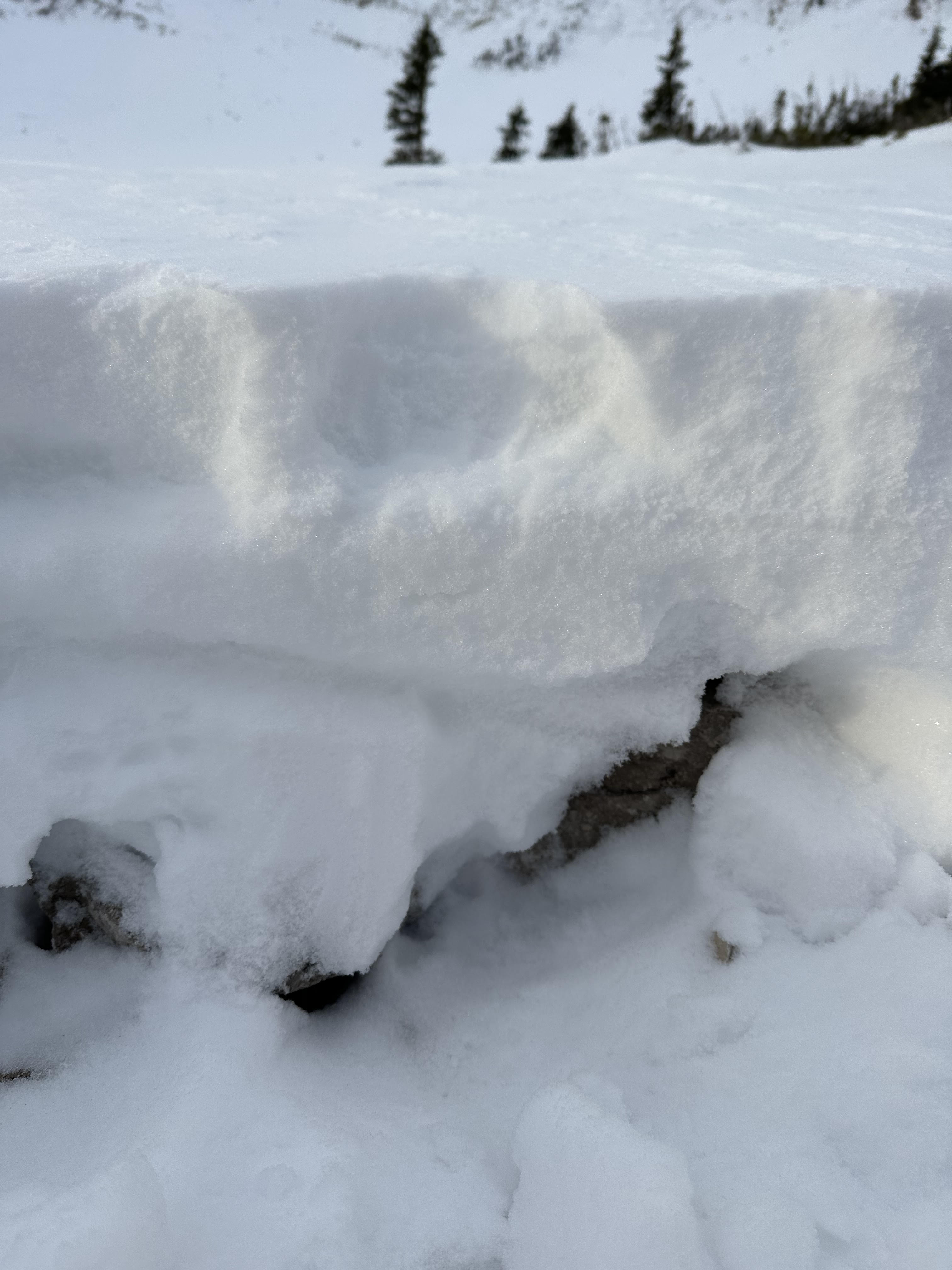
No avalanche activity was seen during a short tour south of Cooke City. ~1-1.5' of snow at low-mid elevations. Supportable crust on solar slopes with 3-4" of new snow on top.
Full Snow Observation ReportGot into the bowl below the face of the peak and didn’t feel comfortable going any further wind slabs were present on the level surfaces around the lake with facets underneath that. Also note that snow depth was minimal to about a foot but quickly increased around the 9000ft mark to the 2-3ft range.
Full Snow Observation ReportOn our way up the main fork we noticed a drastic increase in snow depth, and wind effect with elevation. The height of snow was around 50-70cm near 9500 ft/treeline, though we were walking anywhere below 8200 ft. As well, the effects of the wind during the week were very noticeable once near treeline, with some ENE aspects sheltering a 3-4 inch wind slab, which we also noticed in the lee of the many rocks and saplings still above the snow surface. Our pit (dug in a location without this windslab, but still loaded) showed a decently sound structure with good test results.
A separate party mentioned that they had seen the remnants of an avalanche higher in the bowl near the summer trail, but we did not go this high and did not see it ourselves.
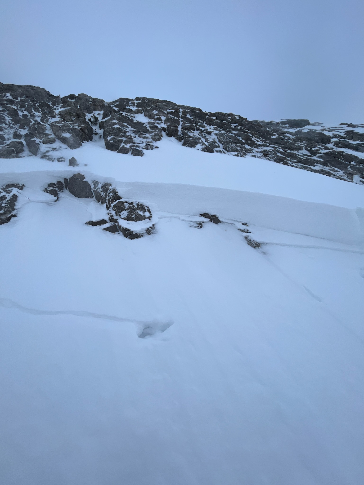
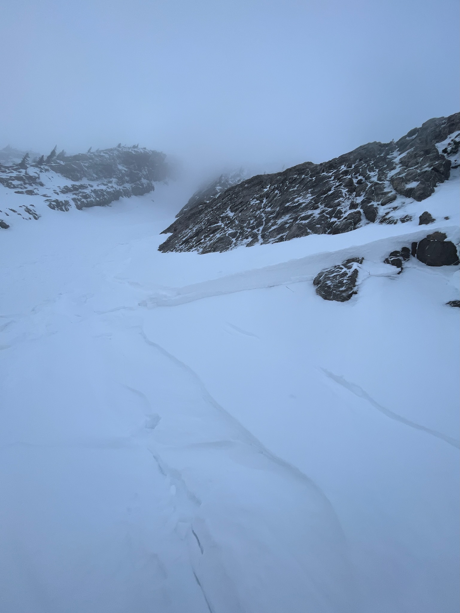
Full Snow Observation ReportWe went up to check out the bottom of The Great One and saw where the old slide occurred. Wind loading had already built up snow right at the crown. We did some pole made single columns and consistently pulled off 6 inch chunks. We turned around and skied the lower part of The Great One. We dug two pits below The Other One and had the lower pit fail a ect at 26 and the higher one at 13. I attached a video of the lower pit. We turned around and skied out after.
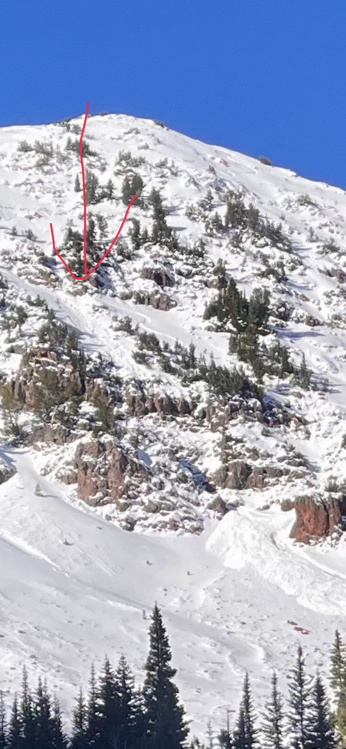
Full Snow Observation ReportAvalanches on Henderson Mountain near Cooke City were reported via instagram on 11/9/2023. Estimating they occurred a day earlier.
From message: "on Henderson in Cooke just above the lulu trail. It was surprising to see so much activity"
Full Snow Observation Report
Skier triggered windslab in the Great One off of Naya Nuki peak, skier was carried 15-20ft before arresting. Slide was triggered roughly halfway down the couloir where the right wall dips away exposing the snow to wind. Hard consolidated snow over facets, roughly 1-1.5 ft thick, ran about 50-100 ft before pouring over the cliff faces below. North- northeast aspect.
Full Snow Observation Report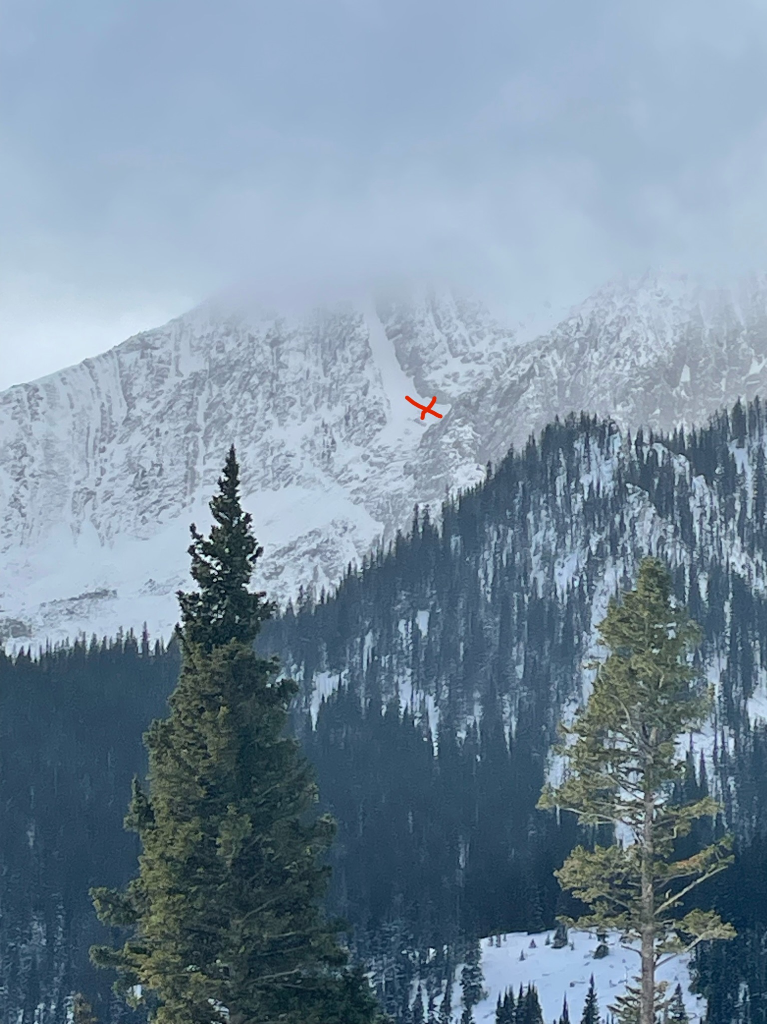
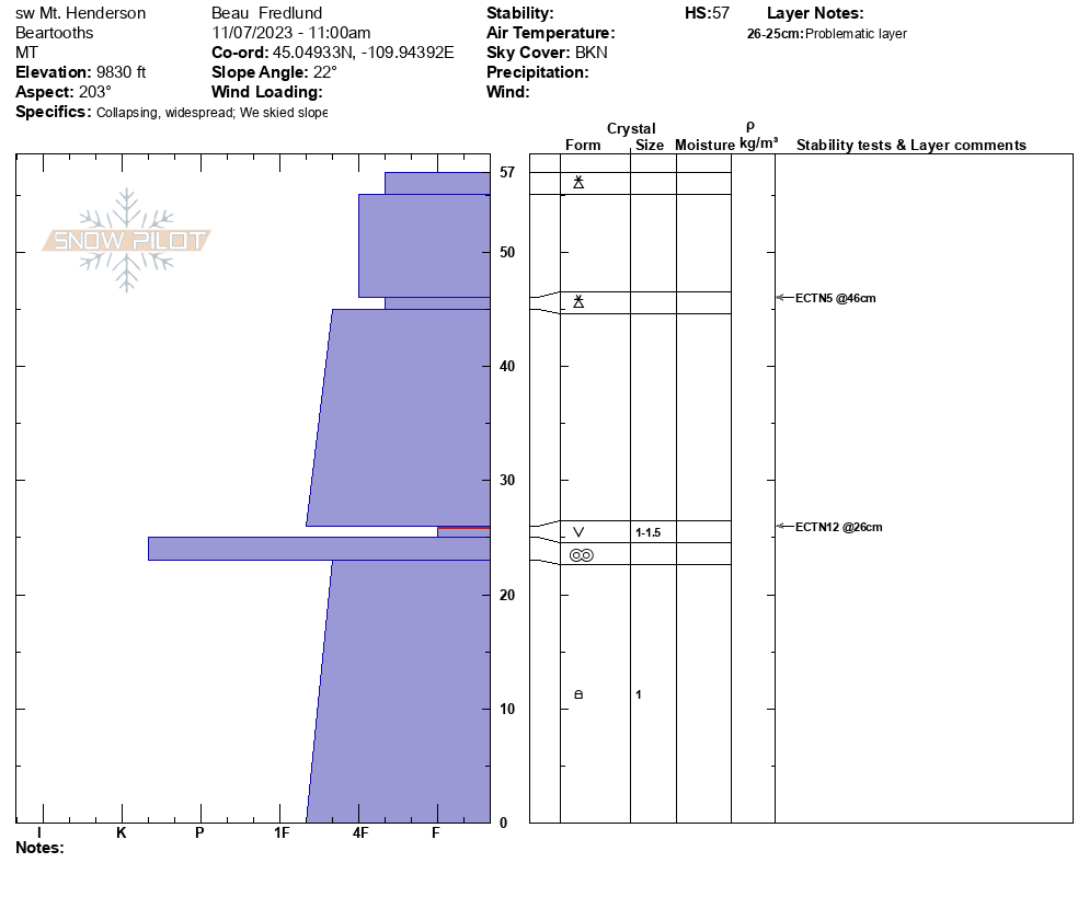
Snowpit attached from today: SW aspect, 9800', HS: 57.
Surfy/ supportable, good early season turns. Though some signifiant collapsing experienced while trail breaking- on buried SH that formed on Halloween.
No avalanche activity to report.
Full Snow Observation Report