Good morning. This is Dave Zinn with the Gallatin National Forest Avalanche Forecast on Monday, New Year’s Day, at 6:45 a.m. This information is sponsored by World Boards and Montana State Parks. This forecast does not apply to operating ski areas.
This morning, temperatures are in the teens to around 20 degrees F with 5-15 mph winds from the west to southwest. There is no new snow. Today, temperatures will be in the 20s F with 5-15 mph winds from the west to southwest and partly sunny skies. The next chance for snow is toward the end of the week.

All Regions
With each day without new snow, triggering avalanches becomes less likely. Field observations of instability, such as collapsing and unstable test scores, have significantly decreased in frequency and volume, and the last known backcountry avalanche in our area occurred one week ago in the Bridger Range (details and photo).
Four ingredients are necessary for a dangerous slab avalanche: a steep slope, a weak layer, a slab of cohesive snow above the weak layer, and a trigger. Yesterday, Alex explained from Cooke City that persistent weak layers exist within the snowpack on nearly every slope in the advisory area, but weeks of mostly clear and sunny weather have deteriorated the slab above them, removing a critical ingredient on many slopes (video). Human-triggered avalanches are still possible on slopes where cohesive slabs rest on top of weak layers. Specific slopes loaded with snow drifts within the last week are areas of concern (Taylor Fork video, Throne video).
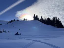
Avoid avalanches by knowing the snow beneath your feet or sled and recognizing changes to it. For example, is the entire depth the consistency of sugar, or is it supportable? Like the groups in Hyalite Canyon, Beehive Basin, near Cooke City and outside our advisory area in Jardine did this weekend, recognize the whumphing sound of collapses as a sign of instability and an indicator that the avalanche ingredients of a weak layer and slab are present (Hyalite Ob 1, 2, Beehive Ob, NE YNP Ob, Jardine Ob).
Avalanches breaking 1-2 feet deep remain possible on some slopes. Dig and test the snowpack, recognize red flags of instability, carry avalanche rescue equipment, and only expose one person at a time to steeper terrain. The danger is MODERATE across the advisory area.
If you venture out, please fill an observation form. It does not need to be technical. Did you see any avalanches? How much snow is on the ground? Was the wind moving snow? Simple observations are incredibly valuable. You can also contact us via email (mtavalanche@gmail.com), phone (406-587-6984), or Instagram (#gnfacobs).
Upcoming Avalanche Education and Events
Our education calendar is full of awareness lectures and field courses. Check it out: Events and Education Calendar.
Every weekend in Cooke City: Friday at The Antlers at 7 p.m., Free Avalanche Awareness and Current Conditions talk, and Saturday from 10 a.m.-2 p.m. at Round Lake Warming Hut, Free Rescue Practice.
We offer Avalanche Fundamentals with Field Session courses targeted towards non-motorized travelers in January and one geared towards motorized users. Sign up early before they fill up.
King & Queen 2024, 3 February 2024. Form a team or sign up individually to hike laps on the Bridger Bowl ridge to fundraise for the Friends of the Avalanche Center.
Loss in the Outdoors is a support group for those affected by loss and grief related to outdoor pursuits. Check out the link for more information.
Here’s a quick read, The Invisible Hands of Avalanche Work, an interview with GNFAC forecaster, Doug Chabot.