Good morning. This is Dave Zinn with a spring weather and snowpack update on Monday, April 17th. The Gallatin National Forest Avalanche Center has stopped issuing daily avalanche forecasts for the season. We will issue weather and snowpack updates on Monday and Friday mornings through April. This information does not apply to operating ski areas.
Bridger Bowl is closed, and backcountry conditions exist. There is no avalanche mitigation or ski patrol rescue. In case of emergency, call 911. Please stay clear of work areas, snowmobiles, chair lifts and other equipment.
This weekend, daytime temperatures climbed above freezing during the day with 5-20 mph winds from the southwest to the northwest. There was no new snow. Last night was the lightest freeze of the weekend, with temperatures in the upper 20s to low 30s F.
Monday will be the warmest day of the week, with temperatures in the 40s F under partly cloudy skies. Cloud cover will increase as the day progresses, and light snow begins Monday night. Snow and cooler temperatures will continue from Tuesday through Friday. The first pulse of snowfall will bring 5-6” to the Big Sky area, 4-5” to the mountains around Bozeman, and 2-4” near West Yellowstone and Cooke City by Wednesday morning.

All Regions
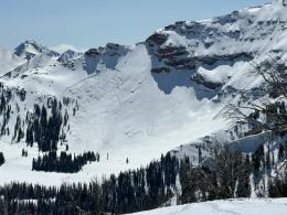
Avalanche conditions change rapidly in the springtime, and we must adapt quickly to these changes. Warm daytime temperatures on Monday and Tuesday make wet snow avalanches the dominant concern. This weather yields to cooler temperatures and snowfall, increasing the danger of avalanches within the new and wind-drifted snow. On top of these, cornice fall and the chance of deeper avalanches releasing on persistent weak layers are possible.
The Breakdown:
Wet snow avalanches - Well above-freezing temperatures and sunshine on Monday will break down superficial crusts and make wet loose avalanches possible. Move to cooler aspects if the surface snow becomes wet and sloppy. Snow and cooler temperatures will largely shut down wet snow concerns by midweek. However, be on guard if the warm spring sun starts moistening the surface even for brief periods. On Sunday, a group on the Fin near Cooke City triggered a wet snow avalanche that carried a long distance (details).
Cornice Fall - These overhanging ledges of snow grew to epic proportions during the winter. They can break far back from their edge this time of year. Avoid traveling on top of them and minimize the time spent below. Cornice fall itself is dangerous, and it often triggers avalanches on the slopes below. Recent collapses occurred on Mt. Abundance and in the Northern Madison Range.
New and wind-drifted snow - Snowfall this week will increase the danger of avalanches within the new and wind-drifted snow. The more it snows, and the more it blows, the more dangerous conditions will get. Before the storm arrives, dry slab avalanches are possible on higher elevation slopes where the snow remains powdery. This Saturday, outside the advisory area in the Crazy Mountains, a group triggered an avalanche that broke 50’ wide and ran 1000’ on a high elevation, north-facing slope (details).
Deep Slab Avalanches and Persistent Weak Layers - The recent melt-down created a thick crust on many slopes and made triggering deep slab avalanche much less likely, but they remain possible, especially on high-elevation slopes where the melt-freeze crusts aren’t as robust. Avoid this problem by choosing simple, lower-angle terrain, especially during and immediately after storms. Deep slab avalanches released during the first week of April in the Northern Madison Range (1, 2), Southern Gallatin Range, Lionhead Area and Bridger Range.
We are updating our avalanche and weather log daily and posting relevant changes to the avalanche conditions so you can track the weather and how it affects these problems. Practice the fundamentals of avalanche safety until the snow melts. Every member of a group carries a beacon, shovel and probe. Signs of instability turn us back to lower-angle terrain. Expose only one team member at a time to avalanche terrain while the rest of the group watches from a safe position.
We will issue spring snowpack and weather updates twice a week through April, and we will share relevant avalanche and snowpack information on our website and social media. If you get out, please send us your observations no matter how brief. You can submit them via our website, email (mtavalanche@gmail.com), phone (406-587-6984), or Instagram (#gnfacobs).
Info and Reminders
Bridger Bowl Ski Area is closed, and ski patrol is no longer performing rescues and making terrain closure decisions for you (video).
Hyalite Canyon road is closed for motorized use until May 16.
Snow will be around the mountains for a month or two and avalanches will continue. When warm temperatures return, wet snow hazards will increase. If there are big spring snowstorms, dangerous conditions may develop for new snow avalanches and wind slabs. With either extended warming or a big storm, there is still a lingering possibility of deep avalanches breaking on deeper buried weak layers. See this article for some general spring travel advice.