Good morning. This is Doug Chabot with the Gallatin National Forest Avalanche Forecast on Thursday, April 6th at 6:45 a.m. This information is sponsored by Werner Wealth Management (Advisors with DA Davidson) and Spark R&D. This forecast does not apply to operating ski areas.
Last night 2” fell at Big Sky, and an inch in Taylor Fork and Cooke City. Wind is blowing west to southwest averaging 10-20 mph with gusts of 35 mph. Wind speed and direction will remain unchanged today. Under mostly clear skies mountain temperatures will rise from the single digits to the upper 20’s to mid 30’s F. No new snow is expected, but today is the first day of a potential 4 day solar storm of sunny skies, warm weather, and the emergence of alabaster white feet in flip-flops.

Yesterday, skiers north of Bridger Bowl triggered a small slide near Texas Meadow (observation and photos). It involved newer snow and was triggered from 35 feet away which indicates a connected weak layer. It did not look deep. On Sunday, skiers got a large collapse (whumpf) in Beehive Basin, another indicator of a buried weak layer. Our last round of significant avalanche activity was Sunday, and many of these involved wind-loaded slopes. Given all this action, it's a good idea to test the upper 2-3 feet of the snowpack.
Large avalanches breaking 5-6 feet deep are not common, but are still on our mind. A few released on Sunday in Lionhead, Cooke City and the Bridger Range. We can’t tell which slopes may break deep, which causes me heartburn. I do not like roll-the-dice scenarios, even when the odds of losing are low. Sticking to shallow-angled terrain offers complete safety but can be less fun, and choosing terrain with clean fall lines (no cliffs, trees or gullies) is much better than not, but isn’t fool proof.
The sun is high in the sky and strong. Wet, loose snow slides will occur on steep slopes and off of cliffs. If the snow surface gets sun it will likely get wet. I only expect wet point release avalanches on east and south facing slopes.
Given yesterday’s remotely triggered slide, deeper layers that are still worrisome, and the potential for wet slides, the avalanche danger is rated MODERATE.
Our last daily forecast will be this Sunday, April 9. We will issue weather and avalanche observations every Monday and Friday through April. Please share avalanche, snowpack or weather observations via our website, email (mtavalanche@gmail.com), phone (406-587-6984), or Instagram (#gnfacobs).

Yesterday, a skier remotely triggered a shallow slide north of Bridger Bowl and on Sunday there were avalanches throughout southwest Montana breaking on a buried weak layer, some quite deep. These deep avalanches are difficult to trigger, but the shallow ones will not be. Investigate the upper 2-3 feet of the snowpack for instability and be mindful of the possibility of triggering something deeper. Sunny skies and above freezing temperatures will create wet, loose slides on slopes getting the sun.
Upcoming Avalanche Education and Events
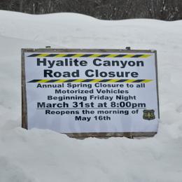
Hyalite Canyon road is closed for motorized use until May 16.