Good morning. This is Alex Marienthal with the Gallatin National Forest Avalanche Forecast on Saturday, February 25th at 7:00 a.m. This information is sponsored by Bozeman Splitfest, Bridger Bowl and Klim. This forecast does not apply to operating ski areas.
The mountains near Cooke City and West Yellowstone have 3-4” of new snow, and elsewhere did not receive any. Temperatures are singles to teens F and wind is west-southwest at 20-30 mph with gusts of 45-60 mph. Today will be partly sunny with temperatures rising to mid-20s and low 30s F, and strong southwest wind will continue. The next chance for snow is tomorrow morning.
All Regions
Strong winds continue to drift snow into thicker slabs that could avalanche naturally, or easily be triggered by a person. A few inches of new snow near Cooke City and West Yellowstone is being transported by strong southwest wind into fresh, unstable drifts. Earlier this week, the mountains received 2-4 feet of snow (1.5-4.5” of snow water equivalent) which was blown into drifts by wind from various directions, and a few large avalanches broke during the storm or immediately after (avalanche and weather log). These large drifts remain possible to trigger, and could avalanche naturally with additional weight from wind-drifted snow.
Doug was in Cooke City yesterday and had a drift collapse and “whumph” as he stepped on it (video). Yesterday near Buck Ridge a rider triggered a 2 foot thick avalanche of last week’s wind-drifted snow (photo and details). Skiers on Mt. Blackmore saw a 2 foot deep large natural avalanche (photo), and skiers in Beehive saw a very large cornice collapse (photo). Both appeared to have happened within the previous day.
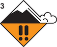
Today, wind-loaded slopes are dangerous, and cautious route finding and conservative decision making are essential. Carefully assess the snowpack for signs of recently formed drifts. Drifts often appear as round or smooth pillows and form below cornices and convex rolls and on the opposite side of scoured ridgelines. Seek out slopes that do not have recent drifts or slopes that are less than 30 degrees steep. Today the avalanche danger is CONSIDERABLE on wind-loaded slopes and MODERATE on all other slopes.
Please share avalanche, snowpack or weather observations via our website, email (mtavalanche@gmail.com), phone (406-587-6984), or Instagram (#gnfacobs).
Upcoming Avalanche Education and Events
Our education calendar is full of awareness lectures and field courses. Check it out: Events and Education Calendar.
March 3, 9 a.m.-3 p.m., Bozeman Splitfest - Companion Rescue Clinic. Classroom session followed by a field session. More information and registration HERE.
March 3-5, Bozeman Splitfest. More info and register here.
March 3 & 4, Companion Rescue Clinic. Online classroom session Friday evening followed by a field session from 10 a.m.-2 p.m. Saturday. More information and registration HERE.
March 9, 6 p.m.-7 p.m., 1-Hour Awareness - Spring conditions. FREE at REI Bozeman.
March 10 & 11, SheJumps - Women’s Companion Rescue Clinic. Online classroom session Friday evening followed by a field session from 10 a.m.-2 p.m. Saturday. More information and registration HERE.
Every Saturday, 10 a.m. - 2:00 p.m. Avalanche Rescue Training, drop in for any amount of time. Round Lake Warming Hut, Cooke City. Free.
Loss in the Outdoors, is a support group for those who have been affected by grief and loss related to outdoor pursuits. Check out the link for more information.
Tragically, On Thursday in Wyoming a snowmobiler was buried and killed in an avalanche. Preliminary details will be available HERE.