Snow Observations List
From email: "Riding was good - deeper than anticipated, though maybe not worth the damage and mud on the way out.
There were plenty of signs of storm snow instability, especially in the wind loaded terrain. Didn’t really need to dig to be on alert. We kept the angles relatively low all day, plenty of fun pow to ride in the trees. "
Riders also noted a human-triggered avalanche on the shoulder of Hollywood Bowl
Full Snow Observation Report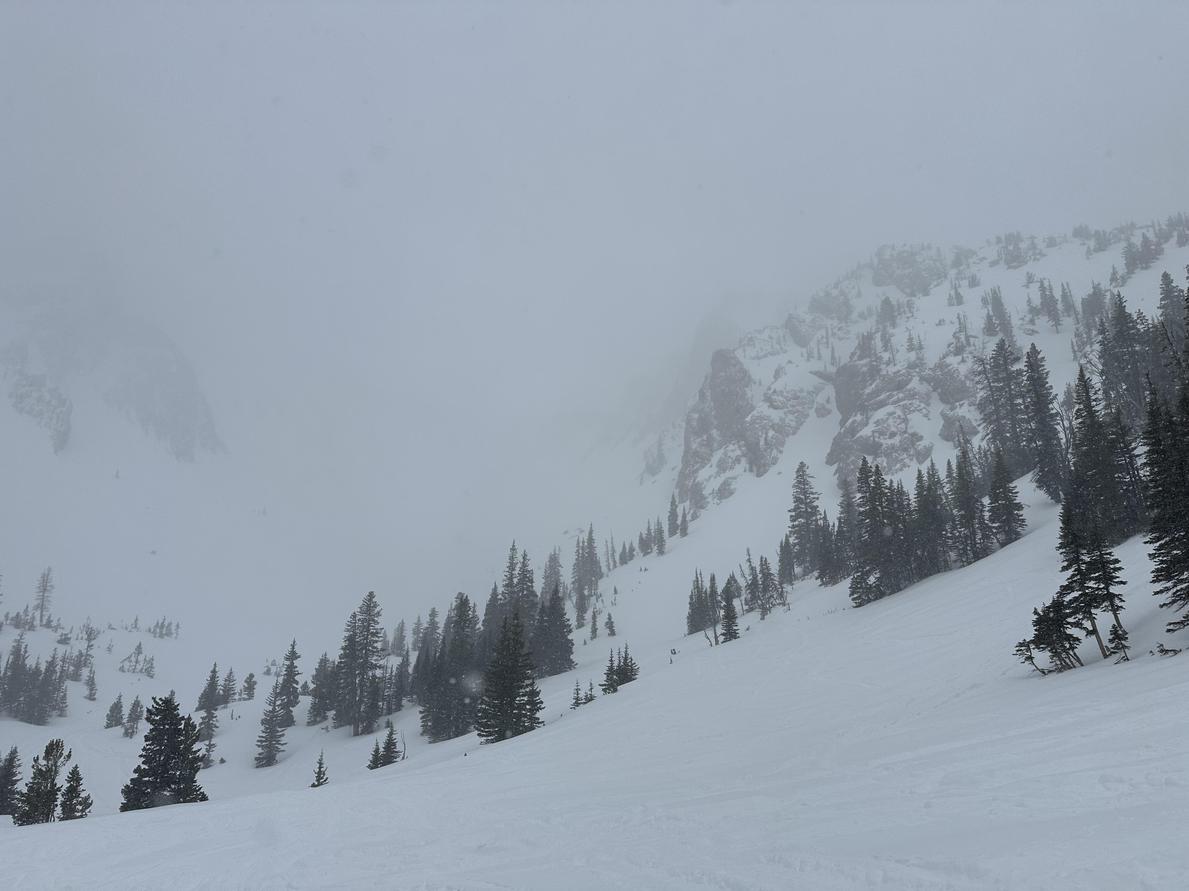
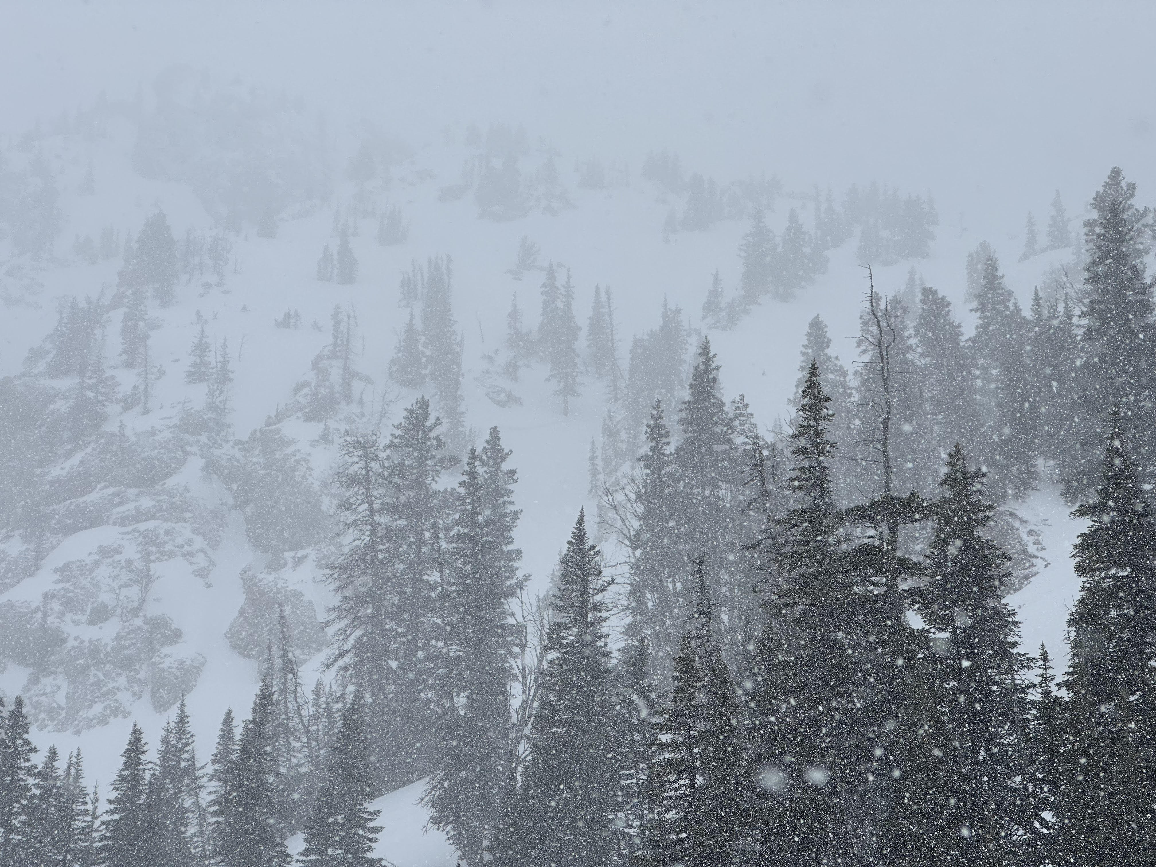
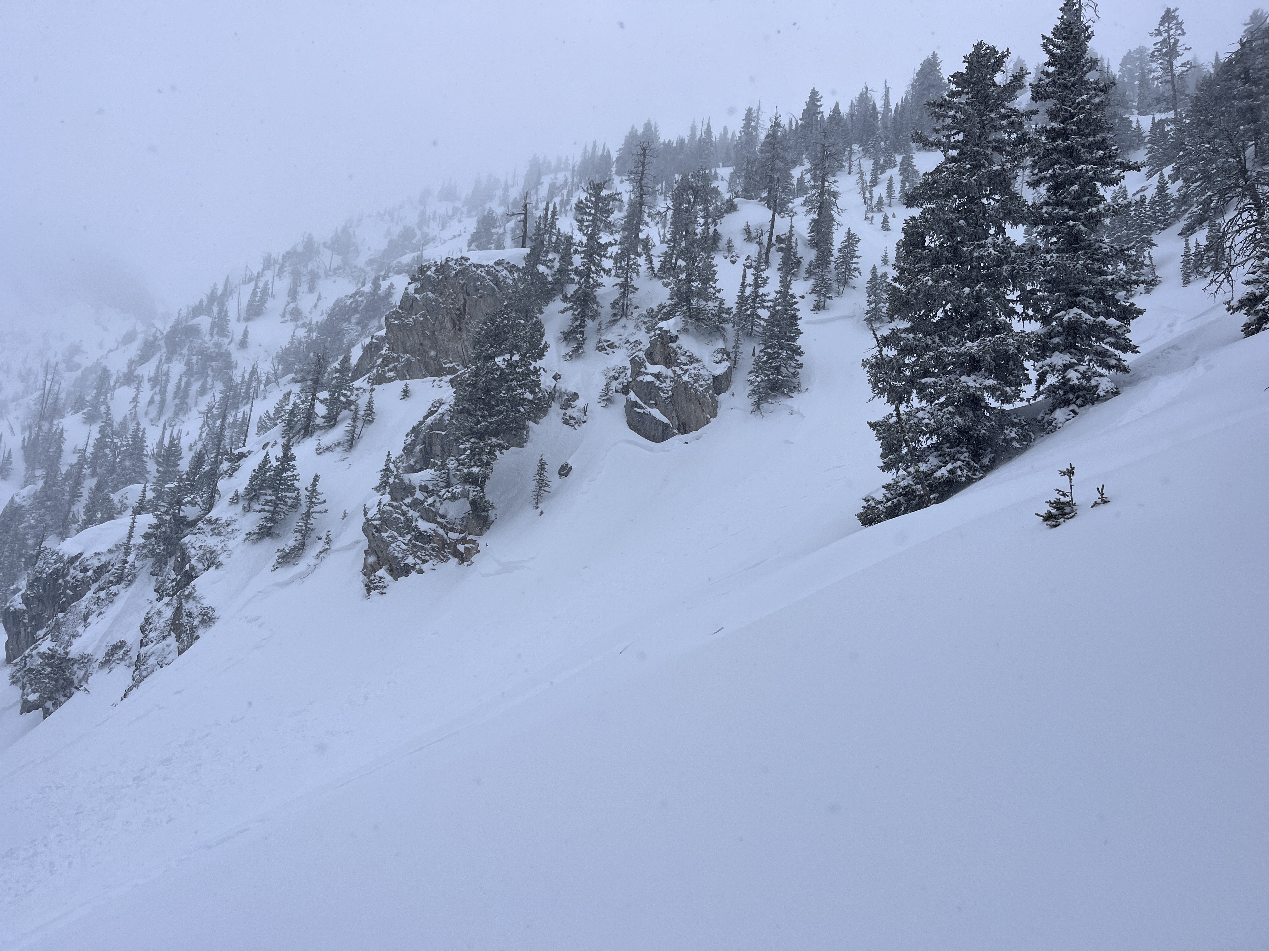
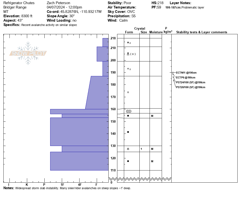
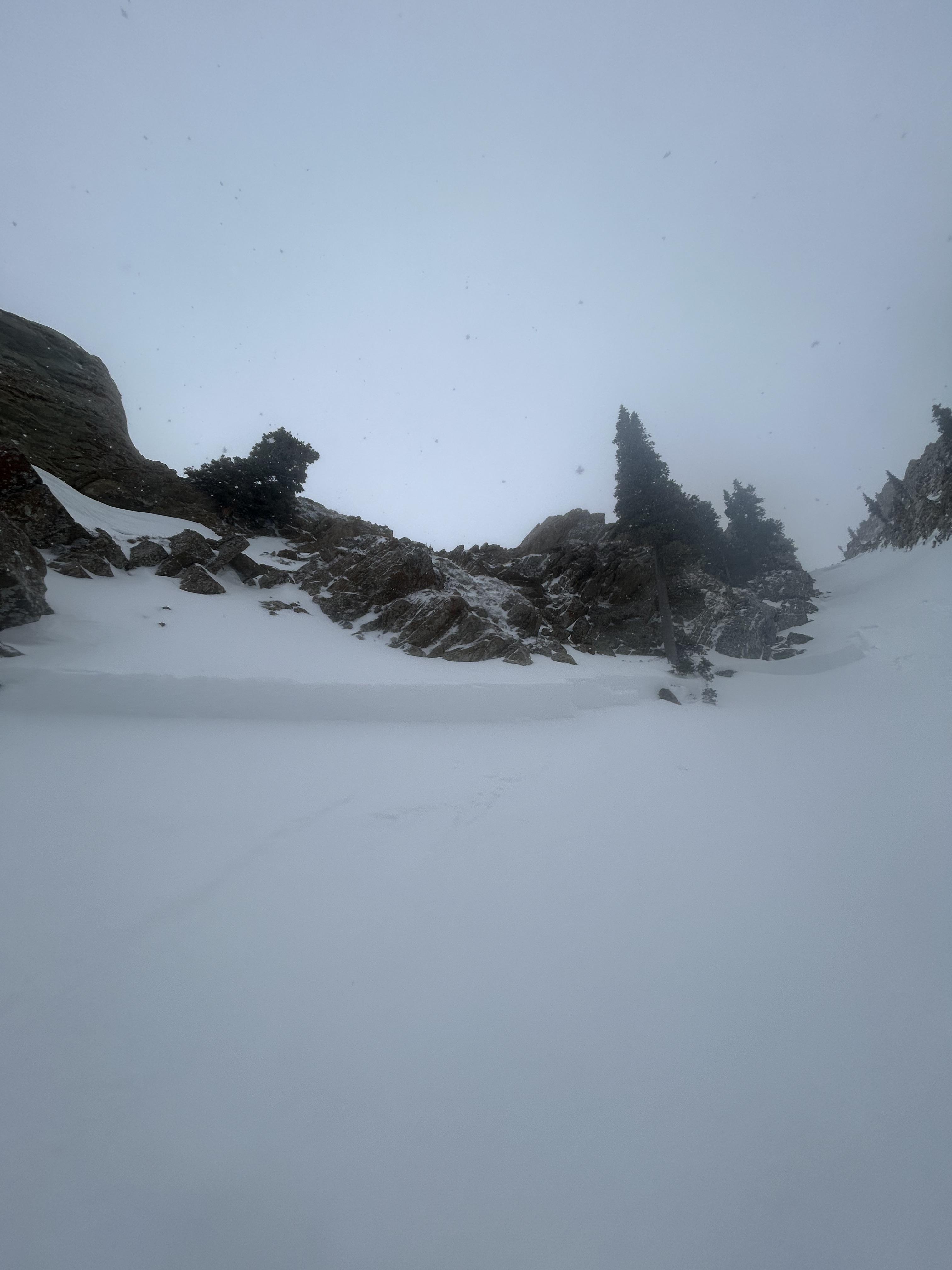
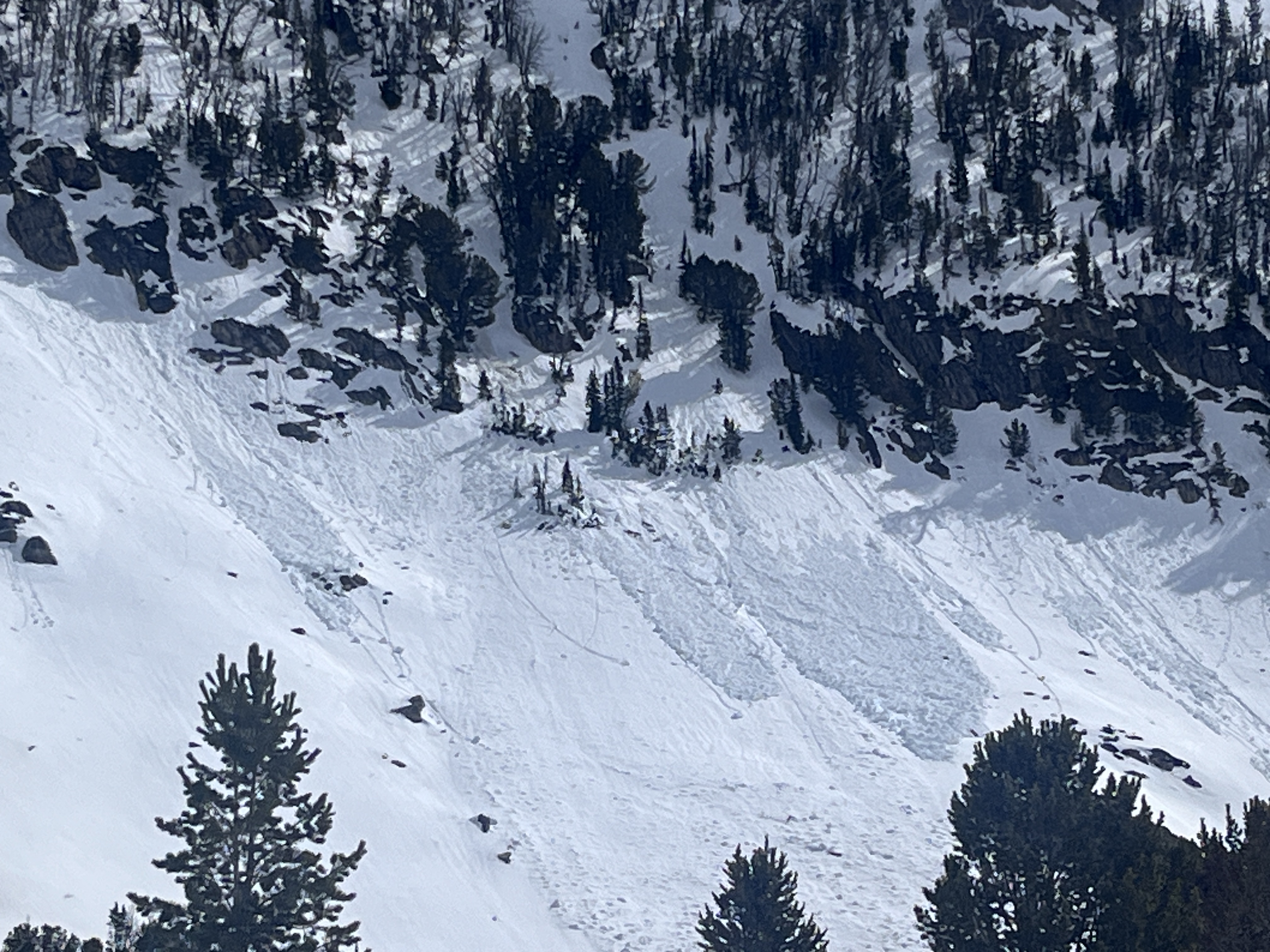
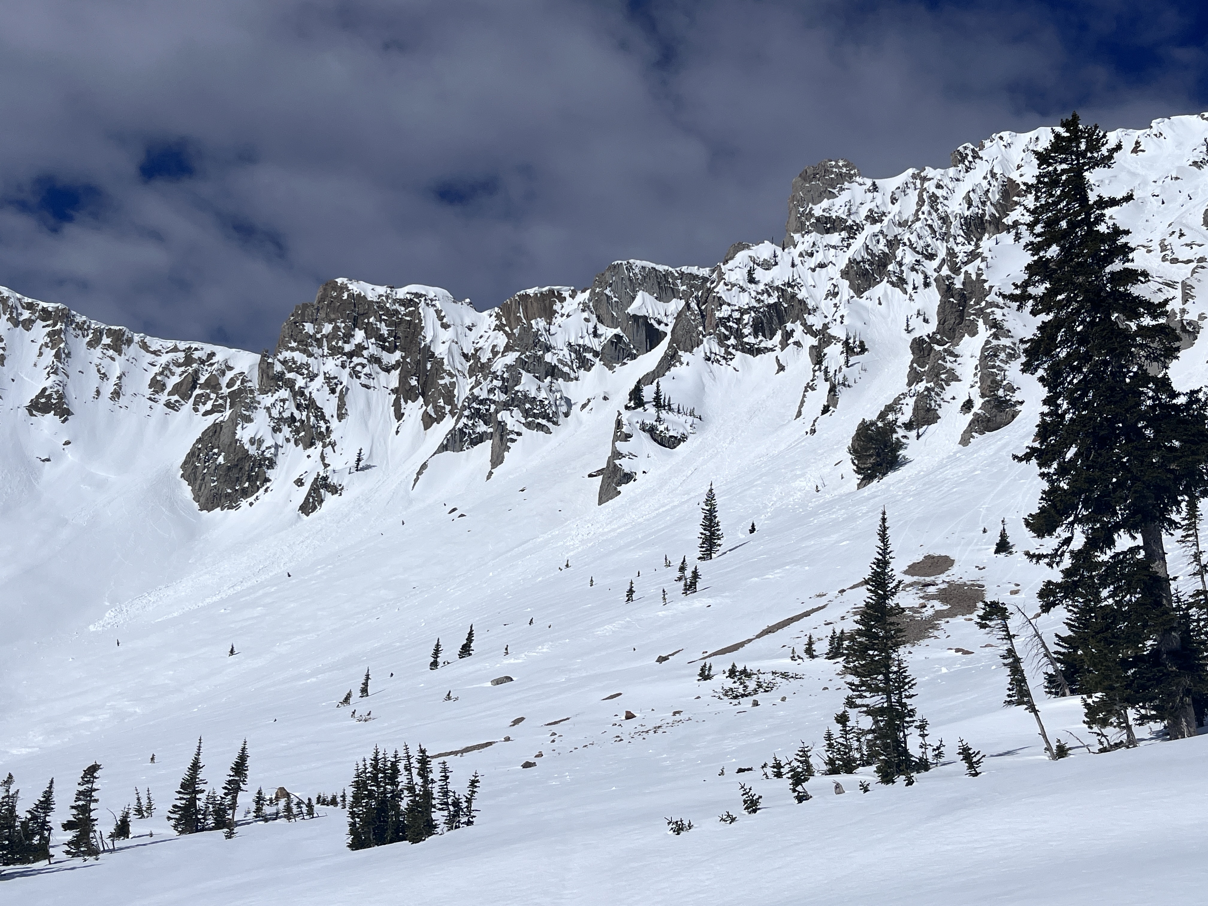
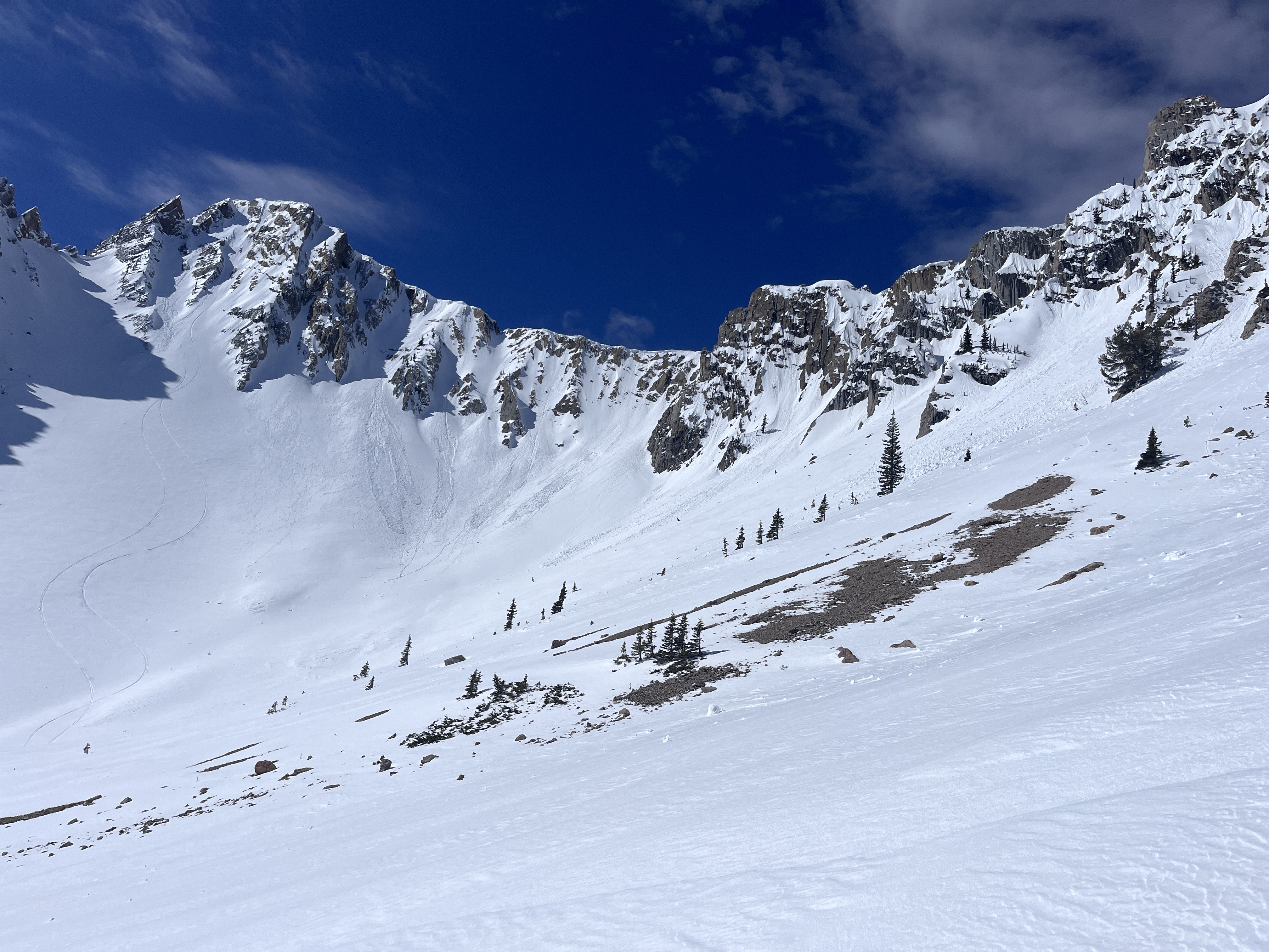
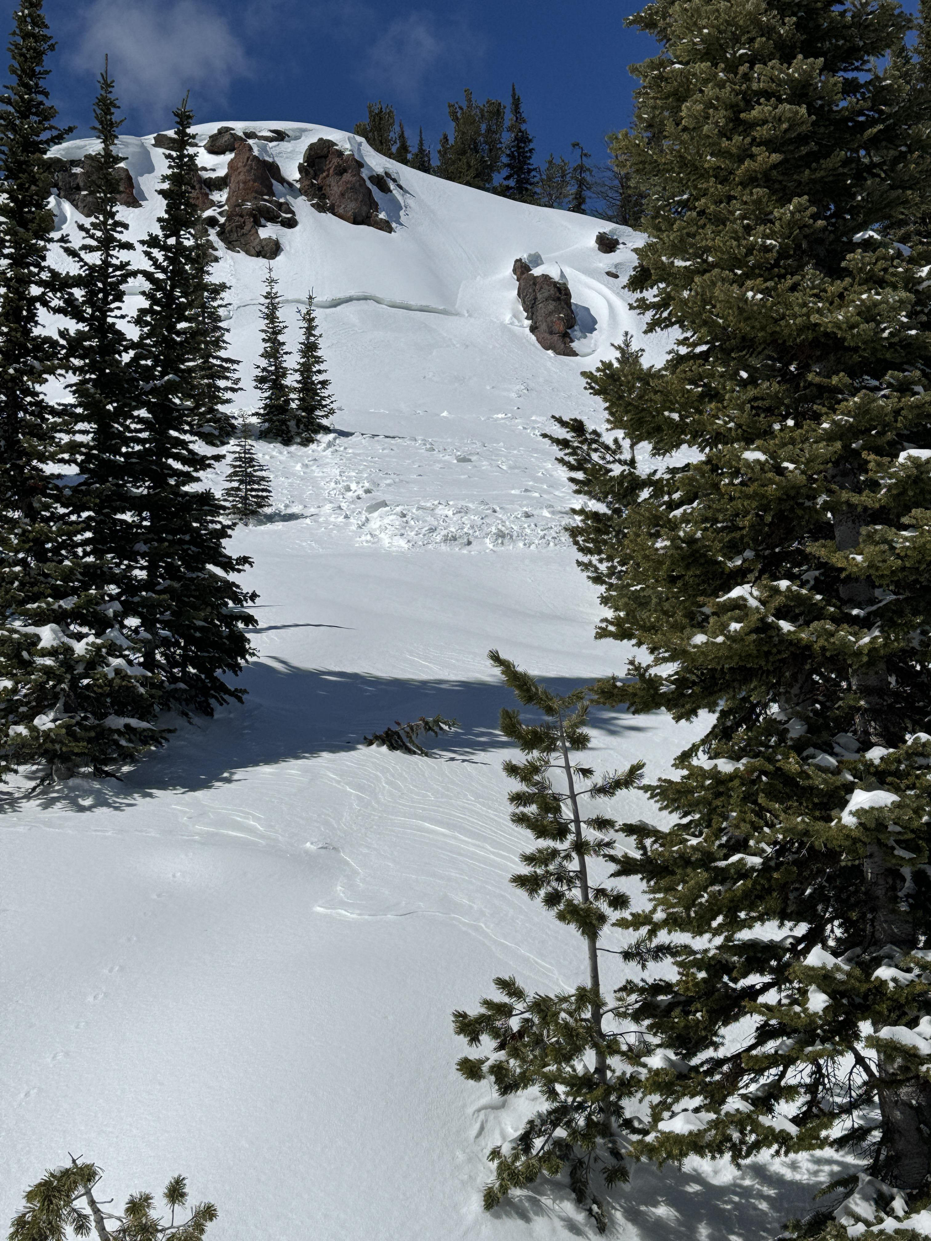
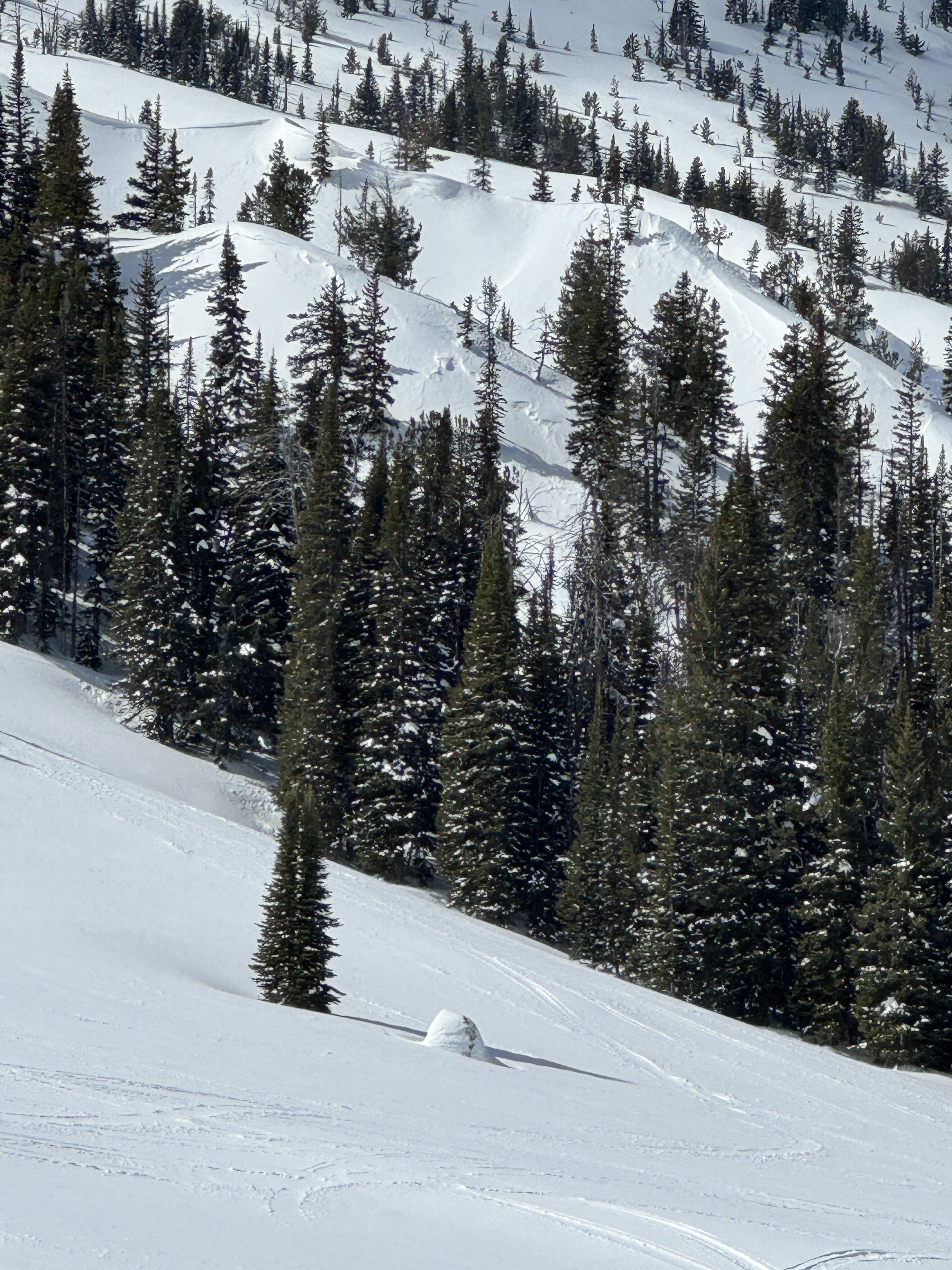
We toured up the Ramp today from the Bradley's Meadow backcountry gate. Near Bradley's we measured 19" of snow and 2.7" of snow water equivalent. On several test slopes, we observed cracking and only triggered small sloughs in steep pockets of terrain. At noon we stopped above the refrigerator chutes and dug there. We found 24" on new snow with 3.05" of snow-water equivalent. In the storm snow, we had ECTP6, ECTN11 & PST24/100 SF. Below the recent storm snow was a 1.5" thick crust with moist snow beneath.
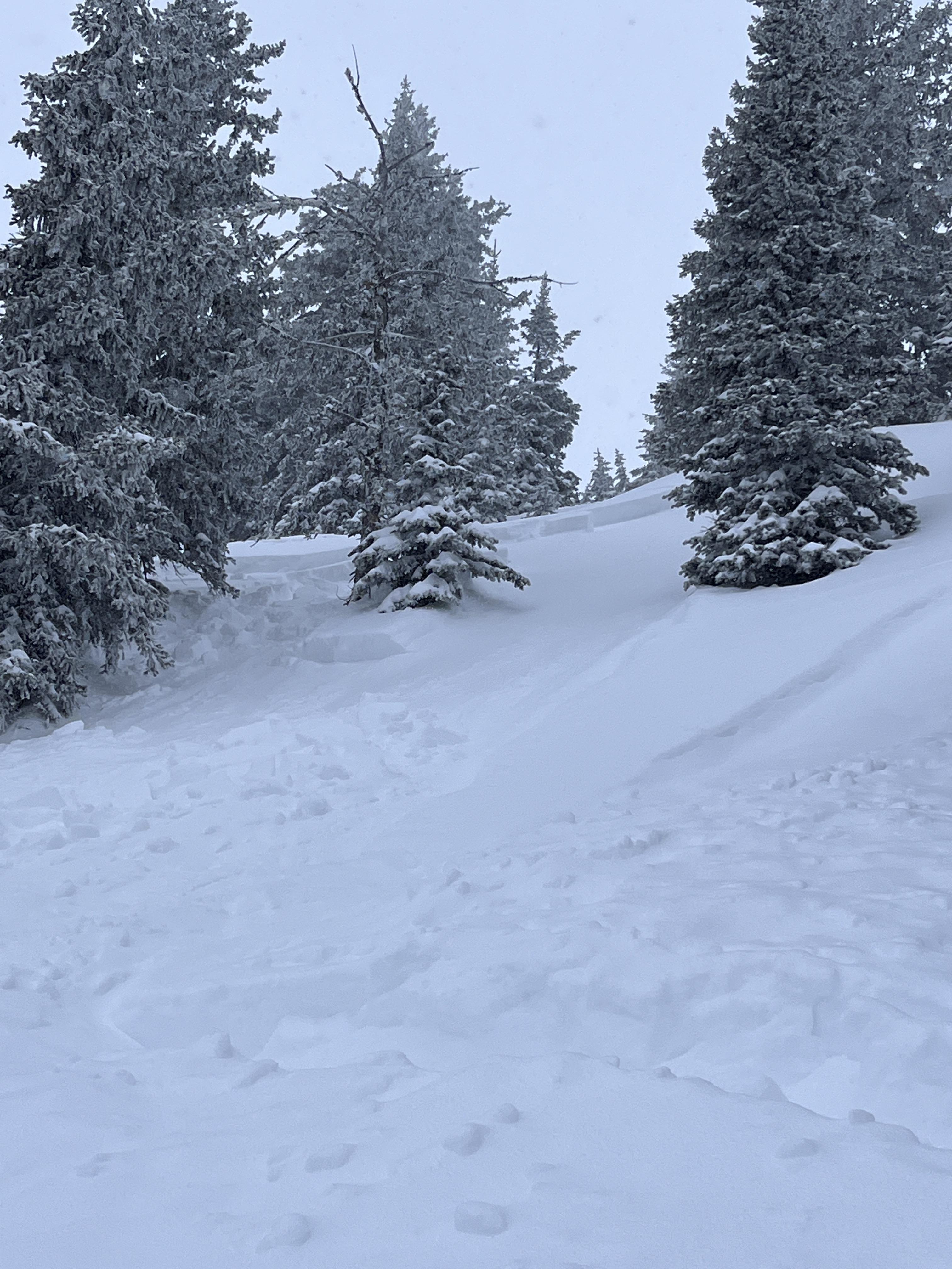
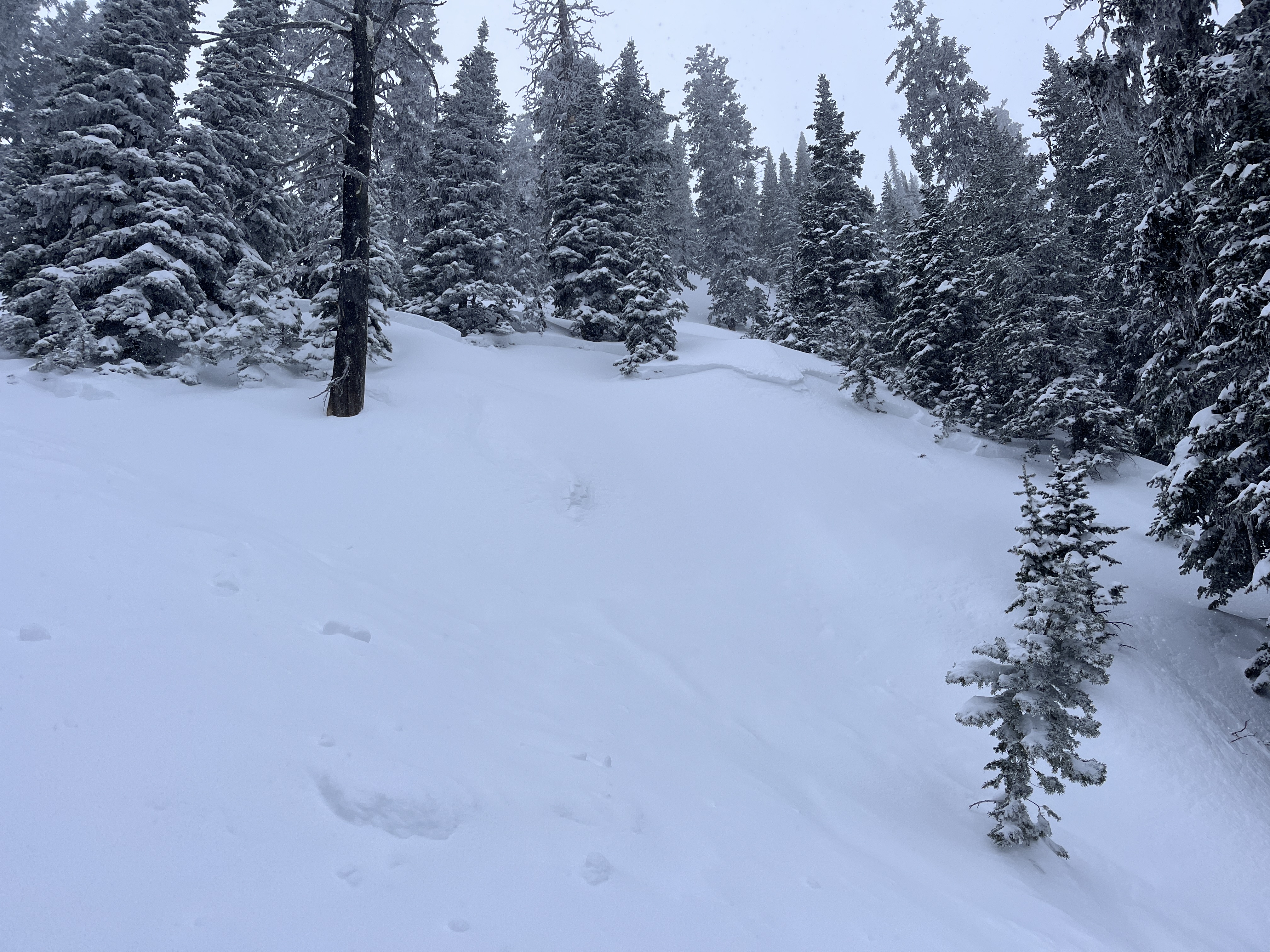
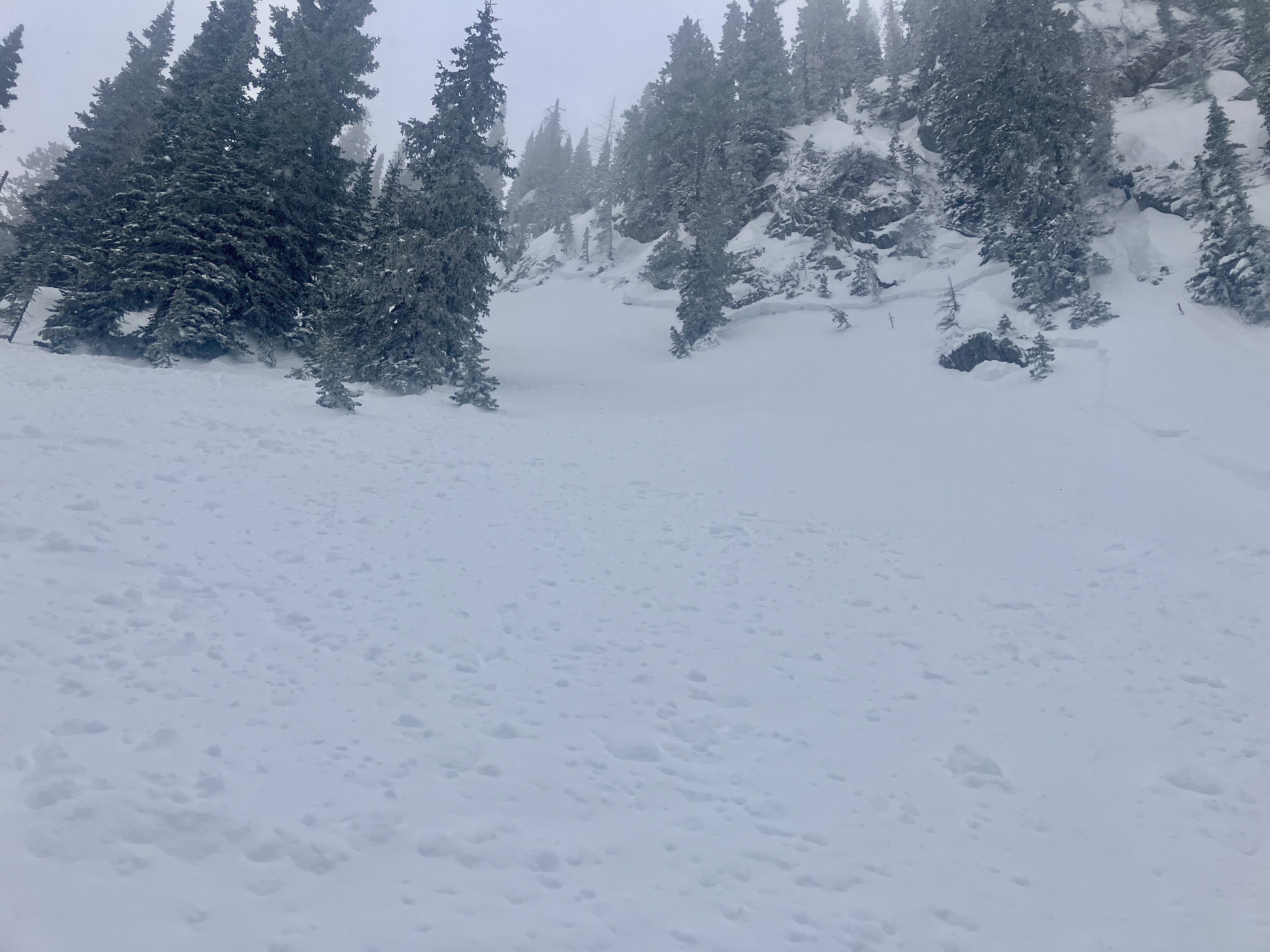
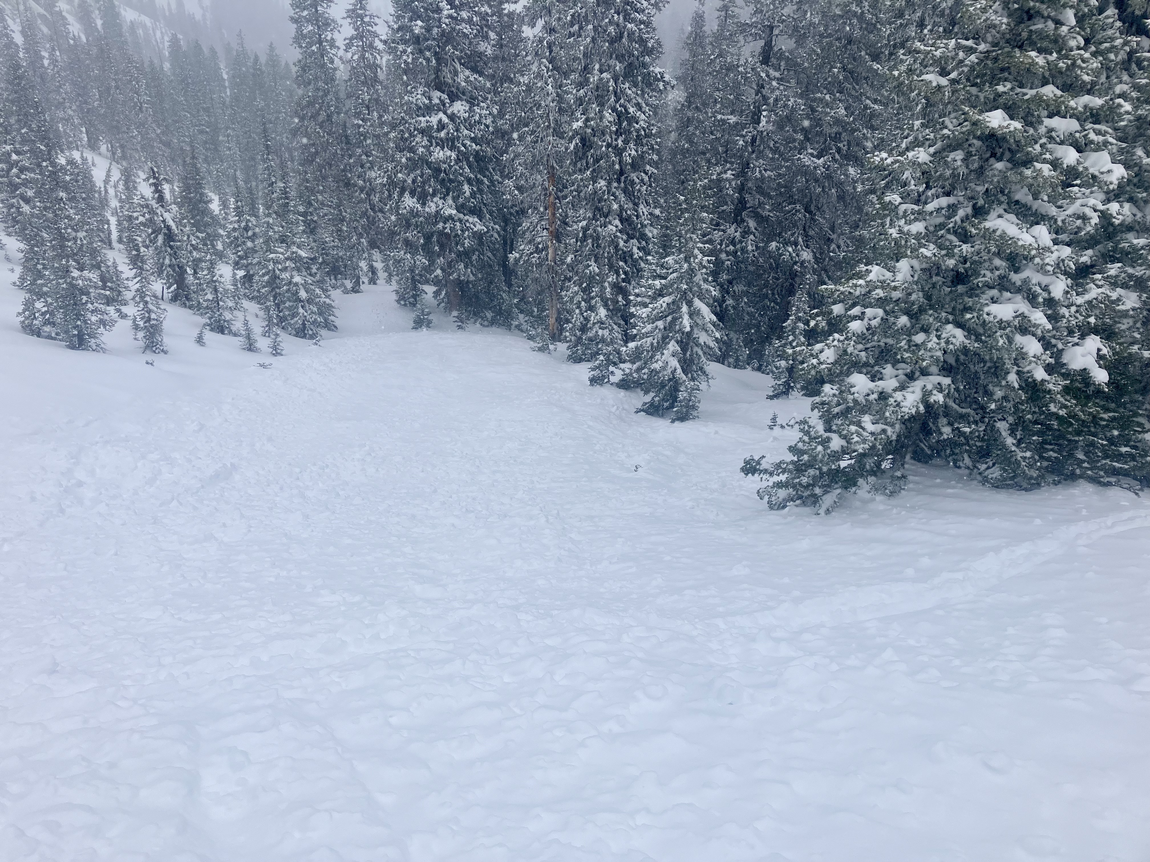
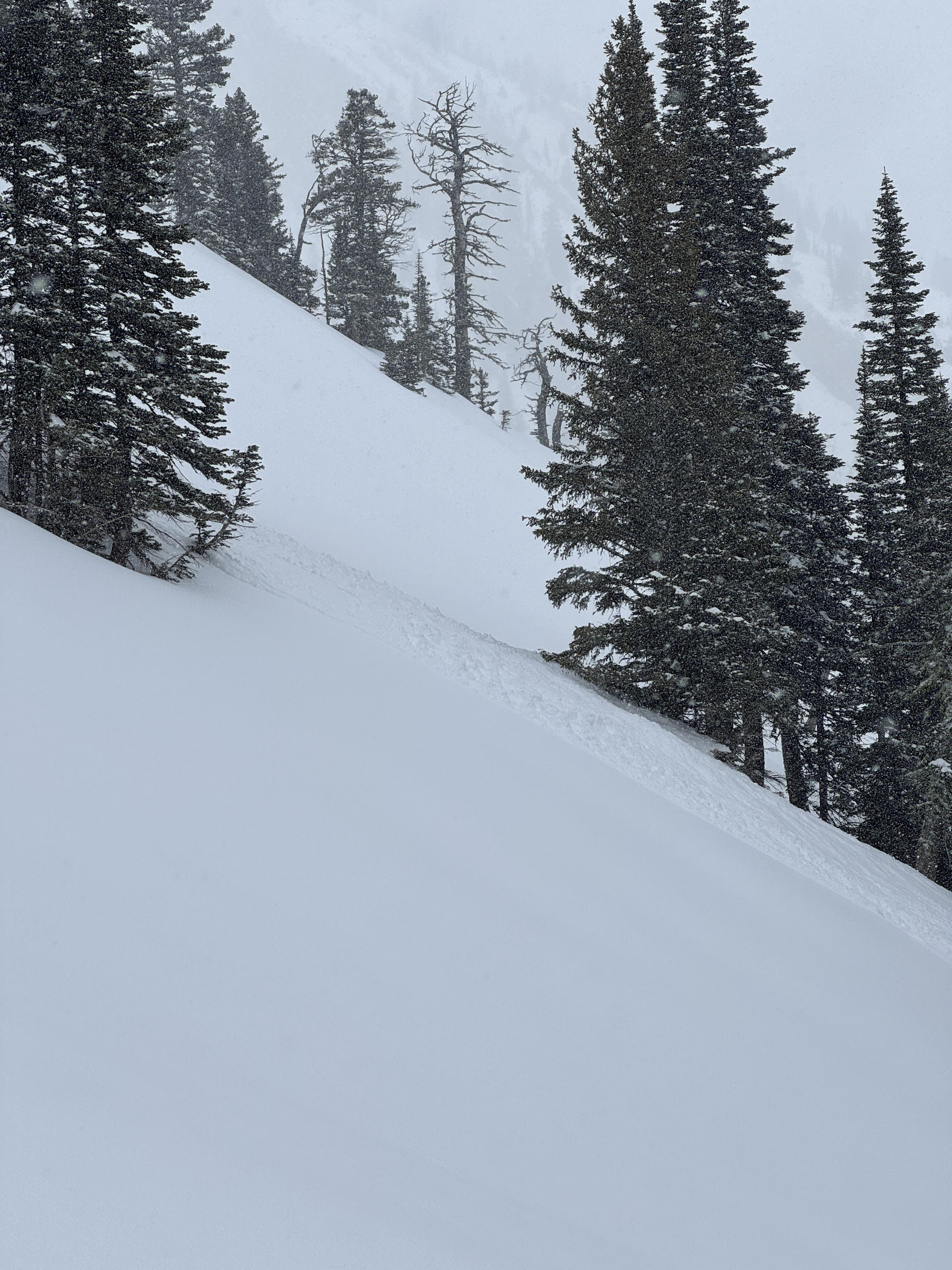
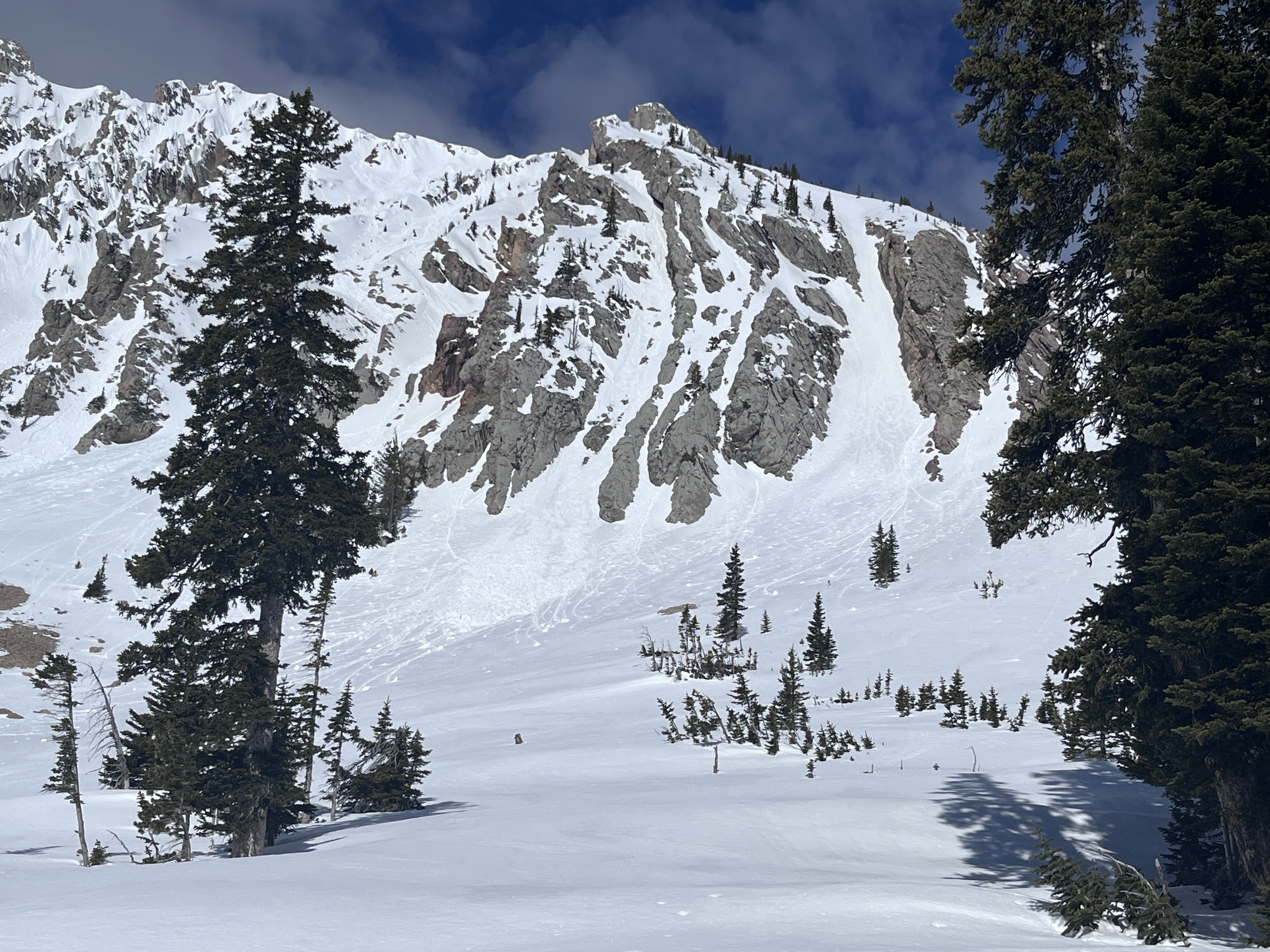
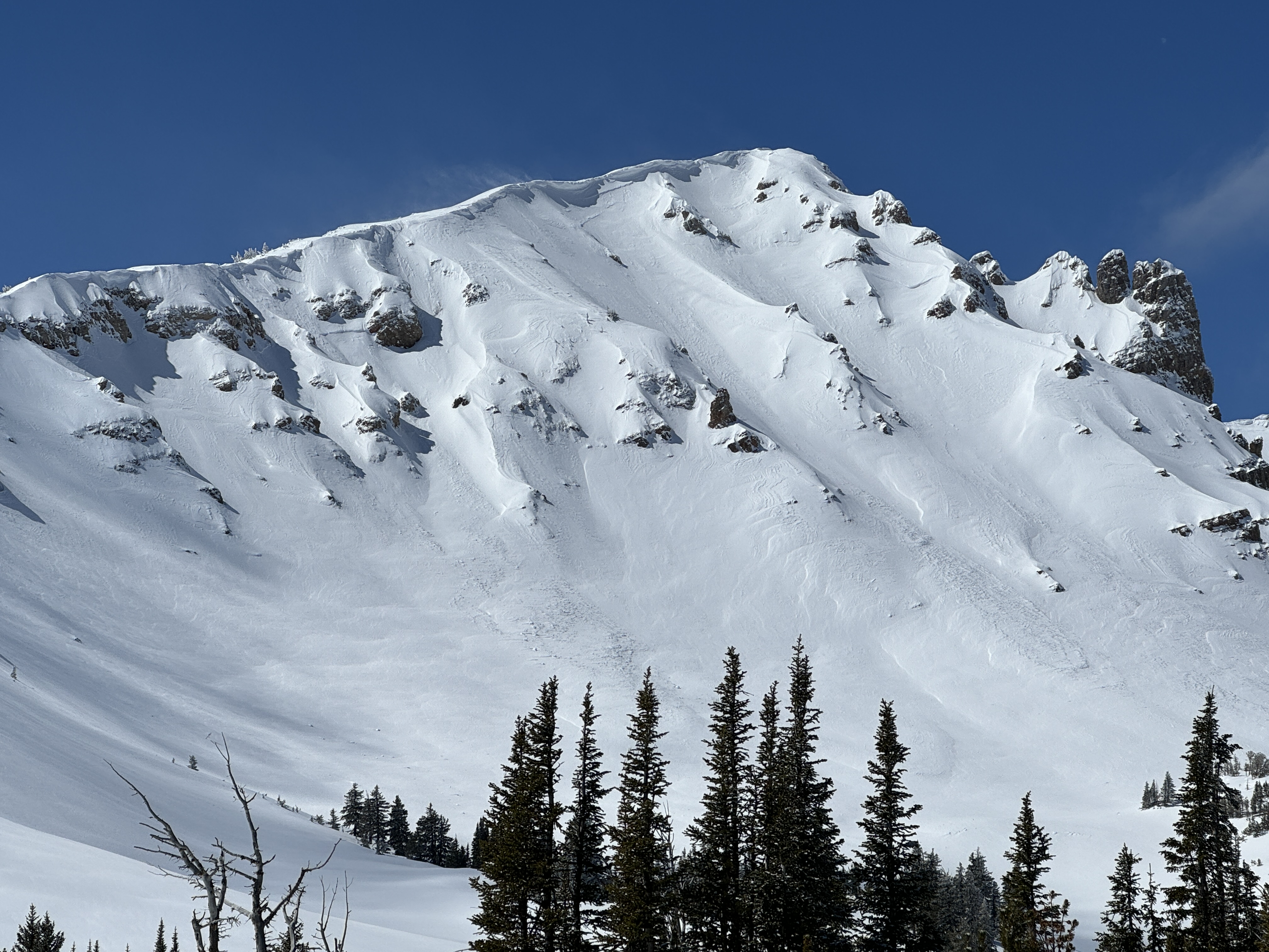
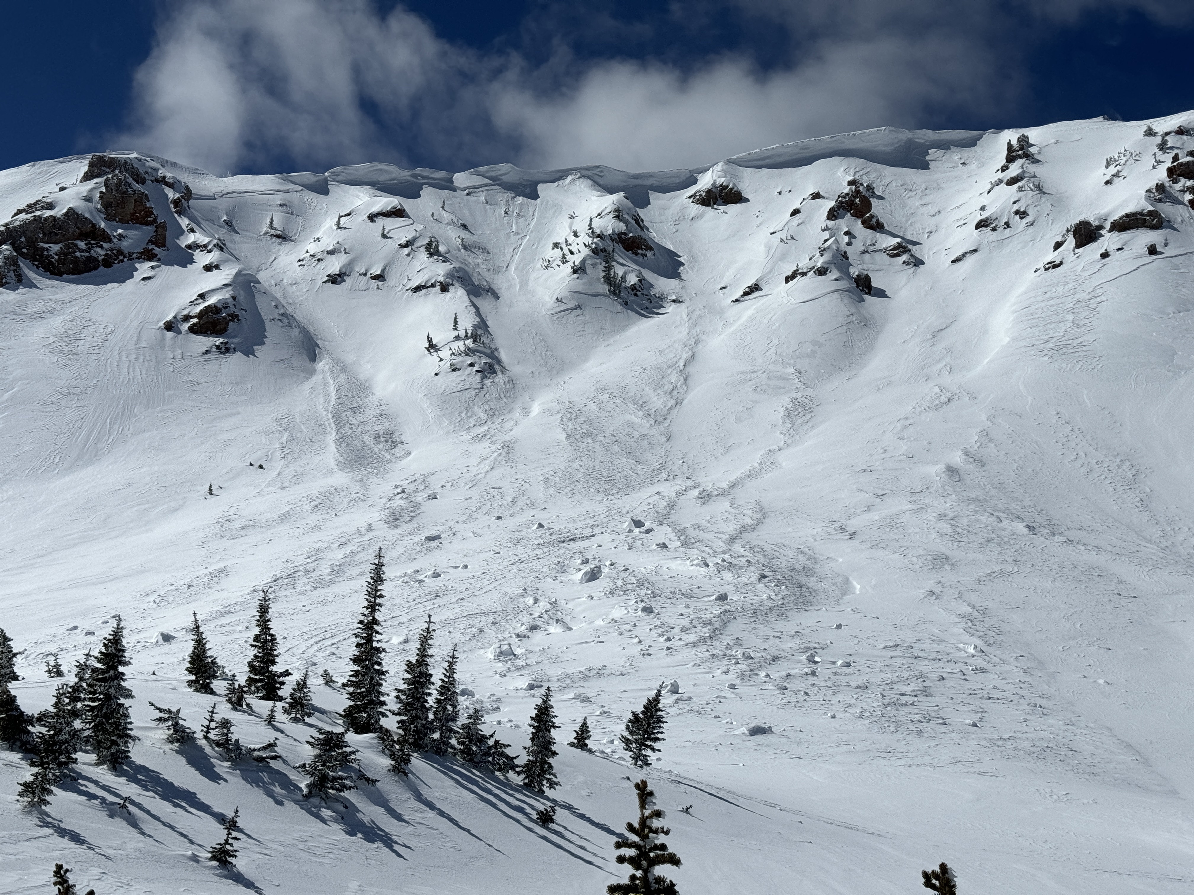
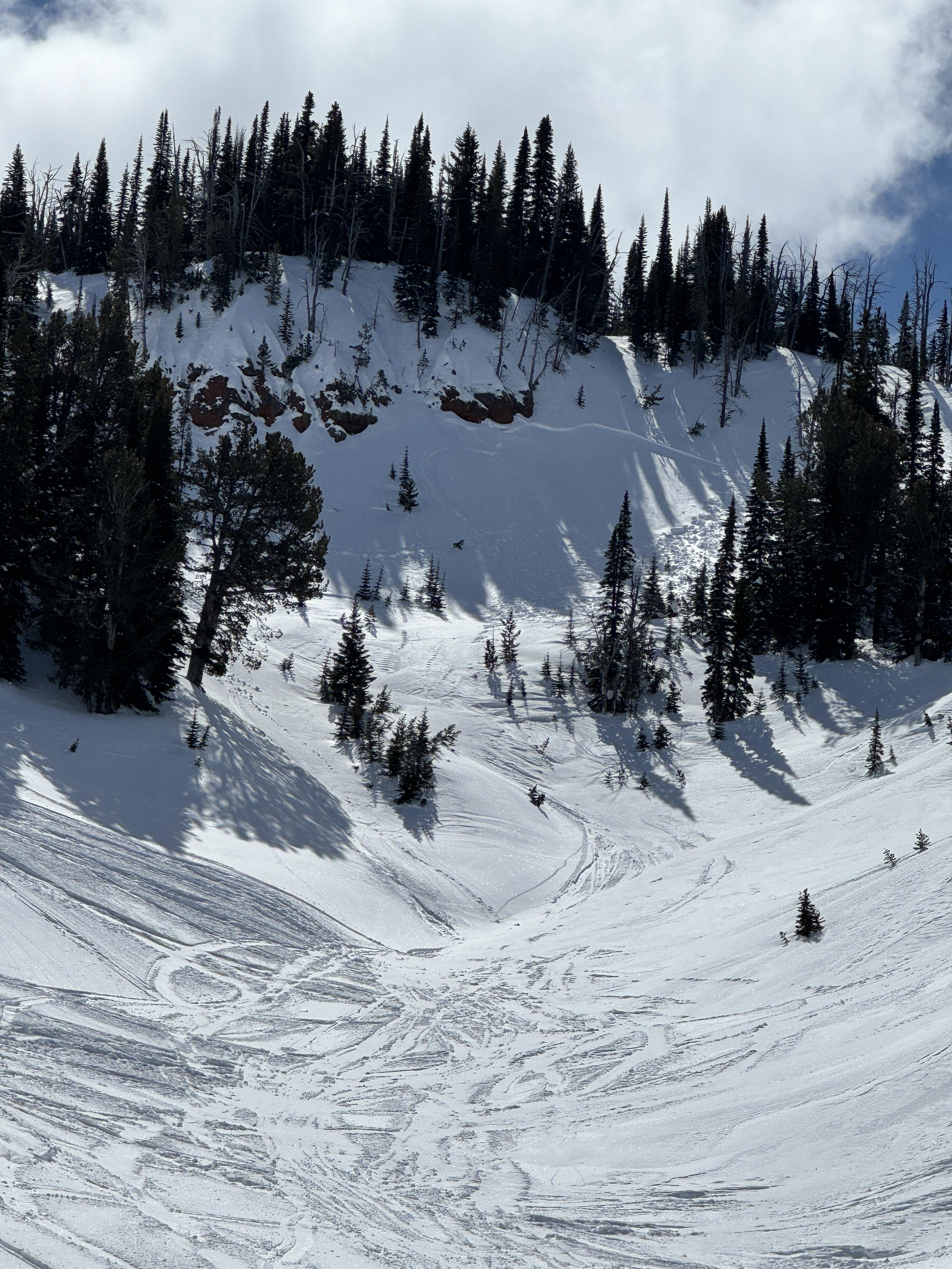
Near the top of the Ramp we saw a small skier-triggered avalanche that buried a portion of the skin track in front of us. While skiing down the ramp new snow was easily sloughed but never picked up much momentum. On our second lap, we saw several skier-triggered storm slab avalanches breaking ~1' deep within the new snow (R2/D1.5). We saw one larger avalanche below the cliffs between the Refrigerator Chutes and Wolverine Cirque (R2/D2). We spoke to a skier who skied Wolverine Crique who reported many small storm slab or slough avalanches. All of these avalanches occurred on slopes steeper than 35 degrees.
Snow continued in strong pulses throughout the day and we estimated 2-3" fell between 12:00 and 2:30 pm. At the top of the ridge, winds were light from the south. At the middle and lower elevations, winds were moderate with strong gusts. Bradley's Meadow back to the parking lot was very wind-affected.
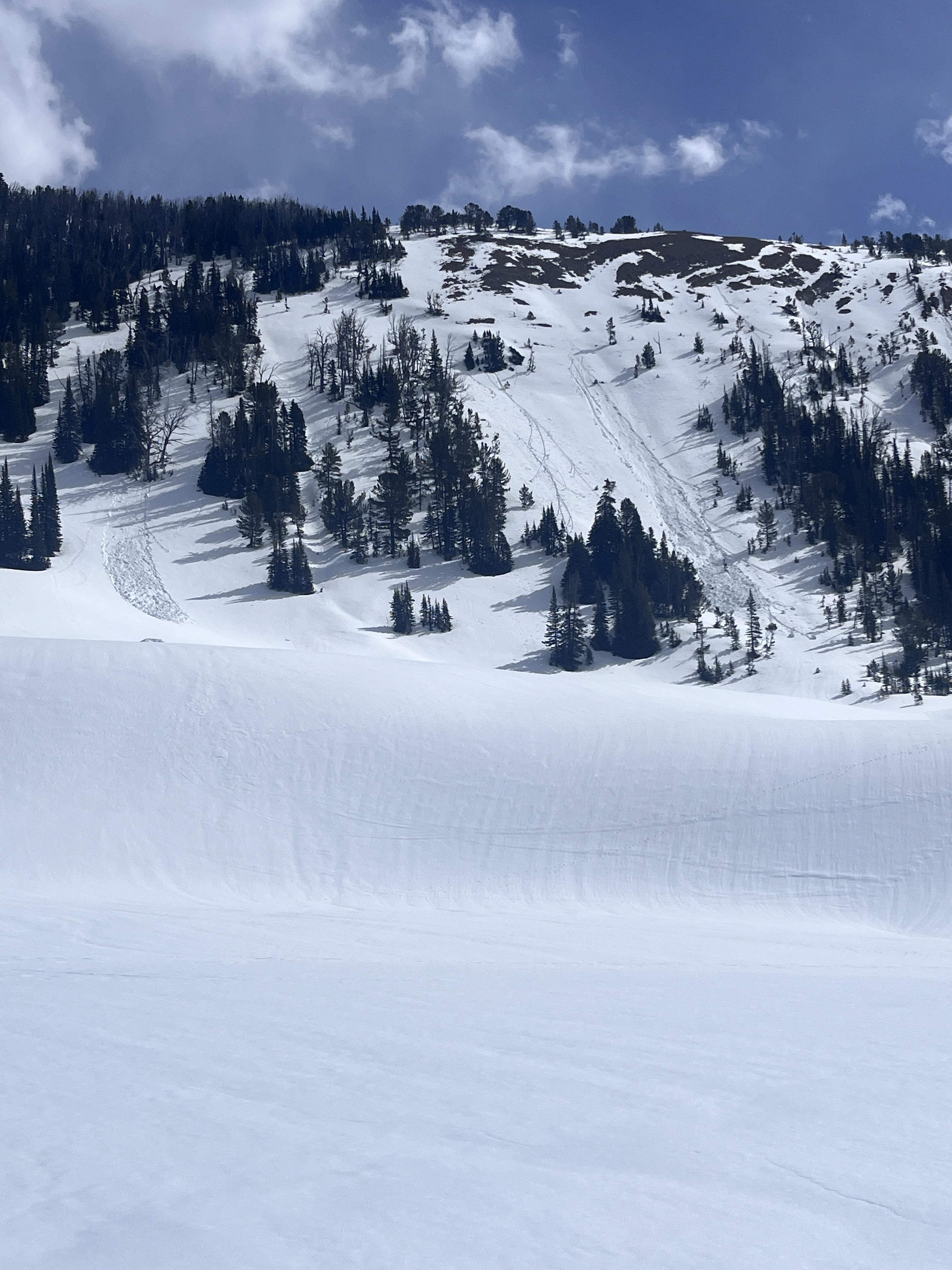
Full Snow Observation ReportInstability was variable, slopes near the top of the ramp did not budge while stomping on them. Most storm slabs happened on steep rollovers and were all skier-triggered. In the largest of the avalanches, Alex saw ski tracks in but no obvious tracks out. We toured up the debris doing a beacon search and found no signal. At the top of the debris, we found their outtrack through the trees.
Despite large amounts of new snow, MODERATE danger didn't seem unreasonable today and going forward (Sun/temps will quickly spike danger though), although I would have probably called it CONSIDERABLE if the weather stations showed the SWE and wind that was actually occurring. Avalanche activity was happening in the new snow, but slabs were small and low volume R1/2, D1-1.5, one D2, and predictable and easily identifiable. Given the large number of people in avalanche terrain today, it seems someone would have suffered larger consequences if conditions were more dangerous/considerable. Yes, slides were likely, but not very dangerous compared to the the pwl season we've had... semi-unpopular opinion, but, this is another example of how likelihood really skews the danger higher, when travel advice can be "identify and avoid features of concern", "choose less consequential terrain" even if a lot of small avalanches are likely, and it is ok for people to consider various avalanche terrain... -Alex

Roughly 2 inches of new snow in the parking lot at Bear Canyon. Up high on the top of Mt Ellis at 8300 feet there was 6 to 8 inches. Did a column test and it broke on the new snow layer above the crust about 23 cm down from the top at 3 taps from the elbow. Then we kept going and got it to fail at the weak layer near the bottom of the snowpack at 6 taps from the shoulder.
Full Snow Observation Report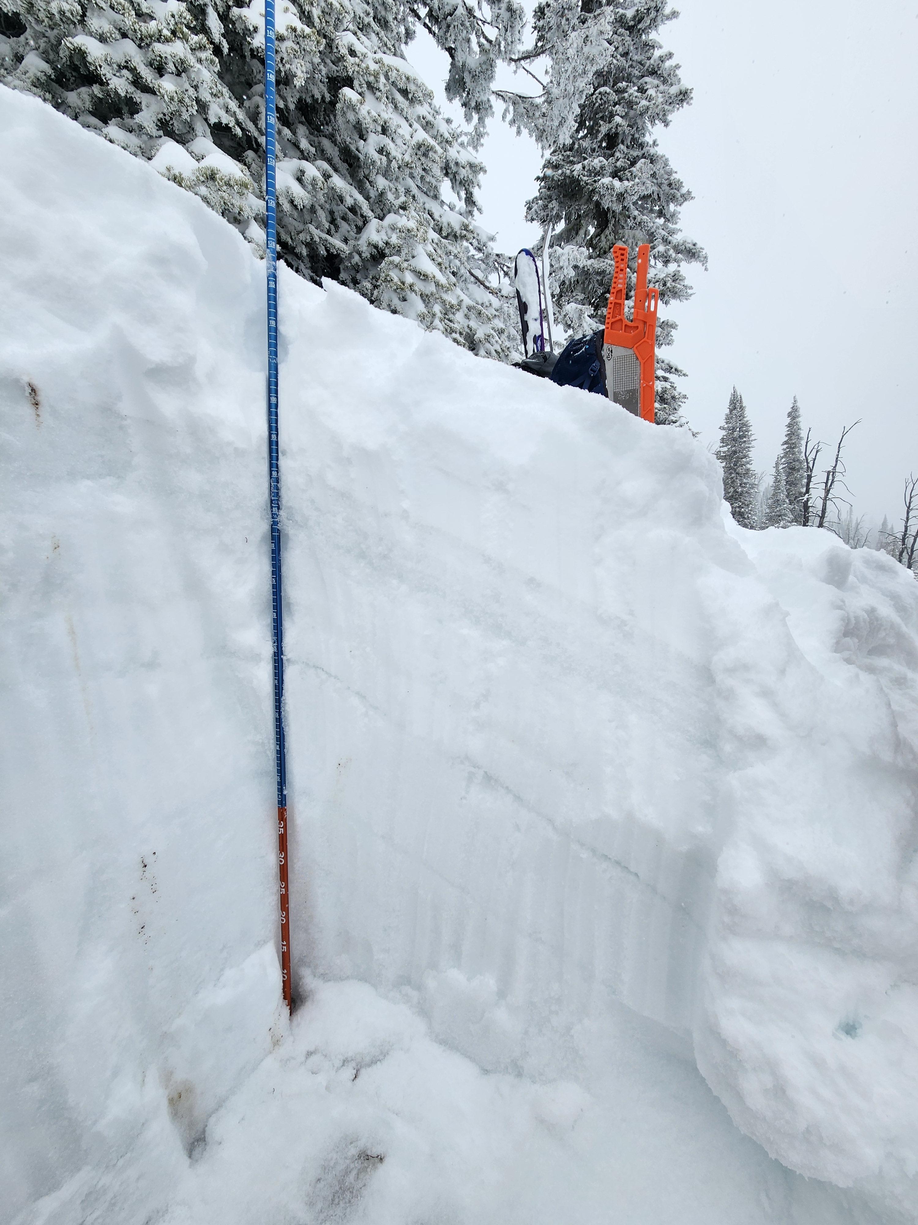
We traveled into the Throne on a snow-covered road, but unfortunately, by the time we came out at the end of the day, it was a couple of miles of off-and-on mud. I can't really see how the road will last beyond the end of the snowstorm for snowmobiling. By the time we turned off the road for the final ascent to the sled boundary, there was a foot of new snow, and by the top of the Throne, over two feet of new snow equal to 2.5" SWE.
There was a thick, supportable crust below the new snow, and our primary concern was instability within the new snow and on wind-loaded slopes. A skier triggered a small avalanche on a steep north-facing pitch, but it did not run far. We saw limited cracking on a layer within the new snow generally 4" to 1 foot deep, and got an ECTP11 on this layer in one of our pits on the east-facing pitch near the standard ski track. Our other pits, one lower on the east face and to the north of the saddle at the top of the Throne, resulted in ECTNs between 5 and 15 on this layer within the new snow. While there was some limited wind transport of the new snow, we did not find any slopes that I would define as wind-loaded to test instability. My educated assumption is that you could trigger a large avalanche on a wind-loaded slope right now.
While we traveled in and skied avalanche terrain, we stuck to the lower-angle end of the spectrum and selected simple slopes with fewer terrain traps.
The new snow will provide fresh ammunition for wet, loose avalanches as the temperatures warm this week.
Full Snow Observation ReportAvalanches breaking a foot deep were likely on slopes steeper than 35 degrees (or just generally on the steeper end of the avalanche terrain spectrum). If it continues to snow as forecast in the Bridger Range tomorrow, I recommend CONSIDERABLE. If it shuts off, I recommend CONSIDERABLE on wind-loaded slopes.
WTF... it's spring, it may be CONSIDERABLE for wet snow by tomorrow afternoon. I don't know, it could go a lot of directions.
Bottom line, there is a lot of new snow out there with the potential to slide and it would pack a punch.

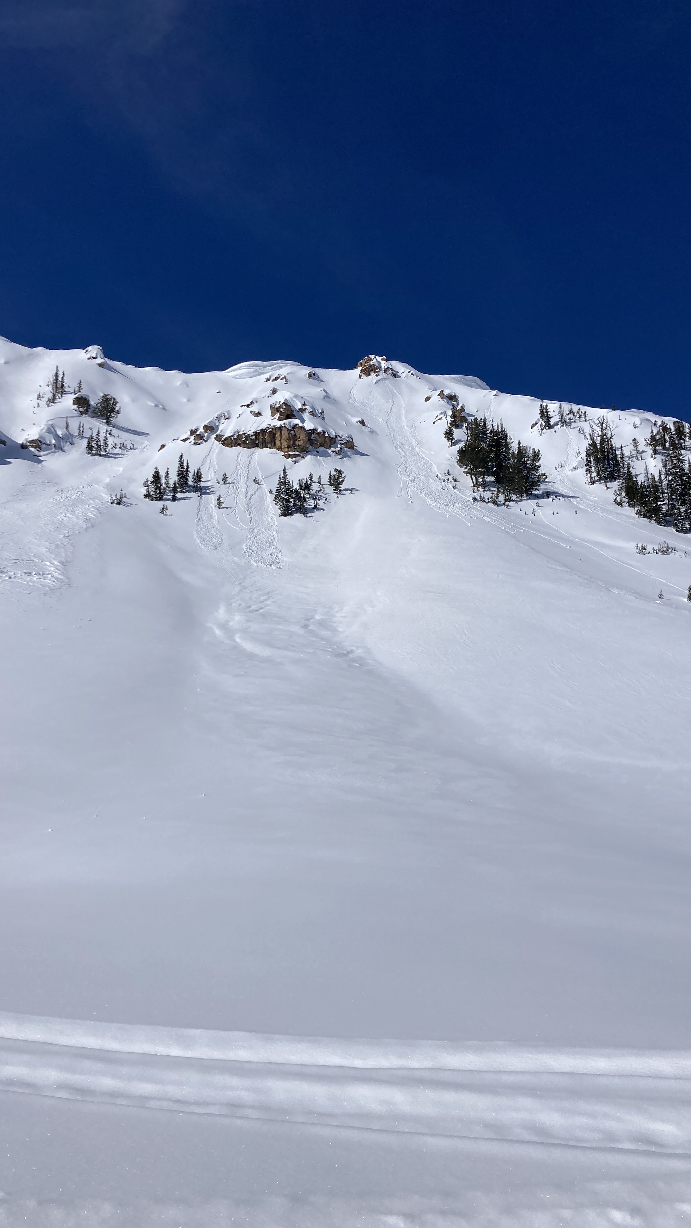
After skiing two laps on East facing terrain two basins north of Anger Lake basin and seeing no significant signs of instability, we descended into a north facing gully around 8,200ft and triggered an avalanche on the new snow/old crust interface. The crown was 4-18 inches deep and propagated the entire width of the gully ~40 feet and ran the entire length of the gully ~500 vertical feet. I was able to ski out of the avalanche right as it broke and was not carried.
Full Snow Observation Report
Skier triggered slide in one of the Love chutes dropping into Frazier basin. Skier attempted to ski cut the top of the chute, snow was not reactive. He began to ski the chute and triggered a wind slab about 18” deep which failed the crust from the recent warm stretch. Was carried about 200 feet and managed to self arrest on the side of the chute while the slide continued to the bottom. No serious injuries.
Full Snow Observation Report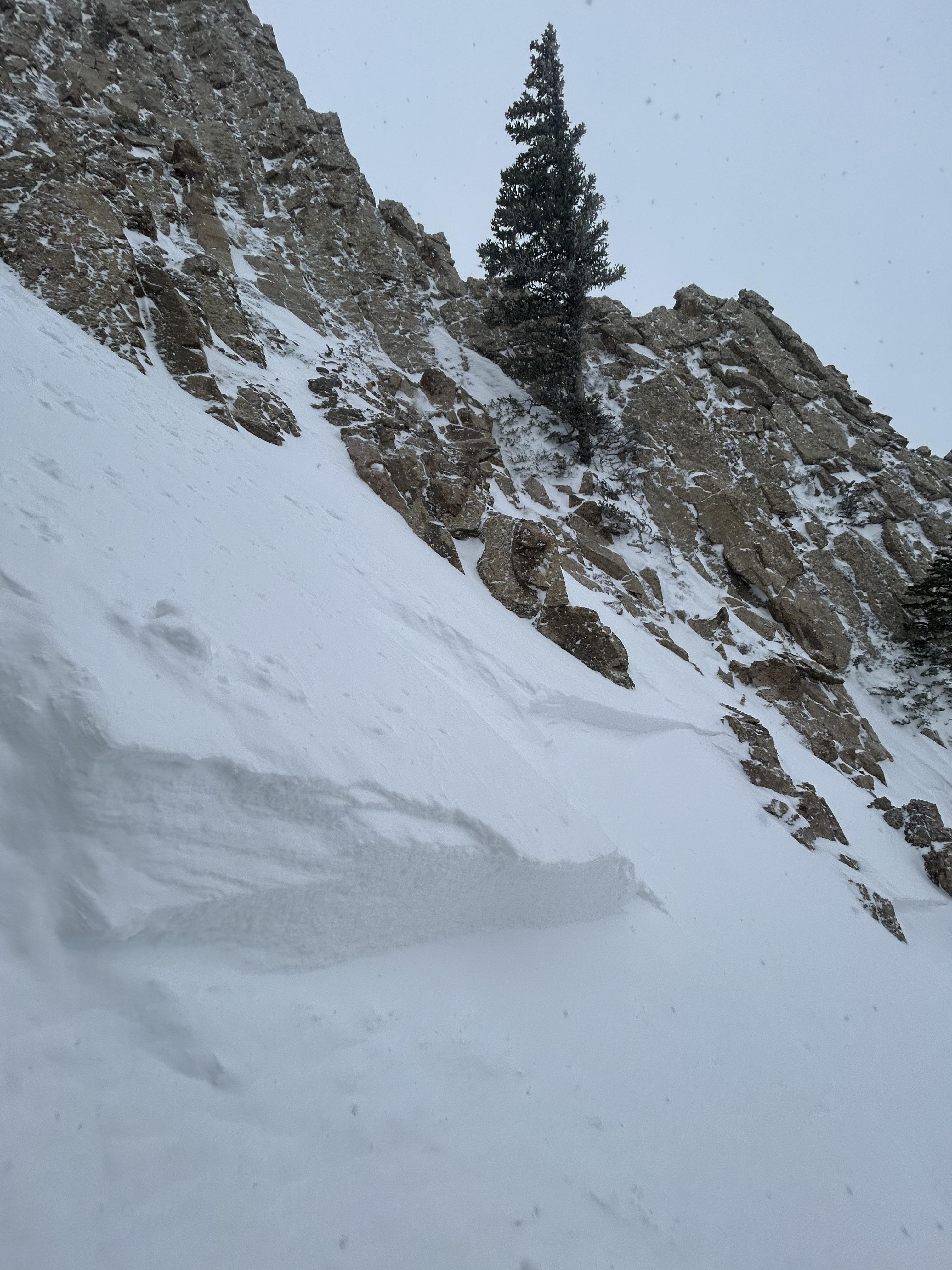
Performed an ECT test high on the east face of Mt Ellis at 12:30 pm on 4/7/2024. Found 8” of medium density powder on a 3” ice crust with 2’ of lowish density slush beneath the crust. Got an ECTP 14 that broke at the ground. The ice crust seemed to hold the slope together well enough to support a skiers weight yesterday. Concerned that additional warming today could make this slope dangerous.
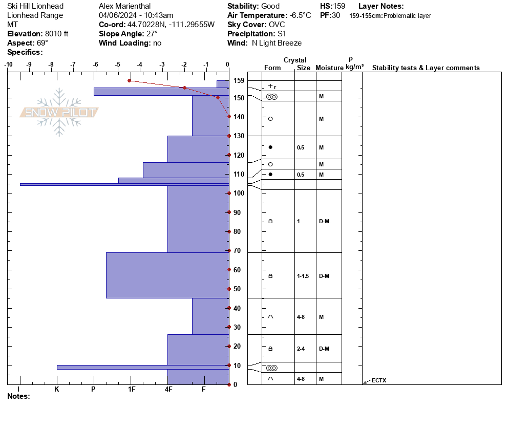
Full Snow Observation ReportToday, we rode from the Buttermilk trailhead to Ski Hill then up to Lionhead Ridge.
At the top of Ski Hill, there was a 2" thick supportable crust below 2" of new snow from the last 24 hours. We dug here on a NE-facing slope at 8000', almost the entire snowpack was moist/wet. We had ECTX results in our stability tests. Just to the north of our pit location we saw a small wet loose avalanche that likely happened earlier this week. Along Lionhead Ridge 2-4" of new snow was beginning to form small drifts that were unreactive on test slopes. On the north side of the ridge, we saw areas where portions of cornice had fallen over the last week of warm temperatures. Snow continued on and off through the day with little to no accumulation. West wind remained light throughout the day with moderate gusts.
Full Snow Observation Report

Toured around Beehive Basin midday 4/6. Very light dusting, no concerns with new snow. Solid 5-10cm supportable refreeze. Hand pits going from 9,400ft to the summit on the SW face of 10,602’ had moist but not wet snow beneath the new crust and a secondary more stout crust 30cm down. The moist snow between the crusts turned to facets as we moved up the face into rockier areas, with depth hoar at ground. We then skinned to the base of 4th of July, which had tracks and refrozen wet loose debris. We dug a pit right below 4th of July @10,200ft and got ECTP12 45cm down within a thin 1cm melt-freeze crust. Surprisingly the snow above the layer was not nearly as saturated as other aspects, we turned around there.
Full Snow Observation ReportFrom IG mesasge (4/6): "Some wet action at arange peak near Sawtell yesterday. From slope Dave and I did our first pit on Monday. Lots of release in that new old interface but didn’t see anything releasing down deeper."
Full Snow Observation Report
Toured into Beehive Basin on 04/05/2024. Light freeze overnight ~0.5" crust with wet snow below on most slopes. Treed areas did not freeze. Clouds along with a cold south wind kept many slopes from softening. By 11:30 sunny slopes below 9000' had become wet and made for poor ski conditions. Attached are photos of recent loose wet avalanches that likely happened 24-48 hours ago. All attached photos on SW-W aspects at ~9800'
Full Snow Observation Report
Toured up to fairy lake this morning, found a somewhat frozen snowpack that rapidly warmed. 830am was when we dropped in, @9000 we found a isothermic snow pack that had only around 3-4 of frozen snow over very warm slush. Rockfall started around 900am.
Full Snow Observation ReportFrom email:" photo of mostly cloudy skies.
53 deg F while driving through IP at around 4pm"
Full Snow Observation Report
Today we rode from the Fairy Lake parking lot to the motorized boundary above Frazier Basin. We skied both north and south-facing slopes.
Small puddles in the parking lot had a thin layer of ice and the snowpack had a 2-3" surface crust above moist/wet snow. While riding in we saw several wet loose avalanches from yesterday on south and east-facing slopes. From the saddle, we skied dry snow on a north-facing slope to the lake below. At 10:00 AM we saw the first wet loose avalanche of the day. We saw a dozen more over the next hour. By 11:30 the upper 6" of the snowpack had become wet and no longer supportable on foot. We exited the basin up a northerly slope that had been shaded for most of the day. Riding out we saw several fresh wet loose avalanches between Pomp and Hardscrabble Peaks. The only other activity we saw was a small skier-triggered slough avalanche in steep northeast-facing terrain.
Clouds increased by the afternoon and remained there for most of our ride out. Temperatures increased noticeably with any break in the clouds from the strong spring sun.
Full Snow Observation ReportBig shed on southerly slopes today. Clouds in the AM and early afternoon seemed to keep the danger from reaching High.
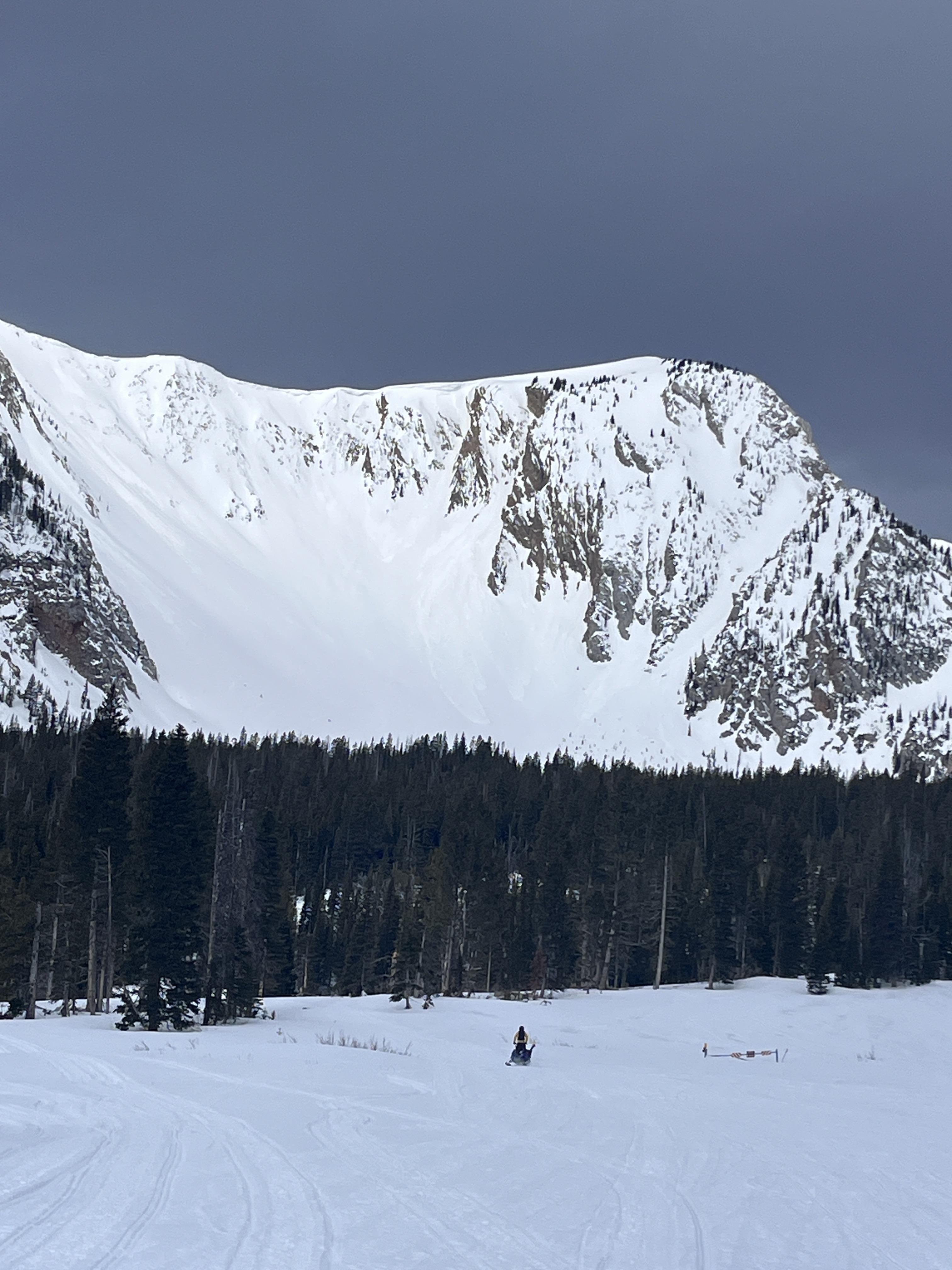

Toured out into Lower Hayden today to look around. Lots of wet loose avalanches on all aspects by noon. And by the time I came back down the hill, the Fin had slid. It likely happened sometime between 10:30 and 1:30 today. It doesn’t look super deep, but it’s hard to say for sure. I’d guess around 2 feet deep.
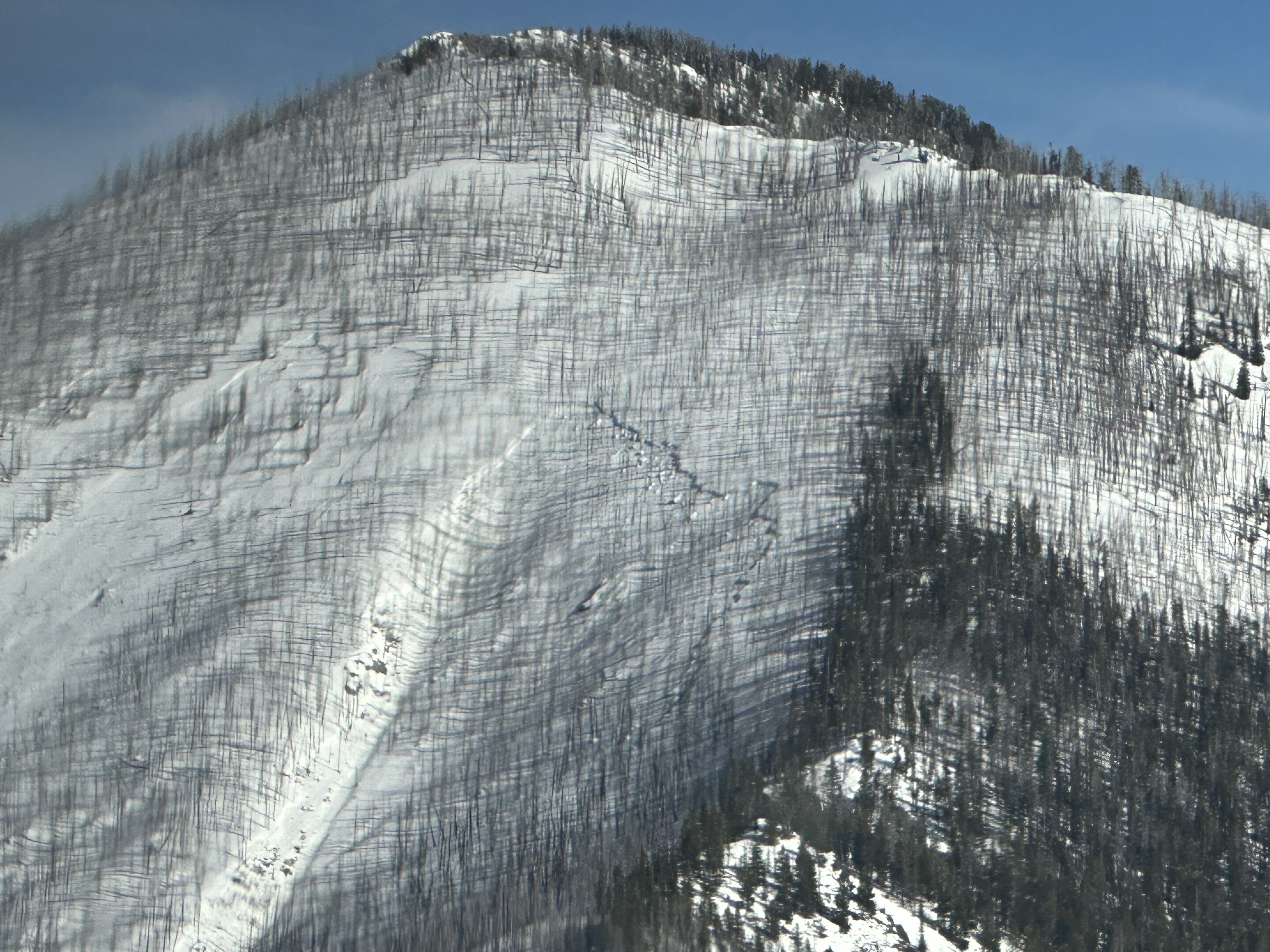
Full Snow Observation Report
This is the absarokee range. 20 miles south of Livingston. Northwest facing at 8000’. Slides like this always remind me to check my local aspects. This type of of slide is one of my biggest fears.
observed from an aircraft.
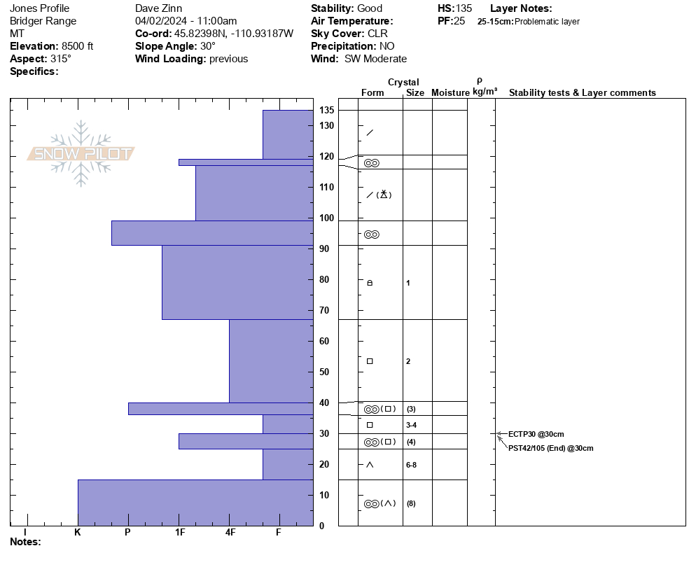
We toured down the west side of the Bridger Range on the edge of Truman Gulch and found predictably weak snow on an upper-elevation NW-facing slope. Conditions were variable and transitioned to a thick crust as we moved on to a lower elevation, west-facing slope. By the time we came down the Ramp, the snow was getting wet, we saw roller balls, and we avoided steep, sun-exposed terrain.
We dug below NW Passage. It was a 135 cm deep snowpack, dry throughout, with Fist plus hard facets and depth hoar making up the foundation (ECTP30, PST 42/100 end at 30 cm from the ground.
Full Snow Observation ReportMODERATE rising to CONSIDERABLE seemed correct.

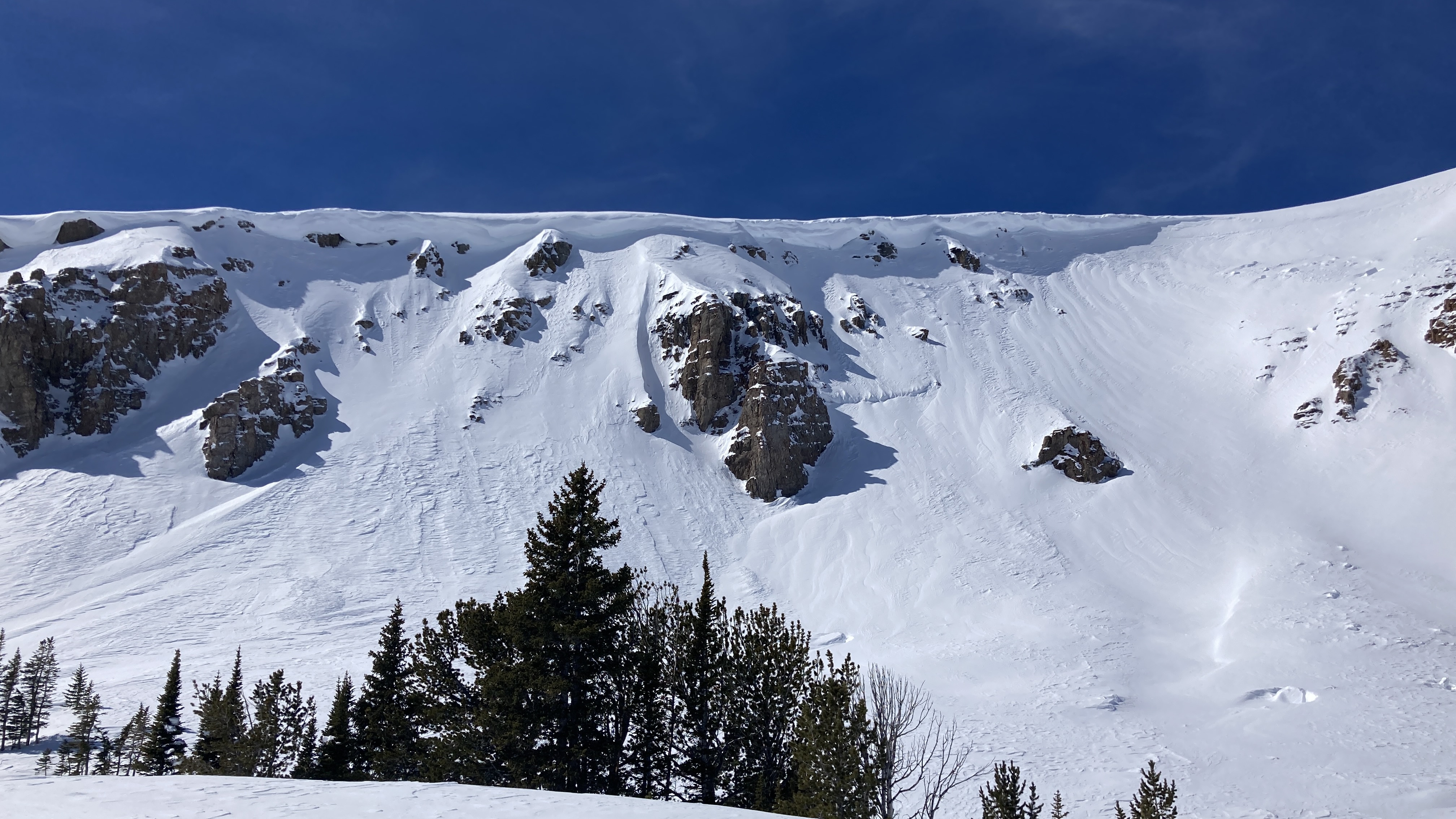
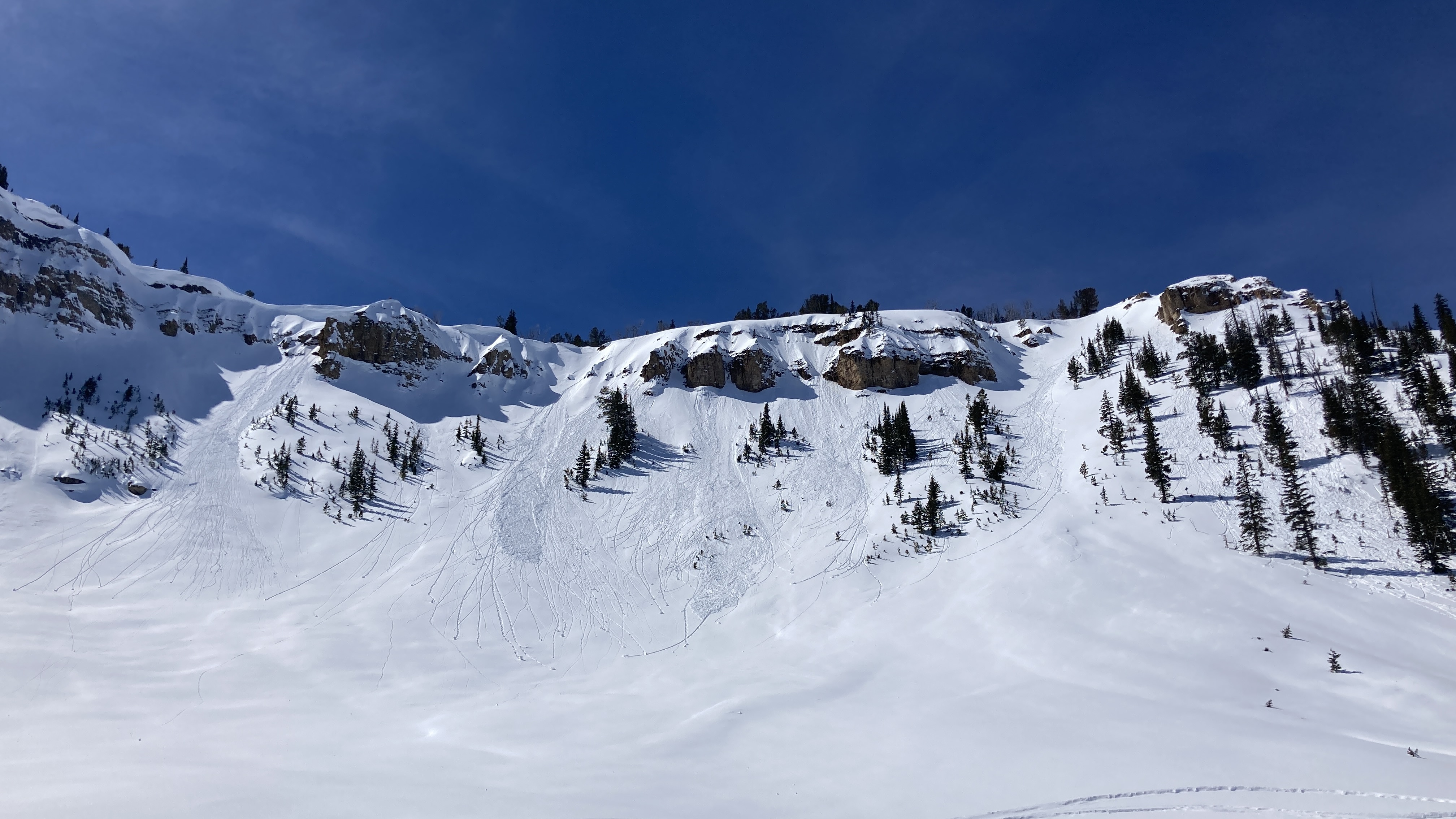
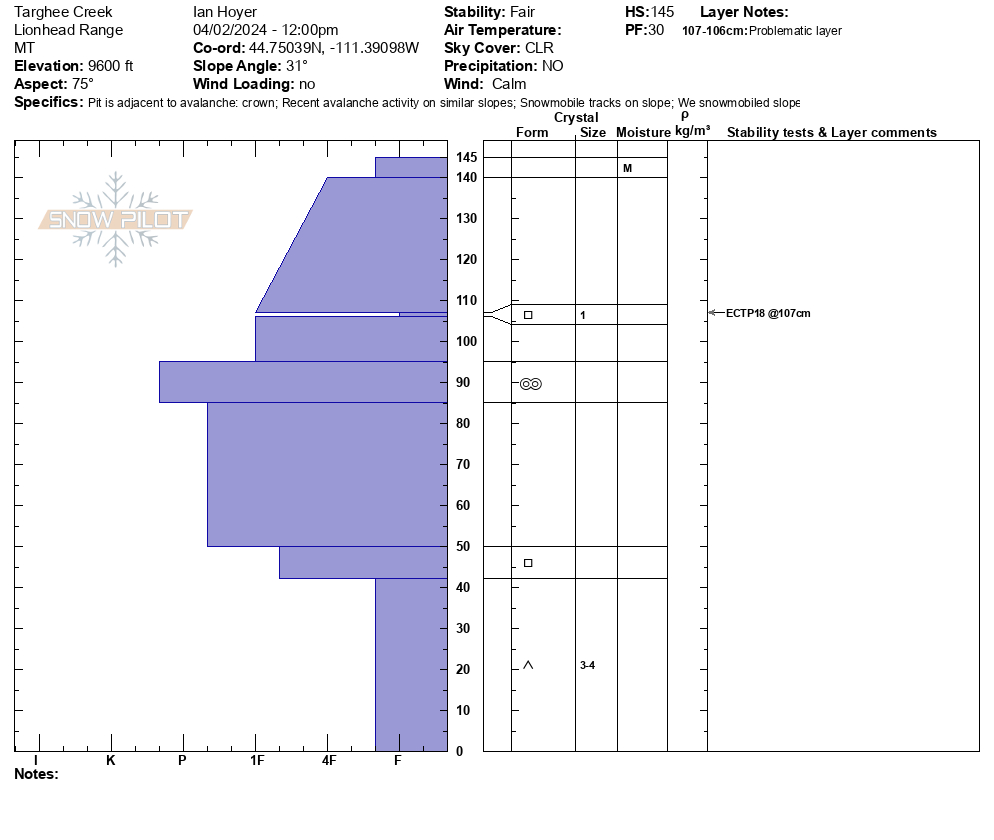
We rode from the Buttermilk trailhead up Denny Creek to Lionhead Ridge, along Lionhead Ridge through Watkins Creek and to the motorized boundary at the head of Targhee Creek.
There was a ~1" crust at the surface when we left the trailhead, with dry snow beneath. We saw our first wet loose avalanche of the day running around 11 am. By 12:30 there were dozens and many rollerballs. None of them ran particularly far or picked up too much volume. The snow surface was moist on sunny slopes by late morning, but not more than a few inches down.
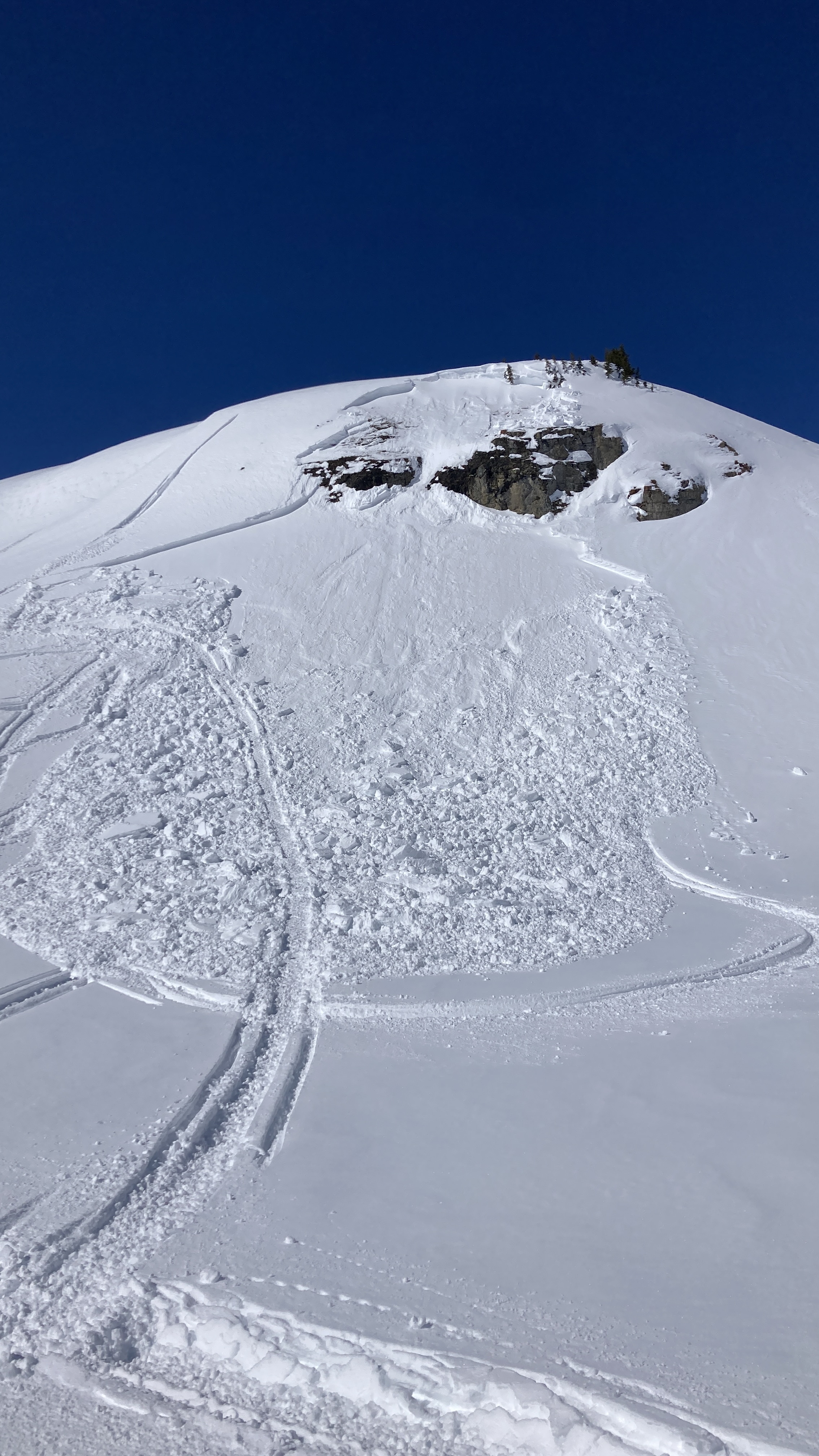
We saw one small slab avalanche that occurred since this weekend's snow. It appears to have been triggered by a snowmobile yesterday (4/1/24). It broke 10" to 2 ft deep, 50 ft wide, and ran ~50 vertical feet. It broke on a thin layer of facets beneath the new snow. Digging in the crown, dry facets at the ground were along still present and weak (fist hardness).
Signs of older avalanches were visible beneath the new snow, including one slide that broke in early March. No cracking or collapsing were observed today.
Full Snow Observation ReportMOD rising to CON seemed totally reasonable.

BZN Snow Rangers rode little bear to check boundary signs and see where closure encroachment issues had been occurring. Boy were we pleasantly surprised to see 10 new inches up high from the previous spring storm cycles which had set up nicely with minimal traffic. Snow was wind affected on high ridgetops but not on less exposed midslopes. Temperatures were below freezing in the morning but by 1400 higher temps and direct sunlight started to cause some roller balls and pinwheeling. We observed no new avalanche activity. There was one pair on a two-seater skandic, and another group of at least two mountain sledders who seemed far above our ability and eluded us despite our best efforts to find them.
Full Snow Observation ReportRode up to maintenance shack then across to East Hotel creek and dug on the south slopes.
From there we rode to upper Hellroaring creek and to below Reas peak and dug another pit. Then we traveled up and around into Jefferson bowl before heading out.
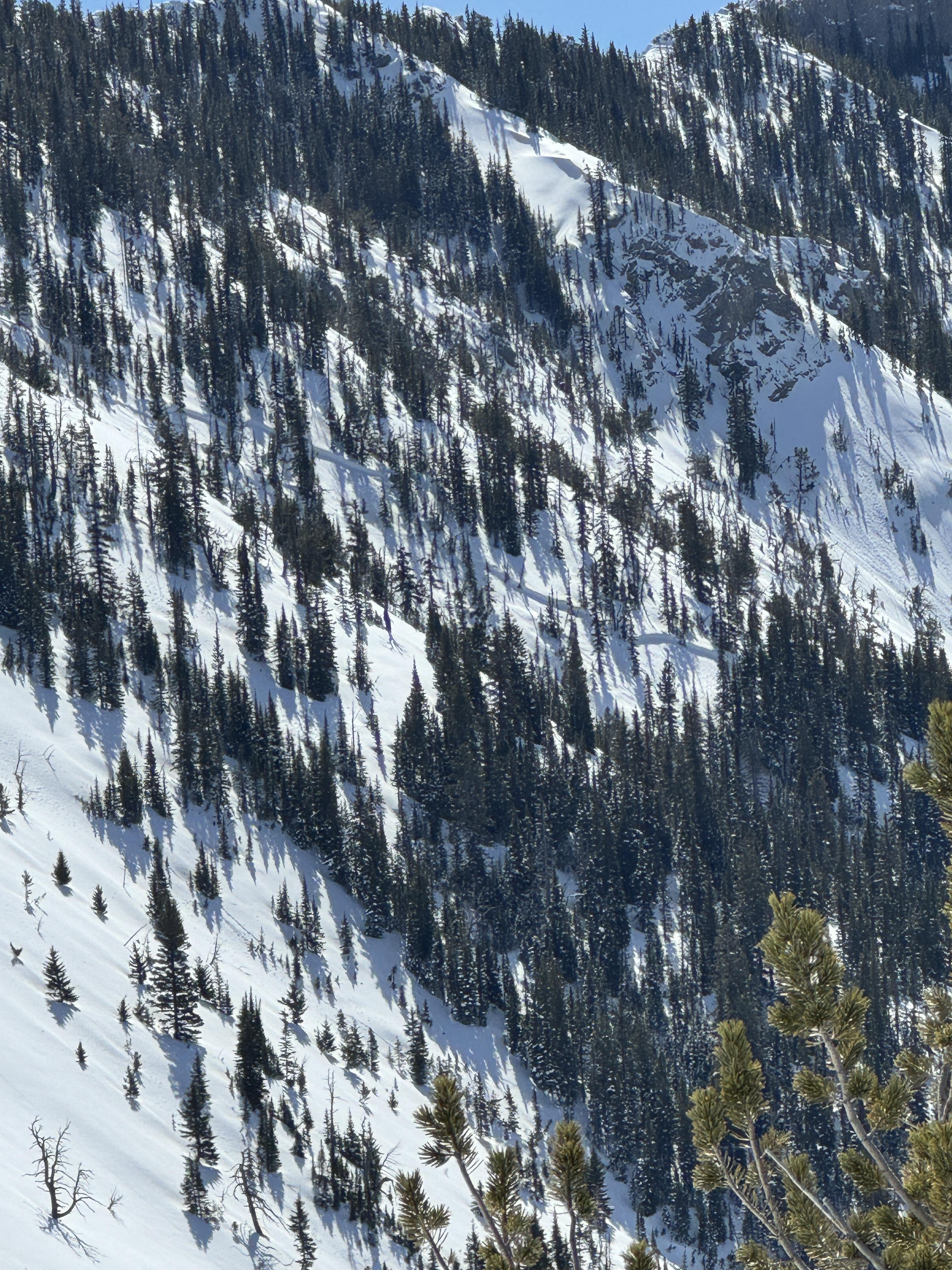
Avalanche activity seen: 5 total
2 appeared to be rider triggered near Reas peak on North aspects that broke within or just below the new storm snow. (D1/D2)
We saw a natural avalanche that broke near Yale creek on a southern aspect, again broke below new snow. (D1)
2 large natural avalanches that broke within the wind drifted snow in Jefferson Bowl.(D2/D2)
Snow depth ranged between 225-275cm in our test pits.
No signs of instability seen on our ride but temperatures were increasing and wet snow activity will likely follow. In our pit above East Hotel we observed the new snow to be bonding well with the old. (ECTN’s 15/17)
In Hellroaring below Reas we observed facets above and below the upper most crust under the new snow and got propagation.(ECTP15)
Travel Advice:
Human triggered avalanches are still possible but it is not unreasonable to explore into avalanche terrain.
However, we suggest digging down about 3’ below the new snow and asses how it is bonding before riding into steeper terrain. As always carry rescue equipment and reduce risks by only exposing one person at a time while others keep watch from non-avalanche terrain.
Moderate is good for now.
Similarly to other forecast regions I expect wet snow instabilities to increase throughout this week.

